Join 40,000+ geospatial professionals and get technology news delivered straight to your inbox every week. Subscribe today.

Examiner Specialist

Examiner Specialist

Kontur AS
Norway

Description

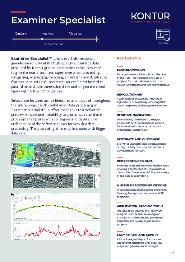
Examiner Specialist™ provides a 3-dimensional, georeferenced view of the high-quality subsurface data produced by Kontur ground penetrating radar. Designed to give the user a seamless experience when processing, navigating, organizing, mapping, annotating, and displaying features. Analysis and interpretation can be performed in parallel on multiple three-slice views and in georeferenced views with full synchronization.

Subsurface features can be identified and mapped throughout the entire project with confidence. Data processing in Examiner Specialist™ is effortless thanks to a dedicated preview window and the ability to create, save and share processing templates with colleagues and clients. The architecture of the software allows for very fast data processing. The processing efficiency increases with bigger data sets.

Documents

Brochure
Kontur_ExaminerSpecialist_ProductSheet.pdf
1.82 MB
Kontur_ExaminerSpecialist_ProductSheet.pdf

Ask a question

We are happy to assist.

Daniël Haanskorf Peter Tapken Sjors Kloosterman

We're available on all weekdays and usually reply within 1-2 working days.

Please provide detailed information.

Let us know a little about you and your contact information.

Do you represent a company or organization?

Before we proceed, would you be interested in subscribing to our newsletter?

By completing this form, you acknowledge and agree to abide by our Terms and Conditions, Privacy Policy and Cookie Policy.

Thank you for your message! Our team tipically to respond to inquiries within 1-2 business days.