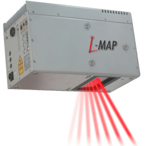

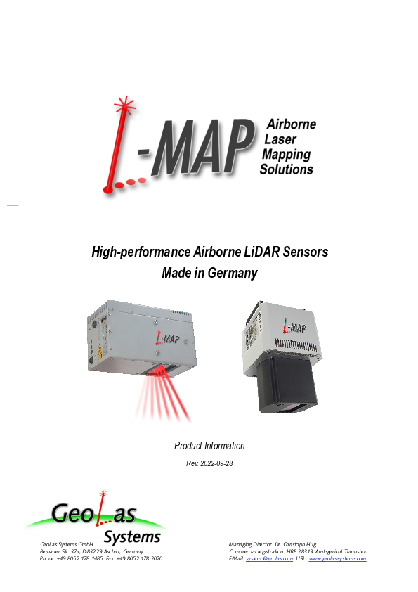
ELMAP-V High-performance Airborne LiDAR
ELMAP-V Airborne LiDAR sensors are high-performance laserscanners designed specifically for installation on aircraft with small camera holes and in stabilizing platforms.

GeoLas Systems GmbH
Aschau, DE
Description
The new ELMAP-V Airborne LiDARs are high-performance laserscanners designed specifically for installation on aircraft with small camera hatches and in stabilizing platforms. With their vertical layout and the resulting small footprint they can be inserted into small-diameter camera wells or mounted into stabilizing platforms, so that the large scan angle of 80° is available on such installations.
The ELMAP-V instruments exhibit the same outstanding measurement performance as the established ELMAP lidars, and are also available in two versions, the ELMAP15-V for operating altitudes of up to 2100 m above ground, and the ELMAP30-V for altitudes of up to 3600 m. Both versions feature
an industry-leading large scan angle of 80° (±40°) for efficient wide-area mapping at the full scan speed of up to 250 scanlines per second.
high effective measurement rates of up to 1.400.000 shots-on-the-ground per second for high-density mapping
waveform digitization for every shot with a market-leading 14 bits-per-sample radiometric resolution for low-noise ranging performance and high-accuracy surface object acquisition, unlimited number of returns per shot, return pulse intensity/surface reflectance, and pulse width/surface roughness information from every pulse
integrated removable data storage with standard high-capacity SSDs for easy data transport and media exchange, even in flight
compact size and the lowest power consumption (max. 125W) of their class
single-handed operation in pilot-only environments and autonomous operation in unmanned airborne vehicles
and last but not least, the EL-MAPs unrivaled friendly price tags in addition their outstanding performance make them the ideal choice for organizations entering the lidar mapping field, or intending to complement or replace outdated existing instruments.
Do you have questions about this product?
- Questions about price, availability, and/or retailers
- Questions about technical specifications and usage
- Questions about suitability for your project or application
Specifications
-
General
-
Year of introduction
2022
Year of last update
2023
Total Weight [kg]
15
Power requirements
18-24VDC, 125W max.
Type of GNSS/INS positioning system
n/a
Camera
n/a
Data storage facilities
integrated, removable SSD
Mission planning software
n/a
Postprocessing software
Geocode
-
Application
-
Main applications
Wide area mapping, high-resolution mapping, corridor mapping, forestry, hydrology, urban mapping
-
Measurement Characteristics
-
Scanning method
Parallel scan lines (rotating polygon mirror)
Scan frequency [Hz]
250
Min. pulse frequency [Hz]
100000
Max. pulse frequency [Hz]
1600000
Max. field of view [deg]
80
Max. number of recorded echoes per pulse
unlimited
Full-wave form digitization
Y
Pulse sampling frequency [GHz]
0.8
multiple pulses in air
Y
Recording of intensity of return signal [bits]
16
-
Operation Characteristics
-
Platform
Helicopter, Fixed-wing, Gyroplane
Max. flying height [m]
3600
Max. acquisition time [hr]
16
-
Laser Pulse Characteristics
-
Wavelength [nm]
1030
Standard pulse length [ns]
6
Beam divergence [mrad]
0.3
Type/class laser
3B
-
More information
-
Distinguishable features
large scan angle, compact size, low power consumption, low price, designed for installation in aircraft with small camera holes or stabilizing platforms
-
Uncertainty and resolution
-
Elevation precision at 1 km [m]
0.03
Planimetric precision at 1km [cm]
0.1
Across-track point spacing at 1km [m]
0.3
-
Application areas
-
Select an application area:
Documents
Brochure
elmap-product-info-20220928-0.pdf
5.61 MB
Other documents
-
GeoLasSystem_ELMAP-V_Datasheet_20231004.pdf1.87 MB
Related products