


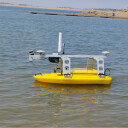


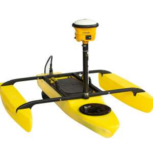
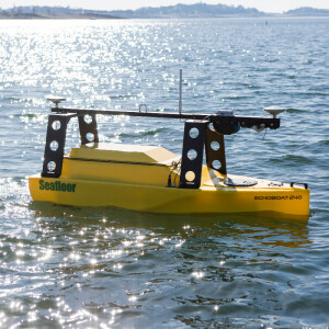
EchoBoat-160™
EchoBoat-160 USV/ASV
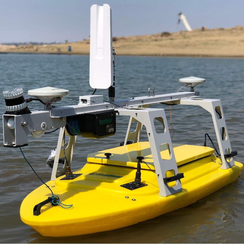
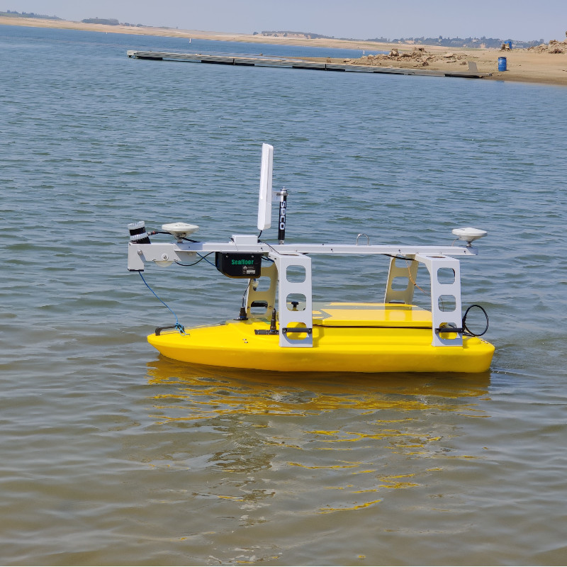
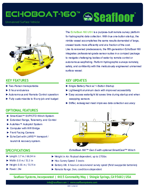
The EchoBoat-160™ USV is a purpose-built remote survey platform for hydrographic data collection. With true one-button startup, the nimble vessel accomplishes the same results demanded of large, crewed boats more efficiently and at a fraction of the cost. Like its renowned predecessors, the fifth generation EchoBoat-160™ integrates professional-grade sensor suites in a compact package to navigate challenging bodies of water by remote control or autonomous wayfinding.
Seafloor Systems, Inc.
El Dorado Hills, US
Description
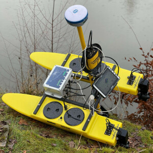
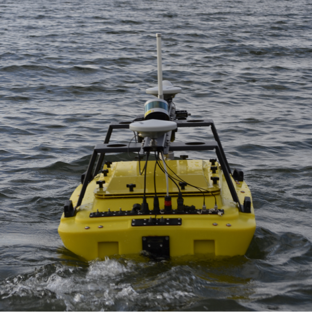
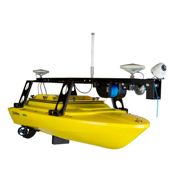
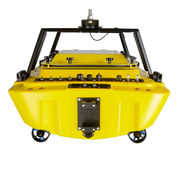
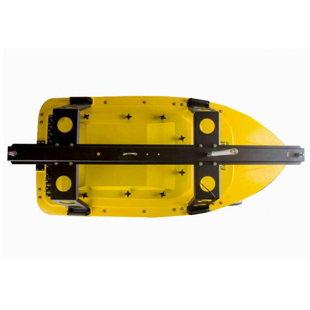
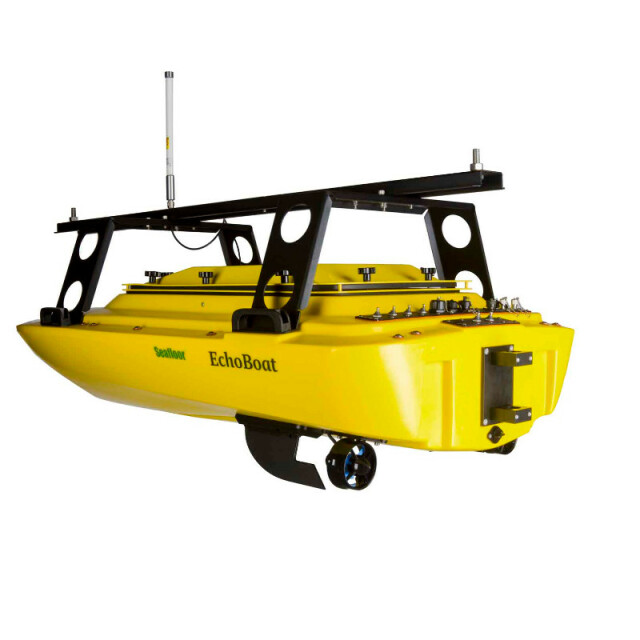
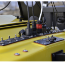
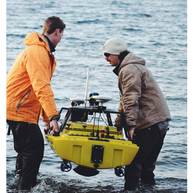
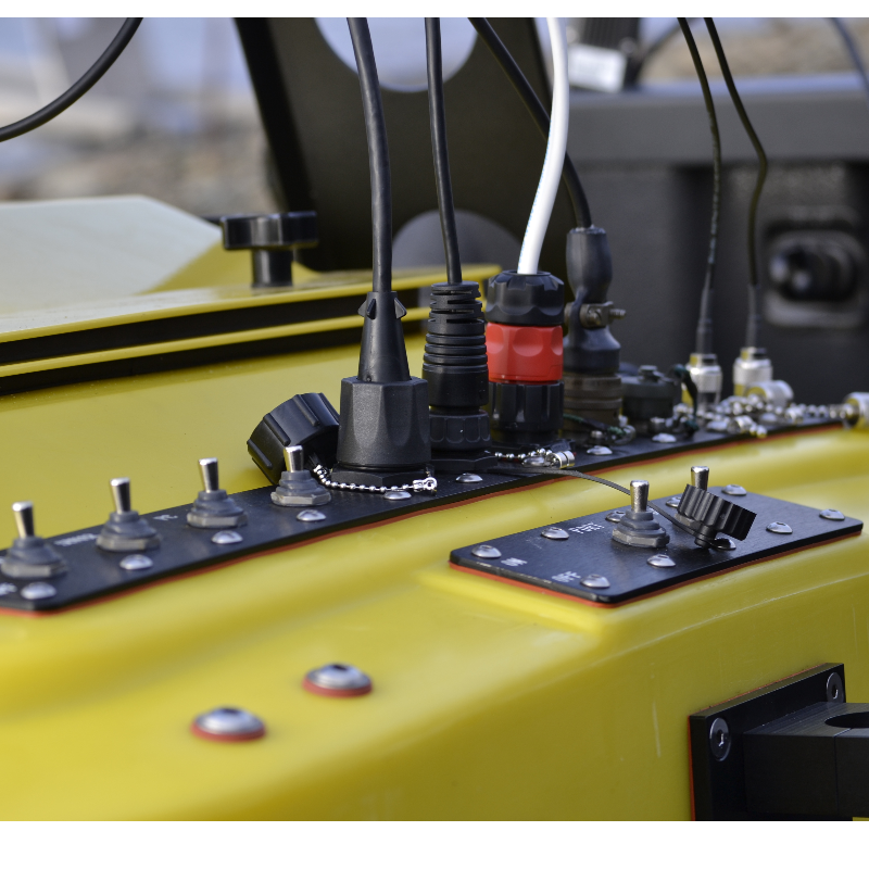
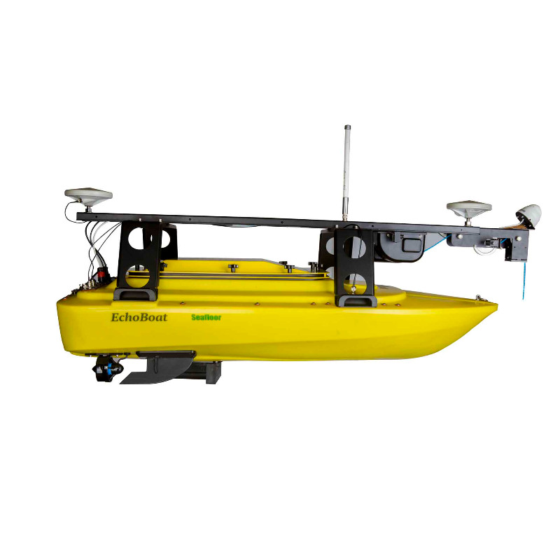
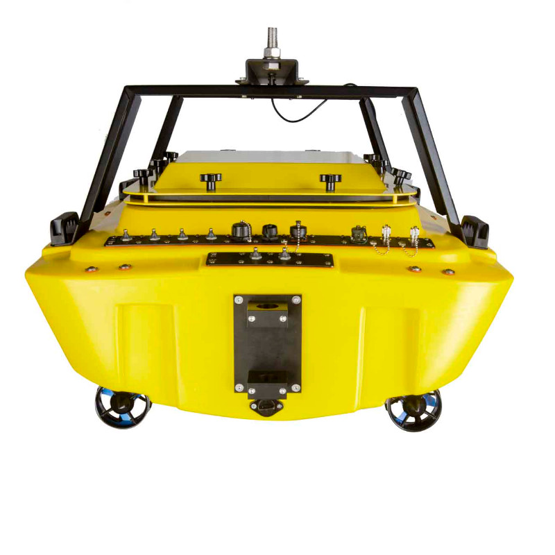
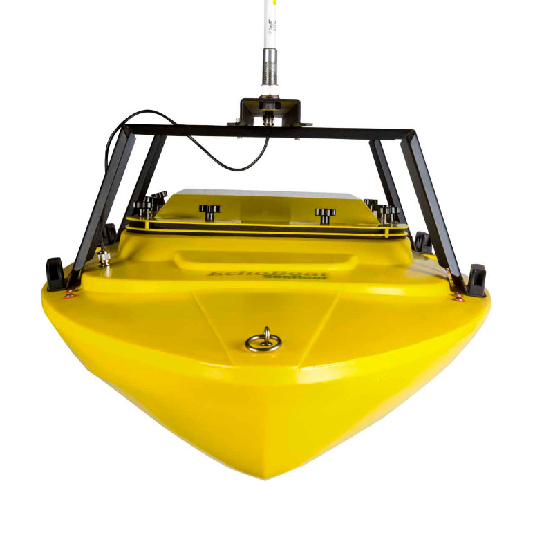
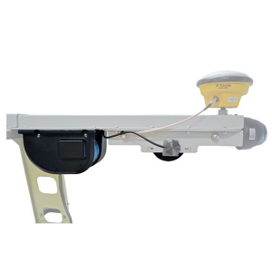
The EchoBoat™ is an unmanned surface vehicle developed for hydrographic survey applications. This is a highly portable survey platform featuring multi-payload capacity, both manual andautonomous control, and swapable sensor suites. While underway, the vehicle can be monitored within line-of-sight range, with over the horizon monitoring possible when running additional hardware. All data is stored via an onboard PC with a direct cable connection. Full equipment contol and data QA/QC is accomplished with a remote data link. Switching from autonomous to remote control on the survey boat is easy using a long range remote control unit (RCU) that offers up to 2km range, with a survey endurance of over eight hours on a single battery bank. For professional hydrographic survey requirements, the EchoBoat-160™ may be tailored to individual customer requirements. The boat may be purchased with the desired depth sounder pre-installed, or supplied ready to accept existing equipment from the user’s survey pool. Similarly, customized cabling can be included allowing the boat to accept existing GPS, GNSS and RTK positioning systems. For a turnkey survey-grade system, the EchoBoat-160™ can be outfitted with singlebeam, multibeam and side scan sonar systems. The EchoBoat™ is compatible with hydrographic data acquisition software such as Hypack, PDS2000, EIVA and QINSy.
Key Features include:
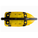
- Improved easy access lid: Equipment stays watertight, sensor swaps are simple.
- New aluminium internal mounting deck: Reduced weight, mounts multibeam sonar systems.
- One button startup and a single battery pack. Unload, start surveying.
- Next Generation AutoNav™ system. Hands-free wayfinding and survey repeatability.
- Long-range communications antenna and forward-looking camera come standard.
- Streamlined battery bank with quick access. Fewer batteries, intuitive charging.
- Taller, more rigid mast. Heightened remote range, more precise readings.
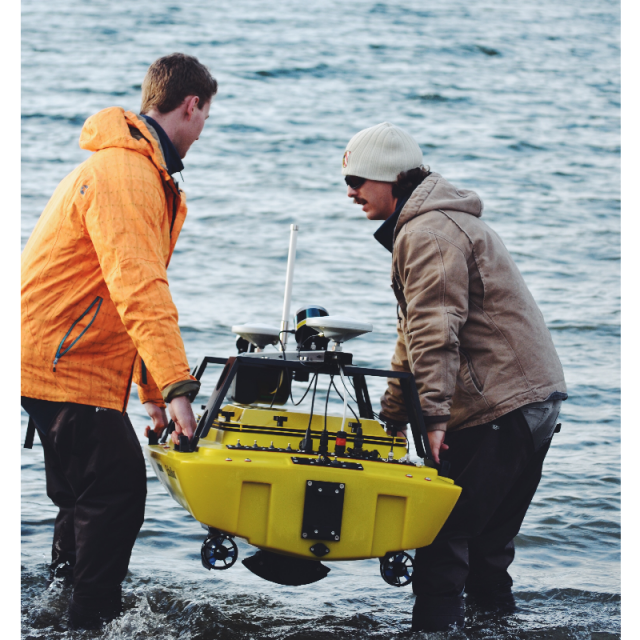
- More handle locations for carrying the USV. Two people, unlimited launch possibilities
- Compatible with EchoCart and Launch And Recovery System (LARS).
- Available integrated SmartCast winch system. Deploy sensors remotely.
- Customizable bulkhead connections. Mount the ancillary equipment you need for your job.
Do you have questions about this product?
- Questions about price, availability, and/or retailers
- Questions about technical specifications and usage
- Questions about suitability for your project or application
Specifications
-
General
-
Length [m]
1.68
Width [m]
0.8
Min. weight of USV in air [kg]
23
Max. Weight of USV in air [kg]
40
Portable
Y
Number of thrusters
2
-
Operations
-
Launch and Recovery System
ULARS
Max. speed [kn]
6
Max. Remote Operating Range {m}
2000
Documents
Brochure
echoboat-160-data-sheet.pdf
474.49 KB
Related products