CrossPoint – GPR Data Visualization Software
Data processing and Visualization Software for ImpulseRadar data files
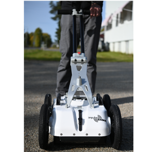
ImpulseRadar CrossPoint is a proprietary Windows-based software program for the visualization and interpretation of ImpulseRadar ground penetrating radar (GPR) data files. CrossPoint can import and work with data files collected with the ImpulseRadar CrossOver series, PinPointR, and Raptor.
ImpulseRadar
Mala, SE
Description
Intuitive Workflows for Productivity
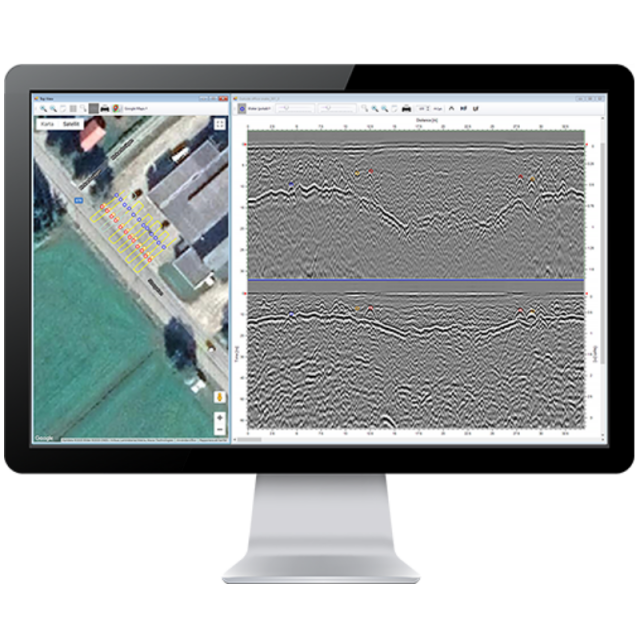
The software is intuitive and easy-to-use and provides effective tools for filter assignment, data processing, marking points of interest, visualising profiles and markers in the site view – including online map support, and exporting markers for geo-referencing within suitable CAD/GIS environments.
The software excels at simplifying the processing and mark-up of multi-line 2D GPR projects but is equally adept at supporting a single-line projects project. Compatible with the project modes in the ImpulseRadar ViewPoint acquisition App, CrossOver and PinPointR data sets can be processed quickly and efficiently. By viewing up to ten parallel profiles simultaneously, anomalies in the data can be more easily resolved, which makes for increased productivity.
Profiles from Raptor surveys can be also be viewed, either individually, or together with all profiles in a single swath. This allows quick analysis of 2D data before import into the ImpulseRadar Condor 3D processing software.
Colour-coded markers are used to indicate anomalies or points of interest within the data. These markers show up both in the radar profile as well as the site map. Once a project is complete, the markers (including profiles) can be exported for import into third-party drawing packages such as CAD, or into geographical information systems.
-
Supports ImpulseRadar 32-bit data formats, as well as 16-bit
-
View dual-channel data from CrossOver and PinPointR
-
Simultaneous comparison of up to 10 profiles
-
Support for both Lat./Long. and UTM coordinates
-
Support for Google Maps
-
Includes a range of common filtering routines
-
Export to ASCII, DXF, KML and KMZ
Specifications
-
General
-
Application
Deliverable vector products [2D and 3D]
Main design elements
Options for delivery
Processing type
Continents
-
Data Processing
-
Connections
-
Software
-
3D GPR Processing Tool
Import and process data automatically
-
Processor and Storage
-
Processor Bit
Related products


