Video
0
views
Join 40,000+ geospatial professionals and get technology news delivered straight to your inbox every week. Subscribe today.
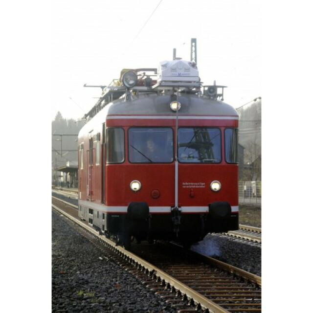
RailMapper is based on the StreetMapper IV system and a complete Mobile Mapping Solution – Accurate, Portable and Easy to Use. 3D Laser Mapping offer the best technical support in the business and guarantees the performance of the system for Rail applications. RailMapper can be easily mounted in different ways to suit any rail-based project and boasts high accuracy even in tunnels and areas of little GNSS.
Year of initial introduction
2005
Year of last update
2014
Application
Outdoor
GNSS receiver: Brand and model
NOVATEL/Septentrio
Number of antennas
2
Update rate of GNSS receiver
2
IMU: Brand and model
IGI - FOG III
IMU update rate [kHz]
600
Wheel sensor: Brand and model
Optical odometer
Number of wheel sensors
1
Tracked GNSS signals
GLONASS, GPS, Galileo, BeiDou
Ground control point integration supported
Y
Brand
RIEGL VUX-1HA
Number of laser scanners
2
Wavelength [nm]
1064
Laser safety classification
Class 1
Min. Range [m]
1.2
Max Range [m]
420
Beam diameter at exit [mm]
4.5
Beam divergence [mrad]
0.5
Spot at 50m distance [mm]
25
Intensity recording [bit]
16
Max. vertical field of view [deg]
360
Max. measurement rate [kHz]
2000
Scans per second
500
Export formats
LAS, interface to 3rd party software
Range precision (1 σ)
0.003
Absolute accuracy (1 σ):
0.005
Measurements per laser pulse
2000
Max. speed [km/hr]
300
Built-in Stabilisation
N
Operating time [hr]
24
Main applications
ENGINEERING SURVEYCHANGE DETECTION
Distinguishing features
• Precise navigation system• World-class laser scanning technology• Innovative system design• Advanced data processing software• Supplied and supported by mobile mapping experts
Training provided
Y
Brand and model
Ladybug 5
Number of cameras
6
Spectral Bands [PAN, RGB, NIR, CIR]
RGB
CCD size [.. x .. pixels]
2048 x 2448
Pixel size [micron]
3.45
FoV per camera [deg]
360
Maximum frames/sec. per camera
16
Export formats
PGR, JPEG
Size with case
57 x 85 x 48
Weight [kg]
10
Min. Operation temp. [°C]
0
Max. Operation temp. [°C]
40
Max. humidity [%]
80
Photogrammetry Software
Yes, TerraPhoto
Laser Point Clouds Software
MMProcess
Project Management Software
MMProcess
Other Software
TERRAOffice, GrafNav, TerraSolid
Recommended software (If no software included)
TERRAOffice, GrafNav, Terrasolid, Orbit
Computer
TOUCH SCREEN
Processor
Intel(R), Core(TM) i7-4770TE CPU @ 2.30GHZ
Size hard disk [GB]
1000
WiFi
Y
I/O port(s)
LAN, USB 3.0
We are happy to assist.


By completing this form, you acknowledge and agree to abide by our Terms and Conditions, Privacy Policy and Cookie Policy.