

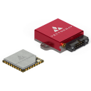
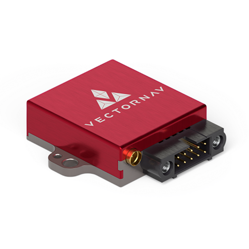
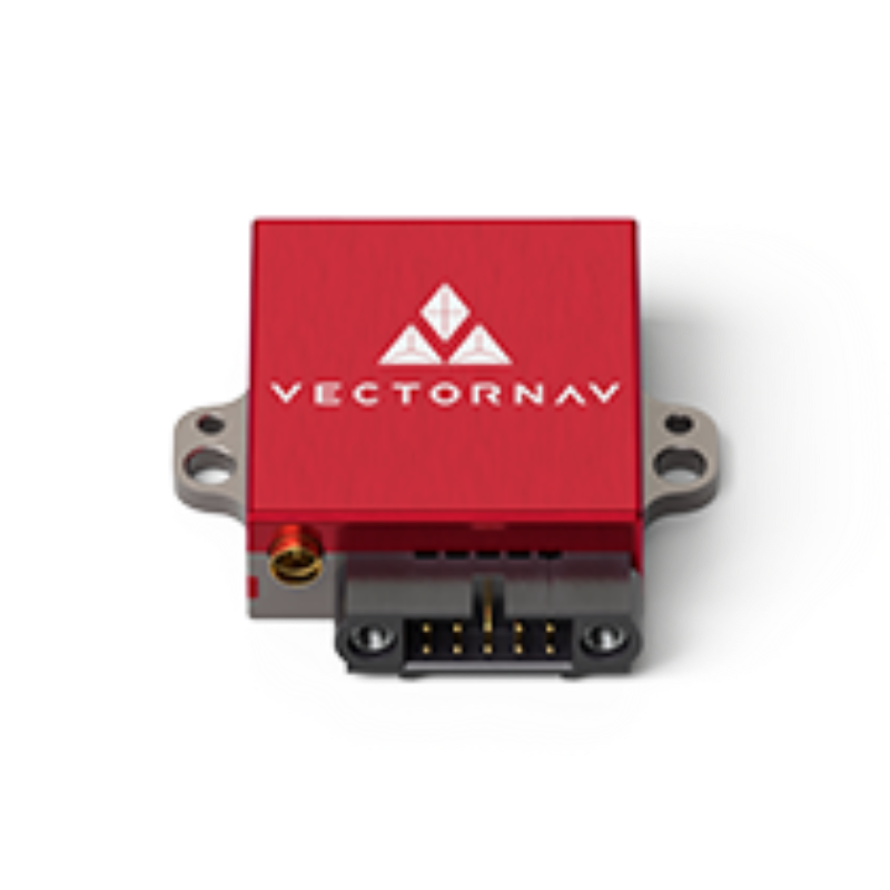
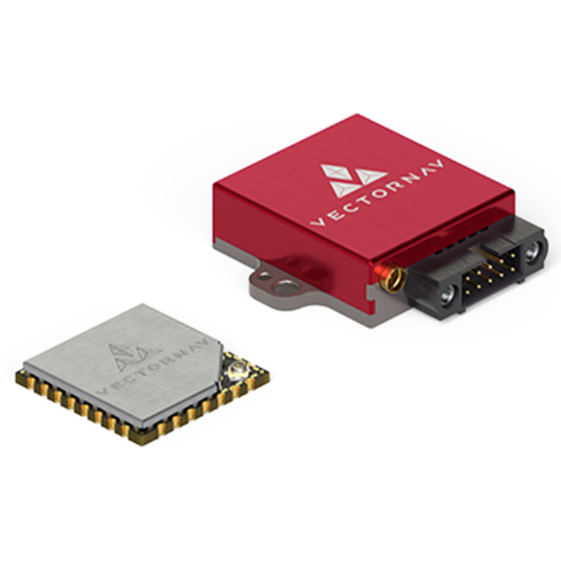
VN-200 Rugged GPS/INS
The VN-200 Rugged is a miniature high-performance GPS-Aided Inertial Navigation System that combines MEMS inertial sensors, a high-sensitivity GPS receiver, and advanced Kalman filtering algorithms to provide optimal estimates of position, velocity, and orientation for industrial applications.

VectorNav Technologies
Dallas, US
Description
The VN-200 is a miniature, high-performance GNSS-Aided Inertial Navigation System (GNSS/INS) that combines 3-axis gyros, accelerometers and magnetometers, a high-sensitivity GNSS receiver, and advanced Kalman filtering algorithms to provide optimal estimates of position, velocity, and attitude.
OVERVIEW
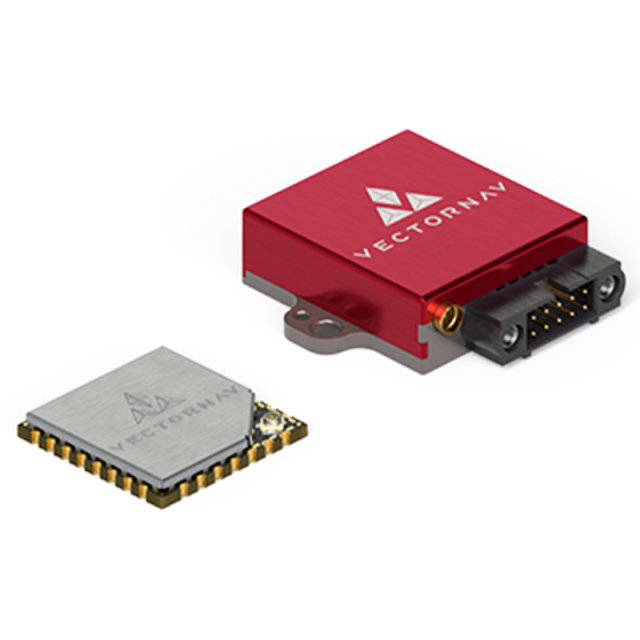
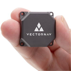
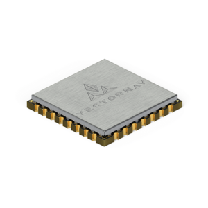
Introduced in 2012, the VN-200 was the world’s first GPS-Aided Inertial Navigation System (GPS/INS) in a single surface mount package. At the size of a postage stamp, the VN-200 SMD requires only a single 3.2-5.5V power supply and can be directly embedded into a user’s electronics.
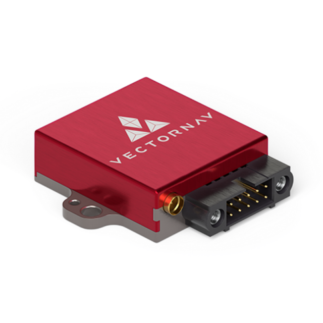
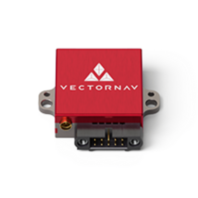
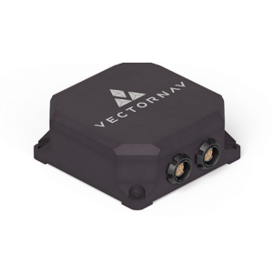
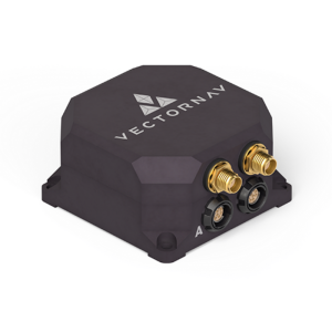
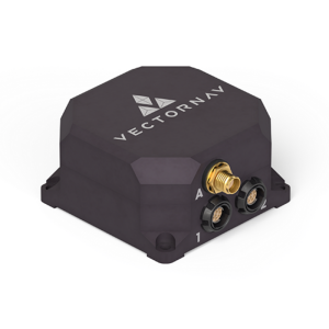
The VN-200 Rugged is the “plug and play” version of the VN-200 SMD. Enclosed in a clamshell precision anodized aluminium enclosure, the VN-200 Rugged offers additional protection of the internal inertial sensors, GNSS receiver and electronics. Interfacing with the module is made through a locking 10-pin connector, as well as an MMCX connector for an external active GNSS antenna.
SENSOR SUMMARY
-
Continuous attitude solution over the complete 360° range of operation
-
True INS Filter, no mounting restrictions, modes of operation or constraints required
-
Compatible with external GNSS receivers:
-
Multifrequency RTK capable
-
SAASM
-
-
VectorNav Processing Engine (VPE) 2.0 for disturbance rejection, adaptive filtering, dynamic filter tuning
-
Hard/Soft Iron Compensation
-
Coupled position, velocity and attitude estimates
-
Solid-State MEMS inertial sensors
-
Available with standard (@ 25°C) or full temperature compensation (-40°C to 85 °C)
-
All sensors are individually calibrated for bias, scale factor, misalignment, and temperature over a full operating range (-40°C to 85 °C)
-
1 x 72 Channel GNSS Receiver:
-
GPS L1 C/A
-
Galileo E1
-
SBAS: L1 C/A
-
-
Raw Psuedorange, Doppler and carrier phase outputs
-
Up to 1 kHz IMU Data
-
400 Hz navigation and attitude data
-
Yaw/Pitch/Roll
-
Position and Velocity
-
-
Coning and sculling integrals (ΔV’s, Δθ’s)
-
Data output format: ASCII (VectorNav), NMEA-0183, Binary (VectorNav)
-
VectorNav Control Center freely available for easy setup, configuration and logging
-
ITAR-Free
Do you have questions about this product?
- Questions about price, availability, and/or retailers
- Questions about technical specifications and usage
- Questions about suitability for your project or application
Specifications
-
Other specifications
-
Graphical user interface
Y
Typical application
UAS, Camera/Antenna Stabilization, Ground Vehicles, Mapping, Smart Weapons
Distinguishable features
SWaP-C optimized, miniature rugged design, calibrated over temperature, onboard Extended Kalman Filter, automatic filter initialization & dynamic alignment, external GPS
Export restrictions
ITAR free
-
Environmental
-
Max. rotation speed [deg/s]
2000
Min. operating temperature [°C]
-40
Max. operating temperature [°C]
85
-
Software
-
Filtering
Y
-
GNSS aided uncertainty
-
Heading [deg]
0.2
Pitch [deg]
0.03
Roll [deg]
0.03
-
General
-
Year of initial development
2012
Height [m]
0.0095
Width [m]
0.033
Length [m]
0.036
Weight [kg]
0.016
Min. Voltage (DC)
3.3
Max. Voltage (DC)
17
Power consumption [W]
0.5
Splashproof casting
Y
Water resistant casting
N
Type of accelerometer
3-axis MEMS
Type of gyro
3-axis MEMS
Type of application
Air, Land, Marine
Moving parts
N
Height [mm]
9.5
Width [mm]
22
Length [mm]
24
-
GNSS Positioning Sensor
-
Number of integrated GNSS receivers and antenna ports
1
No. channels p receiver
72
Tracked satellite signals
GPS L1
SBAS differential signals
Y
Update rate [ Hz ]
5
Cold start [ seconds ]
29
Hot start [ seconds ]
1
-
Unaided uncertainty
-
Heading [deg]
2
Pitch [deg]
0.5
Roll [deg]
0.5
-
Data formats
-
NMEA formats
RMC, GGA, GLL, GSA, GSV, HDG, HDT, THS, VTG, ZDA
Other
PASHR, TSS1
-
Inertial Measurement Unit
-
Accelerometer bias [µ-g]
40
gyro bias [deg/hr]
5
Calibration procedure
Calibrated at room temperature or over full thermal operating range (-40 C to +85 C) for bias, scale factor, misalignment and gyro g-sensitivity.
-
GNSS positional accuracy
-
Horizontal Position Accuracy [ RMS in cm ]
250
Horizontal Position Accuracy (SBAS) [ RMS in cm ]
200
Documents
Brochure
migrationrr9pqr.pdf
4.84 MB

Other documents
-
Product Manual (78)3.55 MB
-
VectorNav Technologies Supplies VN-200 GPS/INS for Troll Systems' SkyLink MINI II Antennas341.6 KB
-
High Precision Antenna Pointing1.41 MB
-
Octopus ISR Delivers Precision Geo-Lock1.7 MB
-
A New Take on Precision Aerial Photography. Overwatch Imaging uses VN-200 GPS/INS for accurate georeferencing5.67 MB
More from VectorNav Technologies

