
HYPACK LITE
HYPACK® LITE:This Is Our Single Beam Package
Designed for users who will perform their final product work in a CAD-GIS package.

HYPACK, A Xylem Brand
Middletown, US
Description
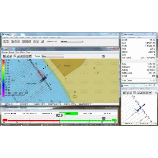
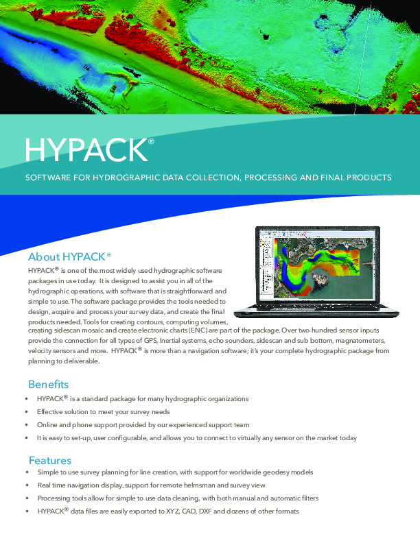
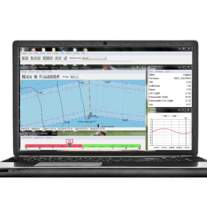
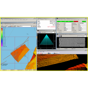
HYPACK® LITE: This is our single beam package designed for users who will perform their final product work in a CAD-GIS package. It contains all of the programs necessary to design your survey and collect single beam data, process and export it to DXF/DGN for import into your CADGIS package.
Do you have questions about this product?
- Questions about price, availability, and/or retailers
- Questions about technical specifications and usage
- Questions about suitability for your project or application
Specifications
-
General
-
Year of initial development
1984
Year of latest version
2022
Operating System
Windows 10 and 11
Area of Application
Hydrographic Surveying, Navigation. Data collection of Single beam and ancillary sensors
-
Geodetic Functionality
-
Supported coordinate systems
Over 100 supported, WGS84, NAD27
Supported datum transformations
Geoid models, user defined
Geographical coordinates (Lat, Long)
Y
Ground coordinates (E,N)
Y
Seven Parameter shift supported
Y
Time-dependent Transformation Parameters (14param)
Y
Supported vertical reference frames
YES
Ellipsoidal reference support (GRS80)
Y
Separation model for vertical datum shift support
Y
Local datum support
Y
Supported map projections
YES
-
Data / System Support
-
Recorded data storage formats
RAW (HYPACK format)
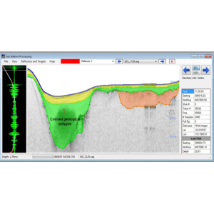
Supported Hydrographic Systems
Single Beam and All ancillary sensors for survey work, including GPS, SV, Heading, Motion.
Supported AUVs
NO
Supported ROVs
NO
Supported ROTVs
NO
Supported underwater positioning systems
NO
Supported multibeam systems
NO
Supported surface positioning systems
GPS, USBL, INS
Supported singlebeam systems
Yes, Odom, Ceeducer, Knudsen, Atlas, Kongsberg, Navisound, Reson, Ross
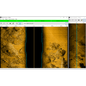
Supported sidescan sonar systems
NO
Supported magnetometer systems
Geomatics, Marine Magnetics, JWFisher, Quantro Sensing, Scintrex Envigrad
Supported gyrocompass systems
All NMEA format output sensors are support, Applanix, KVH, TSS, Novatel,
Supported motion sensor systems
All TSS1 format output sensors are supported, Applanix, SBG, TSS, IXSEA, Kongsberg
Supported imaging systems
no
Supported sub-bottom Profiler systems
All analog sonars, Edgetech, Innomar, Knudsen, Specialty Devices, SyQuest,
Supported ADCP systems
Sontek, RDI, Nortek
Supported (underwater) laser scanner systems
No
Supported INS
Applanix, SBG, Novetel
Metadata management
Y
Time synchronization methods
Veritime (HYPACK proprietary), PPS, ZDA, GGA
Supported total station systems
Leica, Trimble
-
Online capabilities
-
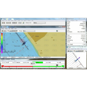
Helmsman display
Y
Max. number cloned displays
4
Supported background formats
BSB, S57, S63, DXF, DGN, DWG, ECW, MIF, JPEG2000, PDF files, PNG, Mr SID, TIF
Available real-time cleaning techniques
no
Type of navigation screens
Multiple displays, independent. Display with lines (heads up, north up, vessel up)
Survey data types real-time navigation display
Trackline, sounding, matrix ( color filled grid )
Max number of online displayed ROVs
16
Max number of online displayed surface vessels
16
Computed orientation solution
N
3D real time display
N
Supported 3D display data
Y
Real time tidal correction methods
RTK
RTK GPS height correction
Y
Real time video integration
N
Real-time Pipe detection
N
Real time IHO / IMCA TPU support
Y
SSS waterfall display
N
SSS target annotations
N
Backscatter display
N
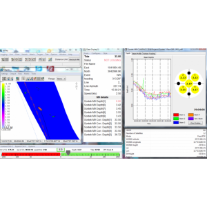
Online filtering options
MIN and MAX depth ( display only, all data is logged )
Status Views equipment
Quality control view for data sensor input, thresholds
Multibeam bathymetry coverage
no
Multibeam water column display
N
Remote control
N
Real-time DTM vizualization
N
Online eventing
Y
Real-time DTM comparison
N
-
Hardware requirements
-
RAM
4
HD (GB)
250
Processor (CPU)
32-bit, 64-bit
Languages Supported
English, Spanish, French, Russian and dozens more
Documents
Brochure
hypack-brochure-6.pdf
2.03 MB

