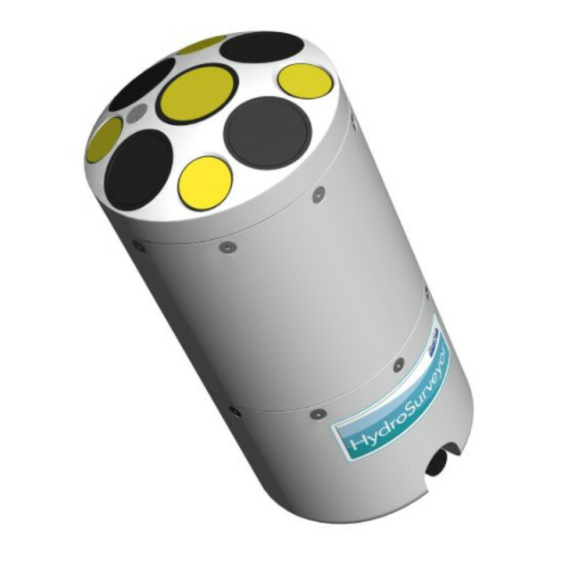
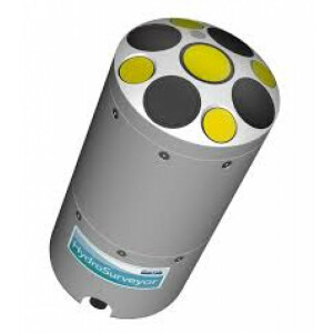
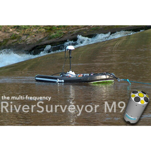
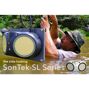
HYDROSURVEYOR M9
EXCLUSIVE 5-BEAM DEPTH SOUNDING DEVICE
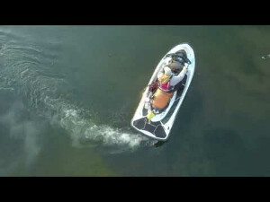
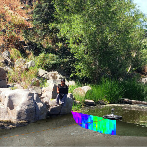
The HydroSurveyor-M9, powered by HYPACK, collects bathymetric, water column velocity profile and acoustic bottom tracking data as part of a hydrographic survey. Full water column velocity mapping, 5-beam depth sounding and acoustic bottom tracking (for speed over the ground when GPS is lost) provide comprehensive data for a complete solution with a single package.

SonTek
San Diego, US
Description
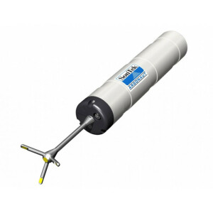
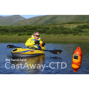
INTEGRATED WITH HYPACK® [Learn more] The HydroSurveyor is a system designed to collect bathymetric, water column velocity profile, and acoustic bottom tracking data as part of a hydrographic survey. The two key components of the system are the HydroSurveyor Acoustic Doppler Profiler (ADP®) platform, and the powerful, yet user-friendly, data collection software. With the HydroSurveyor platform, SonTek is able to offer an exclusive 5-beam depth sounding device, with built-in navigation, full water column velocity (currents) profiling, full compensation for speed of sound (with the CastAway-CTD), and integrated positioning solution.
SOFTWARE CENTRIC.
With built-in automatic data gridding and interpolation, even intricate surveys will not require specialized complex software, saving you time and money.
• Sound speed integration and interpolation (with CastAway-CTD)
• Speed over ground (Acoustic Bottom Tracking)
• 5-beam depth soundings (50° swath)
• Water column velocity (currents) mapping
• Automatic data gridding and interpolation
• 360° compass and two-axis tilt sensor
• Interface for customer-supplied GPS and/or heading sensor
Addtional Options:
• CastAway-CTD
• Upgrade for existing RiverSurveyor M9 systems
• SonTek RTK GPS or DGPS
• Delrin/aluminum boat mount
• Bluetooth/spread spectrum telemetry
Do you have questions about this product?
- Questions about price, availability, and/or retailers
- Questions about technical specifications and usage
- Questions about suitability for your project or application
Specifications
-
Physical Properties
-
Operating temperature: min. [°C]
-5
Operating temperature: max. [°C]
45
-
Operating properties
-
Depth — Accuracy
0.02m (sound speed corrected)
Depth — Resolution
0.001m
Swath Width
50°
Profiling Range — Distance
0.06m to 40m
Profiling Range — Velocity
± 10 m/s
Velocity — Accuracy
Up to ± 0.25%, ± 0.2 cm/s
Velocity — Resolution
0.001 m/s
Number of Cells
Up to 128
Cell Size
0.02m to 4m
Acoustic Bottom Tracking — Range
± 10 m/s
Acoustic Bottom Tracking — Altitude
0.2 – 40m
RTK GPS — Horizontal Precision (Repeatability)
<0.03m
DGPS — SBAS GPS Horizontal Accuracy
<1.0m
Transducer Configuration
8-beam Janus (4 x 1MHz; 4 x 3MHz) and 1 Vertical Beam (0.5 MHz)
Temperature Sensor — Resolution
± 0.01°C
Temperature Sensor — Accuracy
± 0.1°C
Compass — Type
Solid State type, with Built-in Inclinometer
Compass — Range
Full 360°
Compass — Heading Accuracy
± 2°
Compass — Tilt Accuracy
± 1°
Storage Temperature
-20°C to 70°C
-
Power supply and communication
-
Power supply (internal/external with specs)
12-18 V DC
-
Sensor properties
-
Beam Specifications. Vertical Beam Range
0.2m to 80m
Beam Specifications. Vertical Slanted Beams Range
0.2m to 40m
Beam Specifications. Vertical Beam Angle
8°
Beam Specifications. Slanted Beam Angles.
3°
Documents
Brochure
hydrosurveyor-brochure-(reduced).pdf
Videos
