
SPECTRA GEOSPATIAL and APLITOP collaborate on Tunneling Survey Solution
Aplitop Tcp Tunnel Software Now Works with Spectra Geospatial Focus 35 Total Station to provide a comprehensive tunnel survey solution to increase productivity for survey service providers.
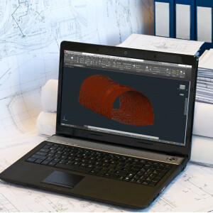
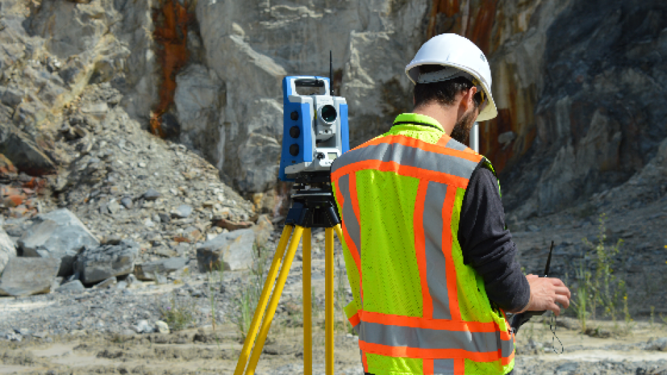
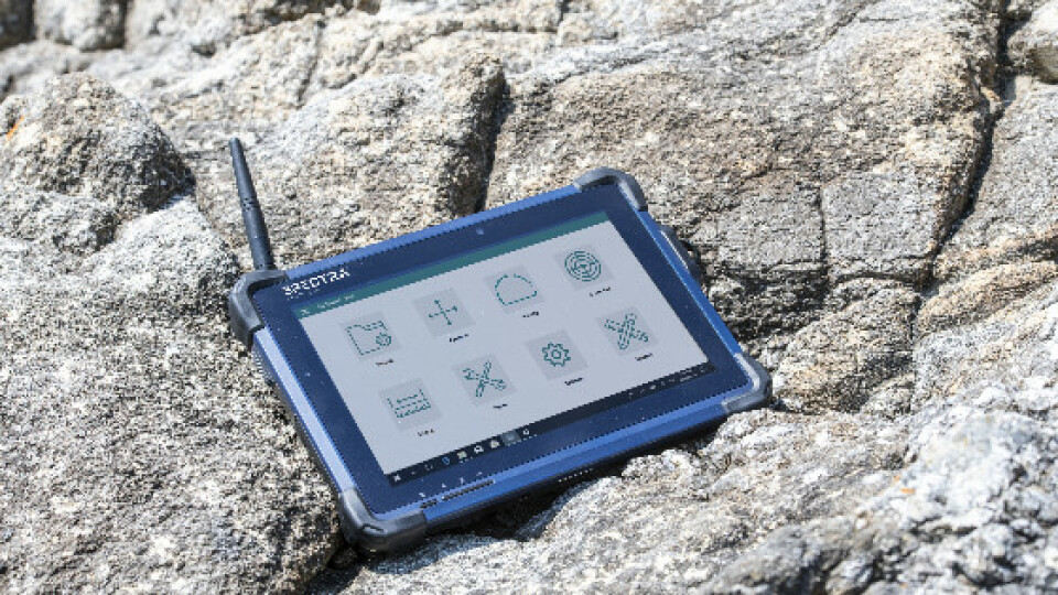
This collaboration provides surveyors and geospatial professionals with a complete hardware and software solution for performing efficient tunnel construction surveys. Combining the accuracy and speed of the Spectra Focus 35 robotic total station with the simple workflows of Aplitop TcpTUNNEL, running on the ST10 or Ranger 7 data collector, enables tunnel surveyors to perform excavation control, automated survey and stakeout of tunnel cross-sections. In the office, data and designs can be transferred seamlessly between TcpTUNNEL CAD, a plug-in for several CAD platforms, and TcpTUNNEL field software.
The Spectra Geospatial and Aplitop solution provide a full-featured workflow for tunnel constructions surveys including:
- Definition of the project design elements such as alignments and templates that can be easily transferred between the field and office
- Efficient tunnel drill and blast setout as well as reporting on the difference to design positions
- Automated data collection for the quality control of tunnel excavation process using cutting-edge tracking mode
- Accurate stake out of key design features and anchor bolts along the tunnel alignment
- Graphical reporting of the differences between design and survey data to calculate over and underbreak volumes and areas to ensure design conformity
“Collaborating with Aplitop enables Spectra Geospatial to provide customers with a world-class tunnelling solution to increase productivity working in underground environments,” said Olivier Casabianca, vice president of Spectra Geospatial. “The combination improves the tunnel construction process by providing customers with increased confidence in the field and streamlining final deliverable creation in the office.”
“We are excited to partner with Spectra Geospatial to introduce a solution for tunnel construction professionals,” said Francisco Navarrete, general manager of Aplitop. “This combined solution enables professionals to leverage the speed and accuracy of Spectra Geospatial total stations with the simplicity of the TcpTUNNEL portfolio.”
Availability
The FOCUS 35 total station, ST10 tablet and Ranger 7 data collector are available through the Spectra Geospatial global dealer network.
The TcpTUNNEL software is available through Spectra Geospatial global dealer network or the Aplitop international distributor network.
About Aplitop
Aplitop specializes in surveying and civil engineering software. It has developed a wide variety of solutions for field survey and setting out, civil projects and special applications for point-clouds, tunnels and photogrammetry. More than 15,000 users worldwide are using its solutions, through an extensive distributor network. Known for its quality and technical support, Aplitop designs products with customer satisfaction in mind. Aplitop actively participates in innovative research projects for BIM, point clouds, augmented reality and more.
About Spectra Geospatial
Spectra Geospatial is an established brand known for delivering quality products to the survey, GIS and construction markets. Focusing on the specific needs of the conventional surveying market, the Spectra Geospatial brand offers a complete product portfolio including Global Navigation Satellite Systems (GNSS), optical total stations, data collection hardware, field and office software, as well as a wide range of construction tools.
Spectra Geospatial surveying equipment is an economical choice that utilizes technologies for optimal efficiency. With convenience and reliability as the foundation of the Spectra Geospatial brand, it is an ideal choice for value. The Spectra Geospatial brand is backed with the strong technical support that users have come to expect from a quality name in surveying and construction.
Do you have questions about this article?
Get in touch with Spectra Geospatial, and they would be happy to answer any questions you have about pricing, suitability, availability, specs, etc.
Related products


