From Theodolites to Total Stations
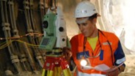
A total station is an angle measuring device, also known as a theodolite, integrated with an electronic distance measurement (EDM) unit. The integration provides the ability to measure horizontal and vertical angles as well as slope distances using the same device at the same time, which benefits the surveyor in terms of portability, convenience and speed. In this article you can find an overview of the histroy of theodolites and the the latest developments.
Total Stations Evolution
For many decades, and up until the 1960s, theodolites were the major surveying instruments for collecting geodata referenced in an Earth-fixed coordinate system. Theodolites measure angles, and the computation of coordinates also requires distances which in the past were measured with chains or measuring tapes.
An important innovation that made distance measurements less cumbersome was electronic distance measurement (EDM). Total stations have always measured two angles – horizontal and vertical – and the range, or slope distance, to a target point. The revolution resides inside: microprocessors, solid-state memory, sensor technology and wireless communication.
Read the complete article on GIM International

Evolution of Total Stations
Over time, and keeping pace with the microelectronics revolution, the primal design of the total station has been extended with features which have made surveying faster and more convenient. Servomotors enable horizontal and vertical angle movements, thus saving time when staking out coordinates as the telescope aims itself and the surveyor just needs to put the prism in the relevant position. The prism is pinpointed through either radio signals or imaging.
The first motors were mechanically geared but today’s stepless magnetic motors operate quickly and silently. A next step was to employ wireless communication so that operation can be steered by an external controller mounted on the pole. Such robotic total stations enable surveys to be conducted by just one person, thus saving labour costs. At least two known points in line of sight of each other are required: one for positioning the instrument above and the other to determine the azimuth.
To eliminate the need for known points it is logical to extend the total station with a GNSS receiver. The GNSS unit can also be mounted on the prism pole for fast data capture, although signals may be too weak in the vicinity of trees or buildings or if high accuracy is required. Here, the total station takes over. The dual configuration increases the efficiency of massive data collection, while surveys can be conducted by one person.
Imaging and Laser
Digital cameras have also been mounted into the telescope, coaxial with the optics and the EDM. The snapshots allow the site to be documented and notes to be written using a digital pencil on the total station’s screen. This reduces the need for office-based post-processing and may also avoid trips back to the field. As the image is stored together with the coordinates of both station and target points, orthoimagery can be created.
Today, terrestrial laser scanners (TLSs) have gained wide acceptance. A TLS and an EDM unit have much in common: a TLS also operates without a prism, and both employ either pulsed laser or range measurement through phase shifts. Therefore, it makes sense to extend a total station with the TLS ability to collect a point cloud. The part of the scene is indicated as a window on the screen by the surveyor in real time together with the specification of horizontal and vertical intervals. The rate of data capture of grid scanning is just a thousandth of what a TLS can accomplish as it is merely an additional facility on the total station. The results can be processed in the office using point cloud processing software.
Concluding remarks
The broad range of different types of total stations may appear dazzling if you intend to renew your equipment. Which one should you select? The latest and most sophisticated one? There are so many functionalities to choose from. Which brand should it be? As usual, the more functionalities a tool has or the more sophisticated it is, the higher the price. Before making your purchase decision, it is wise to make a list of the types of surveys to be conducted and the accuracy required. It will often become apparent that a simple device will meet your needs, or even that a ten-year-old second-hand device is good enough for staking out enumeration boundaries for census purposes in a developing country. And one thing is for sure: no matter how advanced a device may be, if it is not in the hands of a skilled person the output will be garbage.
Total Stations on Geo-matching.com
On Geo-matching.com you can find and compare 94 total stations from 19 suppliers. You can you view specifications, videos, read case studies and contact suppliers directly.


