Join 40,000+ geospatial professionals and get technology news delivered straight to your inbox every week. Subscribe today.

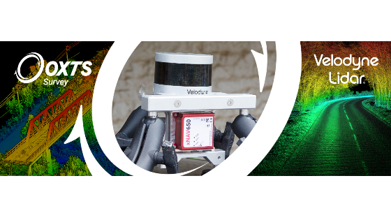
Velodyne and OxTS: Using Inertial Measurements to Enhance Pointcloud Accuracy
Wed, Sep 29, 2021 at 2:00 PM (UTC) 1 hour
There is an almost limitless number of possible applications for LiDAR. From highway surveys to coastal erosion monitoring and more, the pointclouds created through LiDAR scanning can be used time and again to make critical project decisions. However, these decisions can only be made if the pointcloud is clear and accurate. But how do you ensure accuracy?
oxts-and-velodyne-webinar-image.png
Share webinar

Join Velodyne EMEA Marketing Manager Dieter Gabriel and OxTS Product Engineer Jacob Amacker at 14:00 hrs (BST) on Wednesday, 29th September as they discuss how by using inertial measurements alongside LiDAR sensor data you can enhance the accuracy of your pointclouds.

During the webinar you will learn more about:

• Why inertial measurements are so important for pointcloud accuracy
• From setup to survey: Using an INS with a LiDAR sensor
• The impact on the final results

Ask a question

Oxford Technical Solutions - OxTS team is happy to assist.

Oxford Technical Solutions - OxTS

We're available on all weekdays and usually reply within 1-2 working days.

Please provide detailed information. Your input helps Oxford Technical Solutions - OxTS assist you effectively.

Let us know a little about you and your contact information.

Do you represent a company or organization?

Before we proceed, would you be interested in subscribing to our newsletter?

By completing this form, you acknowledge and agree to abide by our Terms and Conditions, Privacy Policy and Cookie Policy.

Thank you for your message! Our team tipically to respond to inquiries within 1-2 business days.