

Z-Boat 1800-MB2
Maximize Hydrographic Survey Efficiency
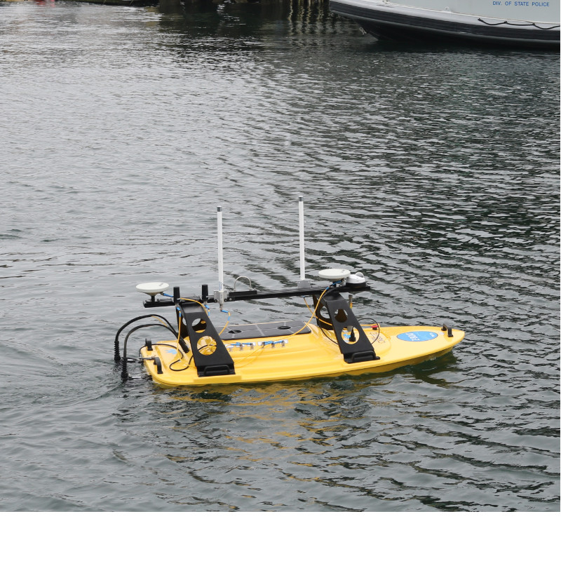
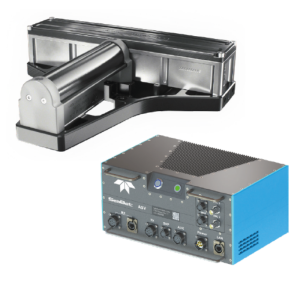
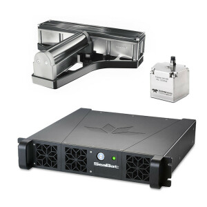
THE TELEDYNE OCEANSCIENCE Z-Boat® with Odom MB2 Multibeam Echosounder, ruggedized design, and interchangeable sensor well, offer an entirely new option for high-resolution shallow-water hydrographic surveying. Teledyne Odom Hydrographic’s MB2 Multibeam Echosounder is optimized for shallow-water survey. With 24-bit raw data, both water column and seabed information can be collected within the controller software onboard the Z-Boat.

Teledyne Marine
Daytona Beach, US
Description
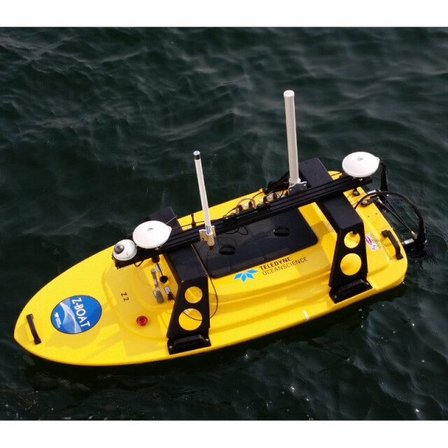
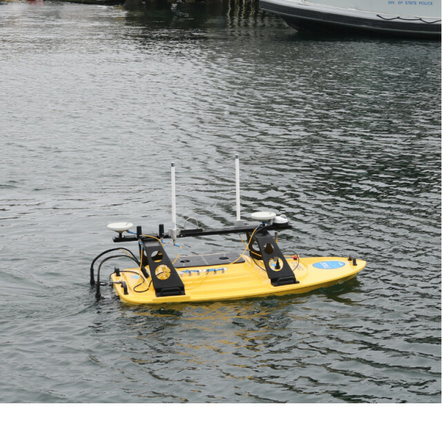
THE TELEDYNE OCEANSCIENCE Z-Boat® with Odom MB2 Multibeam Echosounder, ruggedized design, and interchangeable sensor well, offer an entirely new option for high-resolution shallow-water hydrographic surveying. Get multibeam bathymetry data where conventional methods are not feasible or safe, and avoid mobilizing a workboat or vessel of opportunity. The Z-Boat uses advanced radio telemetry to offer remotely-operated hydrographic surveys. All data is viewable in real time, giving the operator total control over the survey process. Z-Boat navigation is easy using the GNSS position and heading available onboard, and remotely viewed at the operator location. Data processing is available in real time through CARIS Onboard.
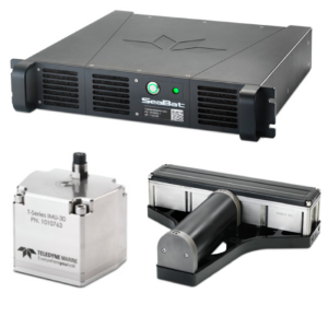
Teledyne Odom Hydrographic’s MB2 Multibeam Echosounder is optimized for shallow-water survey with a dedicated cylindrical transmit array and broad range of sounding frequencies. With 24-bit raw data, both water column and seabed information can be collected within the controller software onboard the Z-Boat. The Real Time Appliance (RTA) synchronizes all of the sensors with accuracy better than 0.1 ms. Precise positioning is powered by the optional integrated Applanix POS MV WaveMaster engine aided by Trimble GNSS.
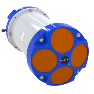
The Z-Boat’s new ruggedized design is IP67-rated and incorporates a modular deck structure for antennas, cameras, and additional sensor mounting, making the Z-Boat ideal for shallow coastal mapping applications. The ruggedized package also includes an interchangeable sensor well which accommodates a range of instruments including the Odom MB2, Odom MB1, Odom CV100. Sensors are easily interchanged from beneath the Z-Boat.
A drone upgrade with waypoint navigation is available to offer laser-straight survey lines and precise positioning for large area or repeating surveys.
Additional features from HYPACK® and CARIS allow for remote viewing of Z-Boat operations or processed data.
Do you have questions about this product?
- Questions about price, availability, and/or retailers
- Questions about technical specifications and usage
- Questions about suitability for your project or application
Specifications
-
More information
-
Applications
Coastal Surveys, Port and Harbor Security, Mining pits, Tailing ponds, Sewage treatment plants, Environmentally sensitive areas, Construction and Inspection zones, Dams and reservoirs, Lakes, harbors, and rivers, and Flooded areas.
Distinguishable features
Ruggedized deck structure and interchangeable payload bays
Commercial Options
Manual and robotic navigation, singlebeam sonars, side scan, ADCP, IMU
-
General
-
Length [m]
2
Width [m]
1
Height [m]
1
Min. weight of USV in air [kg]
38
Max. Weight of USV in air [kg]
38
Portable
Y
Number of thrusters
2 - Dual brushless 24V DC outdrives
Thruster specifications
Options for Low-Profile or Kort Nozzle outdrives delivering up to 4.5 knots top speed depending on conditions and equipment.
Chassis
UV-Resistant ABS (IP67-rated) with modular deck structure for antennas, cameras, and additional sensor mounting. Interchangeable wells for swappable payloads.
-
Communication and Control
-
Type of Communication
Varies
Data sent to shore
Varies
Auto- control
Optional
Control parameters sent to the USV
Waypoint plan
-
Navigation and Payload
-
Navigation sensors - standard
GNSS
Navigation sensors - optional
IMU, Waypoint Autopilot
Payload sensors - standard
Teledyne Odom Hydrographic MB2
Payload sensors - optional
Teledyne Odom Hydrographic MB1, Teledyne Odom Hydrographic CV100, Tritech Side Scan Sonars, Teledyne RD Instruments velocity profilers, HD video cameras, LiDAR
-
Operations
-
Operational Area
Inland waterways and coastal ocean areas
Max. speed [kn]
5
Min. crew size
2
Min. required number of surface computers
1
Max. Remote Operating Range {m}
1200
-
Energy and Propulsion
-
Propulsion
Dual brushless 24V DC outdrives
Energy Source
24V NiMH batteries
Endurance at nominal power [hr]
Up to 4 hrs at survey speed
Documents
Brochure
z-boat-180-mb2-data-sheet-012018h.pdf
1.12 MB