UWIS System for underwater navigation, tracking and communication
UWIS System is accurate and robust acoustic (LBL) system for divers and ROV tracking
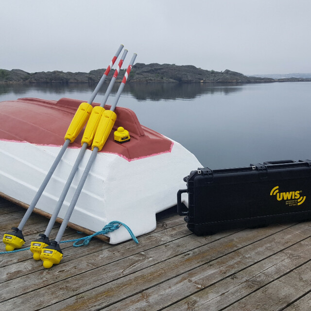
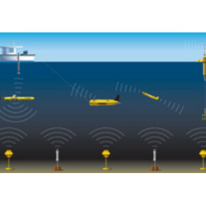
UWIS is a unique system for underwater navigation, tracking and communication with and between the divers. It is only System on the market which enables divers to see also the locations of the dive buddies or ROVs during the dive. UWIS system consists of UWIS Tracker software, three buoys and a diver units that are attached on the underwater objects . The system communicates underwater via ultrasound and via wifi above the water. Thus, it is a completely wireless system.
UWIS Oy
Turku, FI
Description
UWIS System brings GPS level navigation and tracking features for the divers. It does all this using unique technology which makes it really reliable for example in difficult environments like in shallow waters, quarries , harbours or under the thermoclines. These has typically been difficult places for acoustic devices.
The System can track max 100 divers, transfer max 100 pre-defined messages and show max 100 markers (POI). User may set up also so called dynamic markers which can be moved during the dive and show to the diver changed targets.
UWIS Diver units are compatible with underwater devices such as the Alltab underwater computer, Android cellulars or GoPro cameras. By using navigation software "Valtamer Navigator for UWIS" the diver can use all UWIS features underwater. He can navigate in the map or overlay image, let the navigator guide him to the target markers, add new markers and send/ receive messages to other divers or to the surface personnel. All this with the Samsung tablet with the touch screen and pro level underwater housing down to 150m depth.
Tracking data is wirelessly available for example for Sonar softwares or via serial cable (NMEA, GGA) for the ROV control softwares.
UWIS System generates required messages also by itself. For example, if there is enabled message for maximum distance between the dive buddies, divers gets the alarm and it is visible also in UWIS Tracker software onboard.
All diving data is stored for the after analyzes. You can load for example your diving tracks to KML files and show those in Google Earth. More advanced use is to integrate location data and taken underwater images together for example for the photogrammetry purpoces.
UWIS System is efficient tool for every kind of diving and underwater operations. Please visit in our reference pages (https://uwis.fi/en/references/) and find use cases from the sectors in SAR, MIL, commercial, sciense and recreational diving.
UWIS in Brief video: https://youtu.be/8oVJTxKatbQ
Please contact us for more info: https://uwis.fi/en/contact-information/
Specifications
-
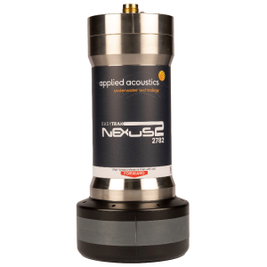
Transponders
-
Type
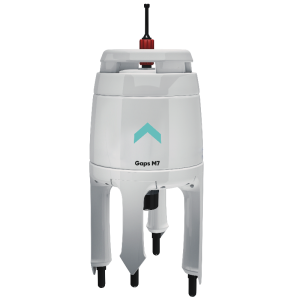
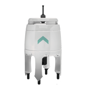
Moored buoy
Dimensions {mm}
105 x 115 x 94
Dry weight {kg}
0.6
Depth rating {m}
150
Additional functions
bluetooth, GPS, leds, sound
-
Physical properties of transducer head
-
Diameter [mm]
100
Height [m]
2
-
System Parameters
-
Frequency {kHz}
59
Min. operation range {m}
0
Max. operation range {m}
500
Operation beam angle {deg}
200
Number of active elements
100
Multi user functionality
Y
LBL-functionality
Y
-
Interfaces
-
Compatible hardware
Alltab, GoPro, Android cellulars
Compatible software
DeepView 5.x (sonar), Windows 64bit
-
Mounting and deployment
-
Mounting
Portable
Retractable
Y
-
Used Sonar Methods
-
Type of system
Floating and wireless LBL method with autonomous three buoys equipped with GPS.
-
More information
-
Distinguishable features
wireless charged units, 14 hours operation time. Maintenance fresh water cleaning only and drying.