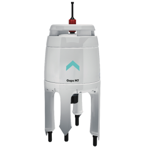
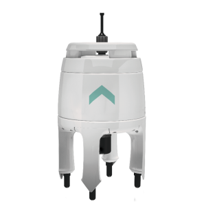
DiveNET: Commander
Advanced USBL Multi-Target Positioning and Navigation
Highly compact and streamlined Diver/ROV/AUV tracking and navigation support Support for up to 23 transponders 32 wireless code commands Mutual Navigation technology provides position topside and vector to base station subsea Autonomous or integrated service Precision: 1° (heading) / 0.34 m (slant range) Range: 1,000 (standard) / 5,000 m (advanced) Maximum depth: 300 m (standard) / 1,000 m (OEM)
DiveNET Subsea Wireless
Los Angeles, US
Description
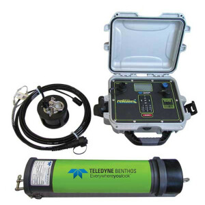
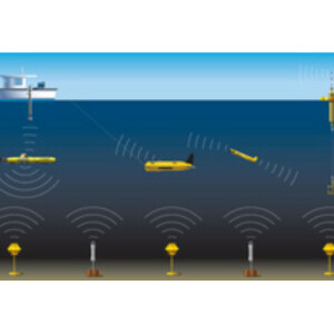
DiveNET: Commander is a compact, multi-function and multi-target Ultra-Short Base Line (USBL) underwater navigation solution designed for diver and unmanned applications.
Commander provides multi-function service:
- Relative Bearing tracking
- Absolute coordinate tracking with track recording
- Underwater navigation support (distance and direction to base station)
- Autonomous or carrier-integrated operation
- Transmission of remote code commands and telemetry
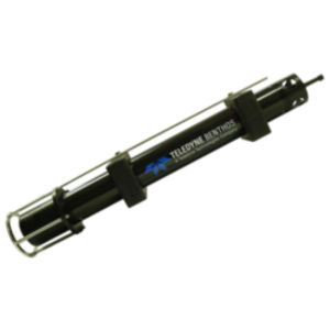
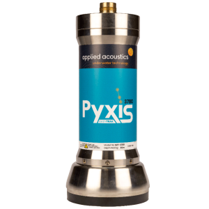
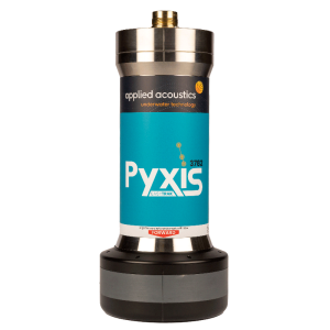
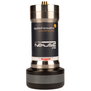
The Commander Transponder (COMT) subsea unit is available with a battery pack for autonomous operation or in standalone configuration for integration with carrier systems. Transponders are available for 300 m and 1,000 m (OEM) maximum depths.
Each COMT beacon supports 16 system commands, 16 user commands and provides own telemetry to the base station.
Each COMT beacon receives the base station azimuth from the MAST topside antenna while independently measuring range, water depth and temperature.
The Master Transceiver (MAST) topside base station antenna supports interfacing with surface GNSS to enable absolute coordinate operation and track recording.
DiveNET: Commander is designed for effective, robust operation in real-world conditions, requiring minimal configuration and maintenance. The system is supplied with dedicated, open-source code operating software.
- Highly compact and streamlined
- Diver/ROV/AUV tracking and navigation support
- Support for up to 23 transponders
- 32 wireless code commands
- Mutual Navigation technology provides position data topside and subsea
- Autonomous or integrated service
- Precision: 1° (heading) / 0.34 m (slant range)
- Range: 1,000 (standard) / 5,000 m (advanced)
- Maximum depth: 300 m (standard) / 1,000 m (OEM)
Specifications
-
Transponders
-
Dimensions {mm}
64x62
Dry weight {kg}
0.44
Depth rating {m}
300 (standard), 1000 (OEM)
Additional functions
Standalone relative bearing tracking or vehicle integration for 32 remote commands and telemetry transmission
-
Physical properties of transducer head
-
Diameter [mm]
64
Height [m]
0.128
Min. external power [Voltage]
4
Max. external power [Voltage]
12
Max power consumption [W]
25
-
System Parameters
-
Frequency {kHz}
6-18 kHz
Max. operation range {m}
5000
Number of active elements
1
Number of transponder channels
23
Multi user functionality
N
LBL-functionality
N
Spread spectrum technology
Y
-
Motion compensation
-
Motion sensors compatible to the system:
Integrated tilt sensing
-
Interfaces
-
Compatible hardware
Surface GNSS and compass
Compatible software
Windows compatible open source control software, real-time GPS emulation output topside
Real-time access procedure
Windows USB with conversion to UART 9600 (RS-232/422)
-
Deployment
-
Recommended distance below keel {m}
3
Inside deployment pole available
N
Outside deployment pole available
N
-
Mounting and deployment
-
Mounting
Hull mounted & Portable
Retractable
Y
-
Used Sonar Methods
-
Type of system
Fixed wavelength signal with code division for up to 23 responders
-
More information
-
Distinguishable features
Optional absolute coordinate tracking with surface GNSS interface, track recording+export; Mutual navigation: determination of range by both base station and transponder, transmission of azimuth from base station to transponder
-
General
-
Date of first release
2018


