
POLYSCANNER LM16/32 C
Aerial HD mapping system Polyscanner LM 16/32 C
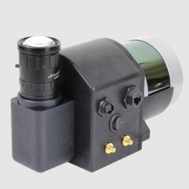
The POLYSCANNER LM16/32C is a flexible, highly integrated Aerial HD mapping system that includes Lidar, an HD Camera, and precision GNSS/INS sensors. The system features dual-frequency PPK/RTK centimeter-level GNSS/INS with, a high level of integration, compact, robust design, and survey-grade post-processing results.
PolyExplore, Inc.
San Jose, US
Description
The system features dual-frequency PPK/RTK centimeter-level GNSS/INS with, a high level of
integration, compact, robust design, and survey-grade post-processing results.
The POLYSACANNER system consists of:
- LIDAR ( 2 options) Velodyne VLP-16 OR Velodyne VLP-32C
- Industrial CAMERA w/Global Shutter
- Dual RTK/PPK INS/GNSS with centimeter-level accuracy
- Onboard FUSION computer
- Data storage
- Postprocessing software with coloration (RGB annotation)
- UAV adaptors :
- Standard DJI Matrice 600 adaptor
- Customized adaptors available on request
Specifications
-
Application
-
Main applications
Aerial HD mapping, Assets Management, Forestry, Digital maps
Training, maintanence and support
Training and support provided
Distinguishable features
All sensor data stored in one folder. No calibration at the beginning of the mission! Survey grade result. Post proceeding software allows colorization (RGB annotation)
-
Measurement Characteristics
-
Scanning method
Mechanical 360 degrees
Range accuracy [mm]
30
Scanning Speed [measurements p second]
20
multiple pulses in air
Y
Min. pulse frequency [Hz]
5
Max. pulse frequency [Hz]
20
Max. field of view [degrees]
40
Max. number of recorded echoes per pulse
2
-
Physical Properties
-
Height [cm]
15
Length [cm]
26
Width [cm]
145
Weight [kg]
2.5
Water and dust proof
sensor are water proof, the unit is not
-
Laser Pulse Characteristics
-
Laser Class
Class 1 – Eye-safe per IEC60825-1:2014
Wavelength [nm]
903
Min. range of laser pulse [m]
5
Max. range of laser pulse [m]
200
-
Power Supply
-
Power requirements
12 V DC, 25 W
Type of battery
Li Ion
Operation time on single battery [minutes]
45
Power consumption
25 W
-
Positioning System
-
Number of GNSS positioning sensors
1
Type of GNSS positioning sensors
PPK/RTK dual frequency, four constellations, dual antennas
Typical positioning accuracy [cm]
2
Heading, Pitch and Role internally captured
Y
Type of INS or IMU
Polynav 2000
Gyroscopes Bias In-Run stability [deg p hr]
2
-
Operation Characteristics
-
Camera included
Yes
Mounting
Adapter with antennas included
Requirements for compatible UAVs
DJI M600 standard. Other upon request
Camera specifications
Industrial global shutter comera
Control and user interface
Ethernet. Control interface PC software included
-
Data and Software
-
Type of storage
SSD
Included software
Post processing Sensor Fusion Polyfusion software
-
General
-
Year of last update
2021
Year of introduction
2019


