Nano Vux 3
The perfect solution for every small LiDAR project.
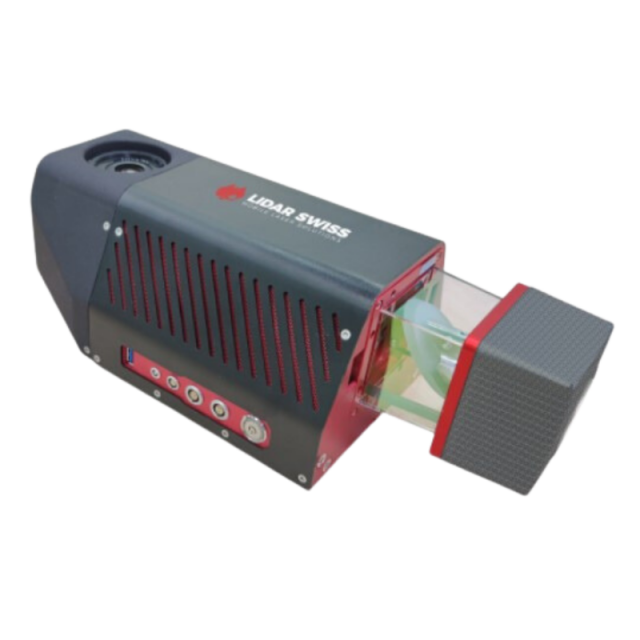
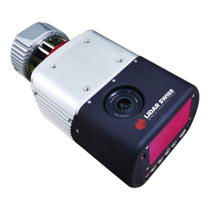
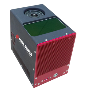
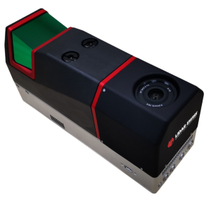
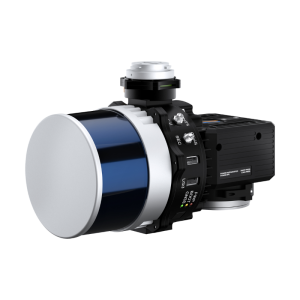
The latest model of the Nano Vux series, the Nano Vux 3 integrates the Riegl® miniVUX-3 scanner, Applanix® IMU/GNSS, and a 42mp calibrated camera. It weighs only 3.0kg making it suitable for various kinds of multi-drones.
LidarSwiss Solutions
Buchs, CH
Description
Nano Vux 3 is the latest model of the Nano Vux series. This upgraded LiDAR model integrates the Riegl® miniVUX-3 scanner, Applanix® IMU/GNSS, and a 42mp calibrated camera. It weighs only 3.0kg making it suitable for various kinds of multi-drones.
When operating onboard a LidarSwiss geo controller, it automatically collects laser and image data. LidarSwiss' proprietary Geo-LAS generates laser point cloud with RGB value simultaneously. The algorithm it uses to process 3D data for all objects above ground is proven to be highly accurate.
Nano Vux 3 is easy to transport, easy to install, and easy to operate. It is the perfect tool for rapid and accurate 3D data for small areas - whether it's on electronic copters and other flying platforms.
Key Features:
- 360° FOV @ 100kHz, 200kHz reduced power 180° @ 200kHz
- 120° @ 300kHz
- Applanix® IMU/GNSS
- Intelligent system controller
- Autonomous operation
- 42mp calibrated camera
- Automatic RGB attribution to laser points
- Only 30% side lap needed to generate survey grade DOM
- Lifetime system calibration
- Direct geo-referencing technology
- Support Geo-RT real-time process
LEARN MORE ABOUT THE TECHINCAL PERIMETERS FOR Nano Vux 3 HERE
Specifications
-
Application
-
Main applications
High accuracy small area mapping, Terrain modeling for heavy vegetation areas, Historical site mapping, Rapid and accurate distance measuring, Quick response mudslide analysis, Disaster management, Volumetric calculations for mining, Power line inspection/danger tree analysis, Riverbank and coastal line mapping, Water resource monitoring
Distinguishable features
360° FOV @ 100kHz, 200kHz reduced power, 180° @ 200kHz, 120° @ 300kHz
Training, maintanence and support
Training included in purchase
-
Measurement Characteristics
-
Max. pulse frequency [Hz]
300000
Max. field of view [degrees]
360
Scanning method
Rotating mirror
-
Physical Properties
-
Height [cm]
120
Length [cm]
36.3
Width [cm]
15.3
Weight [kg]
3
-
Laser Pulse Characteristics
-
Laser Class
Class 1, eye safe
Min. range of laser pulse [m]
3
Max. range of laser pulse [m]
330
-
Power Supply
-
Power consumption
50W (typical)
Power requirements
14-30V DC
-
Positioning System
-
Heading, Pitch and Role internally captured
Y
Type of INS or IMU
Applanix
-
Operation Characteristics
-
Camera included
Yes
Camera specifications
42mp calibrated camera


