


Lidaretto - Multiplatform Mapping System
Your Personal LiDAR
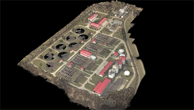
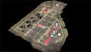
Improve your efficiency with Lidaretto and capture 3D reality using latest scanning technology. Be more productive and competitive. Invest just once in extremely versatile system that you will be able use for many applications.

Lidaretto
Bratislava, SK
Description
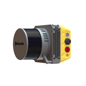
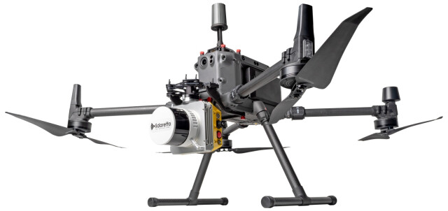
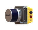
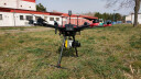
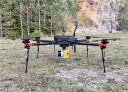
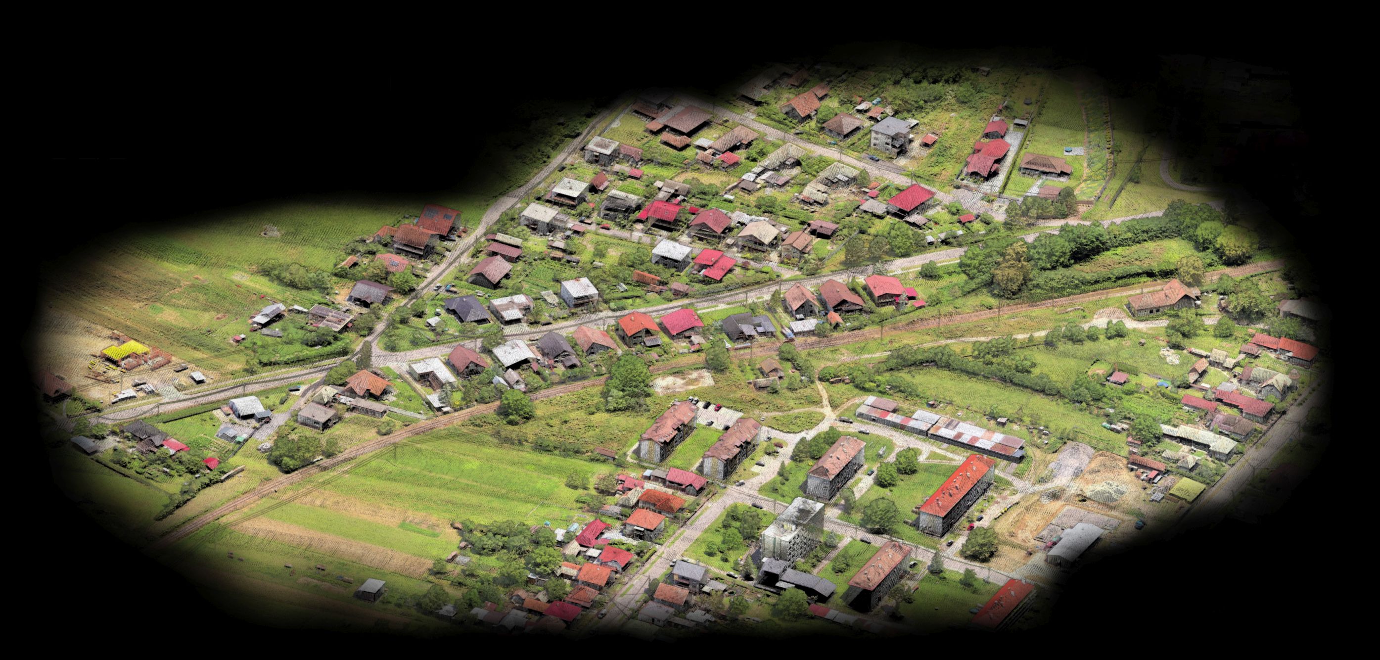
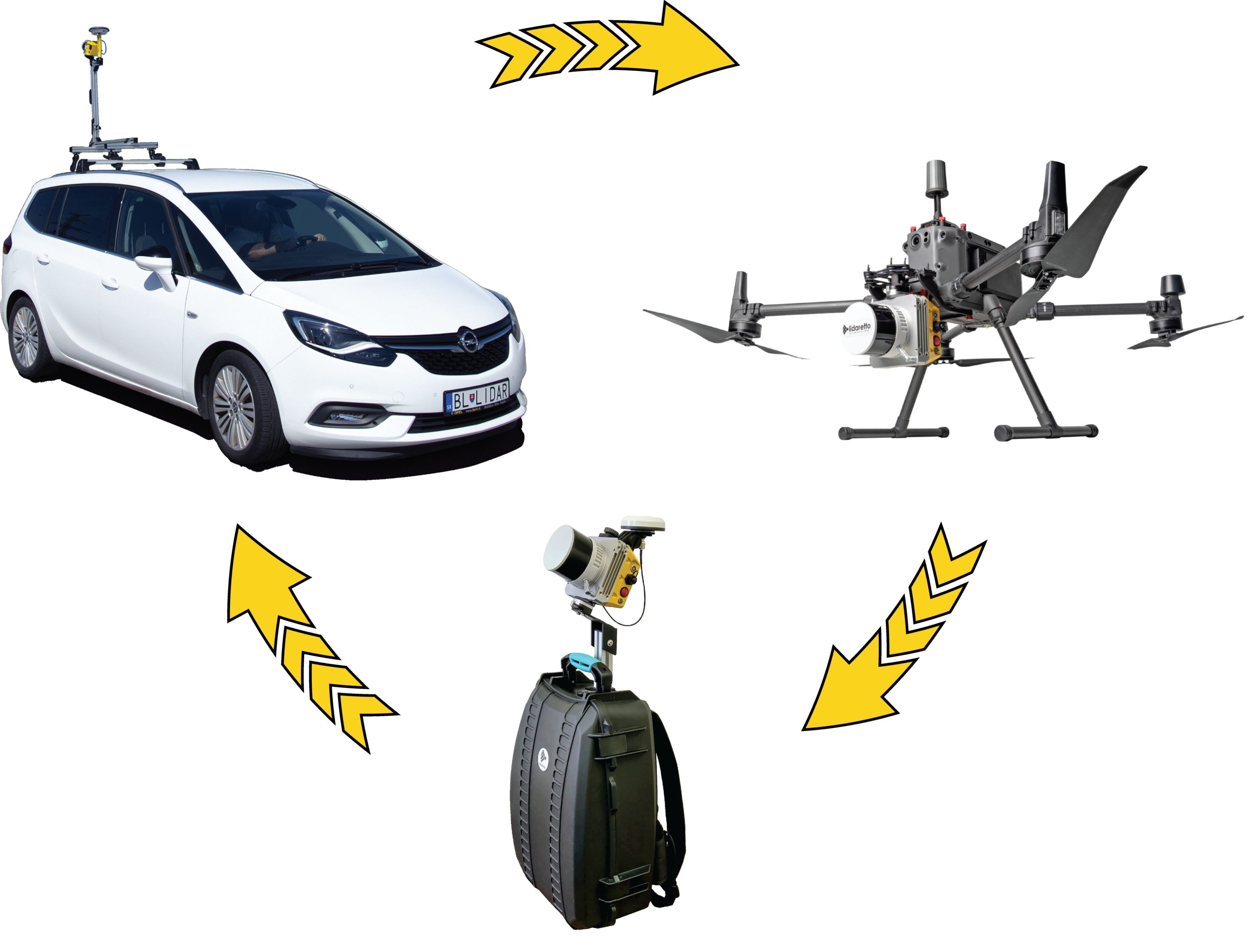
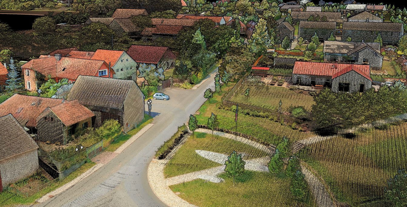
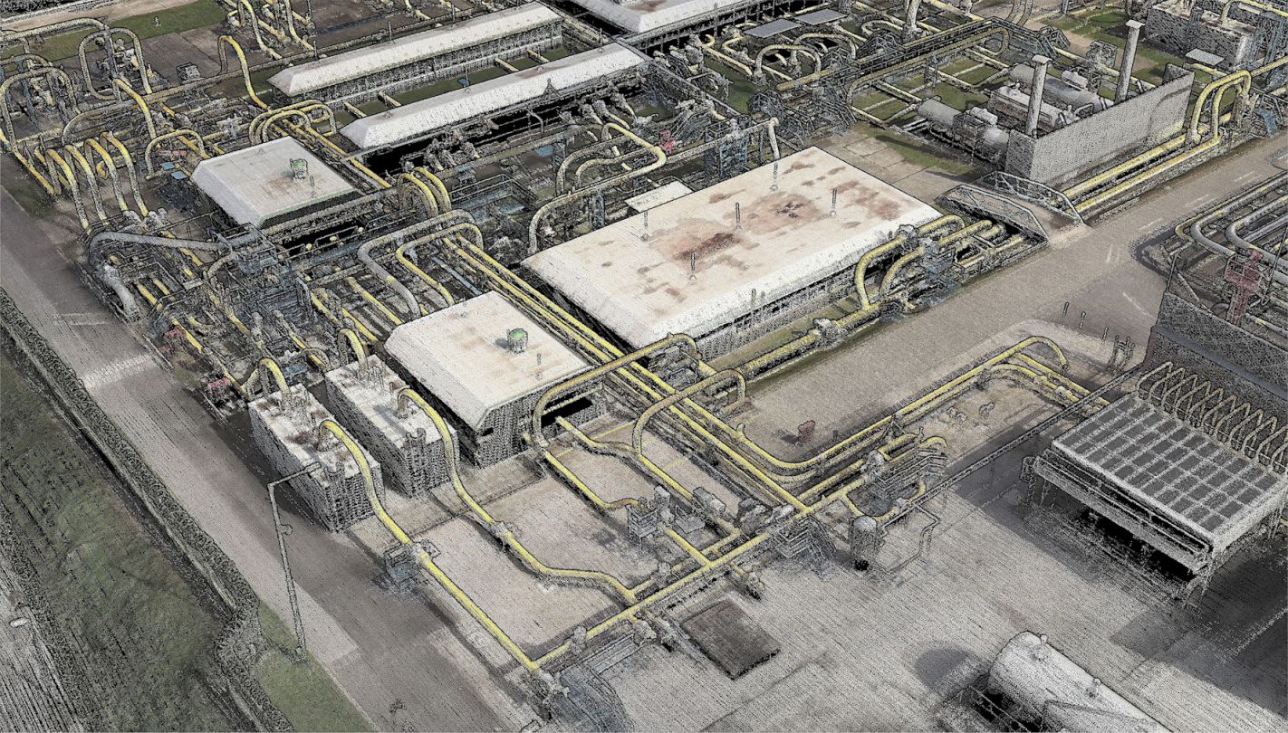
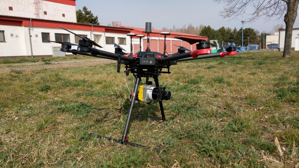
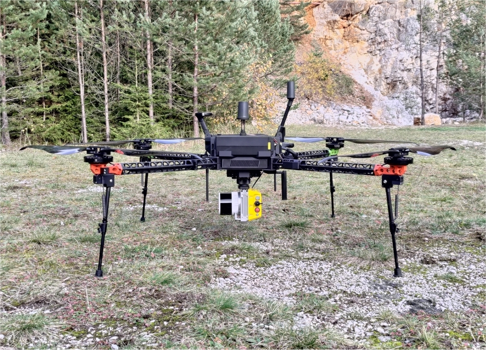
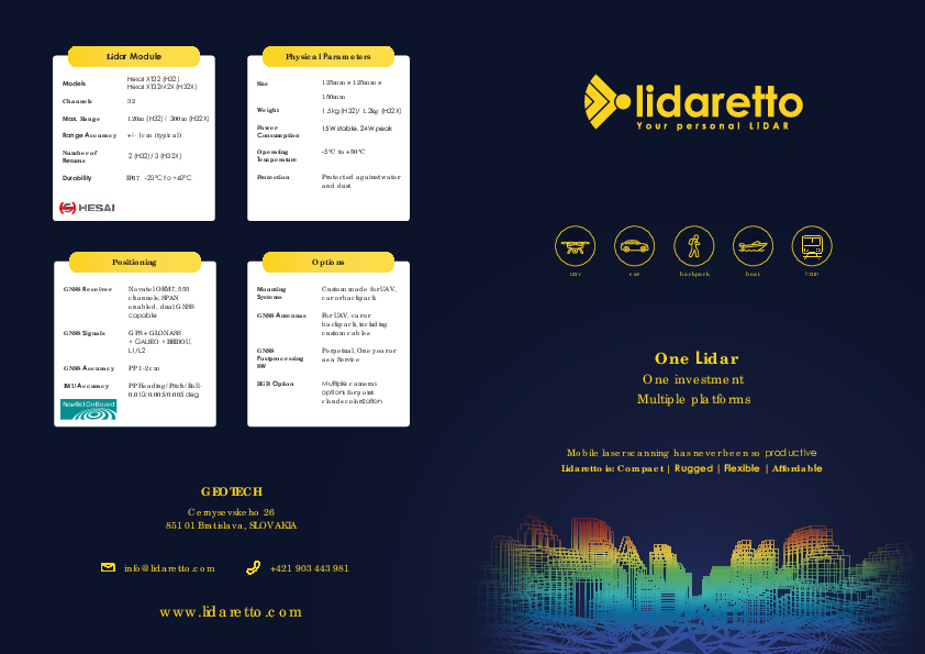
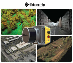
Lidaretto is compact and multiplatform Lidar scanning system with survey grade accuracy that can be easily mounted on various carriers such as the car, UAV, backpack, boat or train. Within Lidaretto we integrate best in class 360deg Lidar modules (Hesai, Teledyne Optech), and most accurate positioning (GNSS/IMU) technology from Novatel.
Mobile 3D scanning system Lidaretto is an ideal tool for many field applications where accurate and reliable geospatial data are needed.
Do you have questions about this product?
- Questions about price, availability, and/or retailers
- Questions about technical specifications and usage
- Questions about suitability for your project or application
Specifications
-
Application
-
Main applications
UAV mapping
Training, maintanence and support
Yes
Distinguishable features
Multiplatform
-
Measurement Characteristics
-
Range accuracy [mm]
10
multiple pulses in air
Y
Min. pulse frequency [Hz]
5
Max. pulse frequency [Hz]
20
Max. number of recorded echoes per pulse
3
Max. field of view [degrees]
360
-
Physical Properties
-
Weight [kg]
1.2
Height [cm]
12.5
Length [cm]
15
Width [cm]
12.5
Water and dust proof
Yes
-
Laser Pulse Characteristics
-
Laser Class
1
Wavelength [nm]
903
Max. range of laser pulse [m]
300
-
Power Supply
-
Power consumption
15W
Power requirements
12-24V
Type of battery
LiPol, LiIon
-
Positioning System
-
Number of GNSS positioning sensors
1
Type of GNSS positioning sensors
Novatel
Typical positioning accuracy [cm]
1
Heading, Pitch and Role internally captured
Y
Type of INS or IMU
MEMS
-
Operation Characteristics
-
Camera included
Optional
Camera specifications
360 or surveying camera
Mounting
Variable
-
Data and Software
-
Type of storage
SSD
Max. storage space [mb]
1000
-
General
-
Year of last update
2024
Documents
Brochure
Lidaretto_with_Hesai 2024.pdf
314.36 KB