
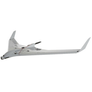
C-Astral SQA eVTOL
SQA eVTOL Multirole System Is an Evolutionary & Compact Small Unmanned System
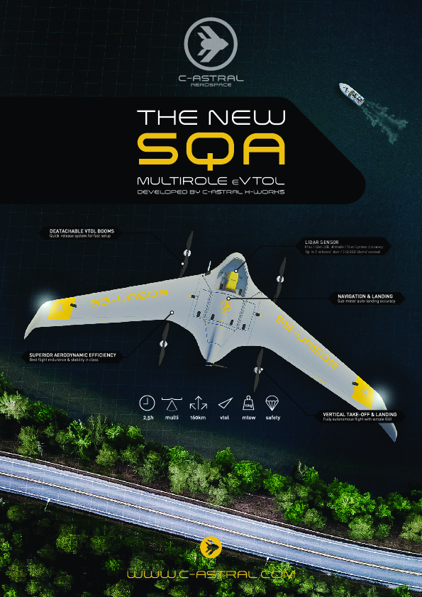
Developed by C-ASTRAL advanced X-WORKS laboratory enabling the complete spectrum of remote sensing, multirole and ISR operations over medium distances of up to 40 km from the ground control station. The SQA eVTOL can be equipped with several different command and control datalinks at frequencies from 1GHz up to 5GHz in MANET or MIMO configurations.

C-ASTRAL
Ajdovščina, SI
Description
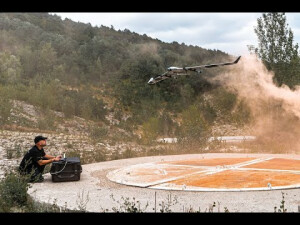
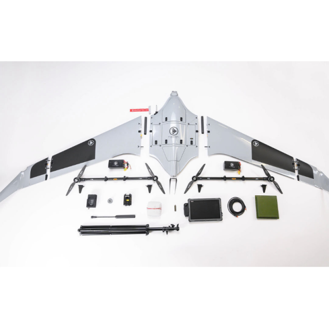
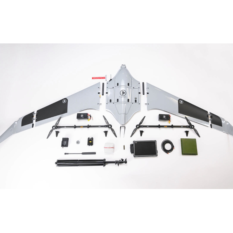
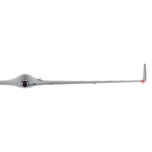
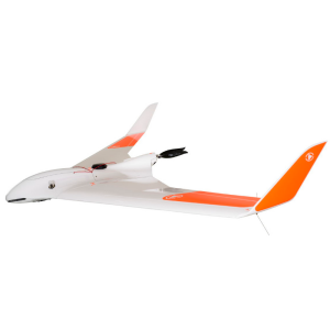
The mk1 basic SQA system can be configured for first responders, search and rescue, and firefighting, as well as complex military-level ISR and fire control missions with an array of stabilized sensor options, including the new Yellowscan sourced LIDAR system. Additionally, the SQA eVTOL can serve as a very capable remote sensing platform for aero photogrammetry as well as scientific atmospheric sensing including gas leak detection missions, Lidar and other advanced environmental sensors. Developed on the robust legacy basis of the more than 140000 global flight hours experience of the C-ASTRAL BRAMOR and ATLAS systems, the SQA eVTOL is delivered with the unified C3P command, control, communications and planning software package on a simple tablet-level GCS that provides superior situational awareness and safety of unmanned operations through a user-friendly graphic interface and intuitive control. With C3P you can plan and execute your flight missions, control the flight parameters and sensors in real-time and collect and aggregate geospatial data.
Features:
- Precise VTOL takeoff and landing
- Superior aerodynamic efficiency
- Up to 2,5h endurance*
- Flight range up to 180 km
- Video/Datalink range up to 40 km
- Silent & Stealth
- GNSS jamming / spoofing mitigation
- Best in class stabilized ISR payload
- LIDAR, multispectral, hyperspectral and other sensors
- Quick release - detachable VTOL booms
- Automated digital preflight checklist
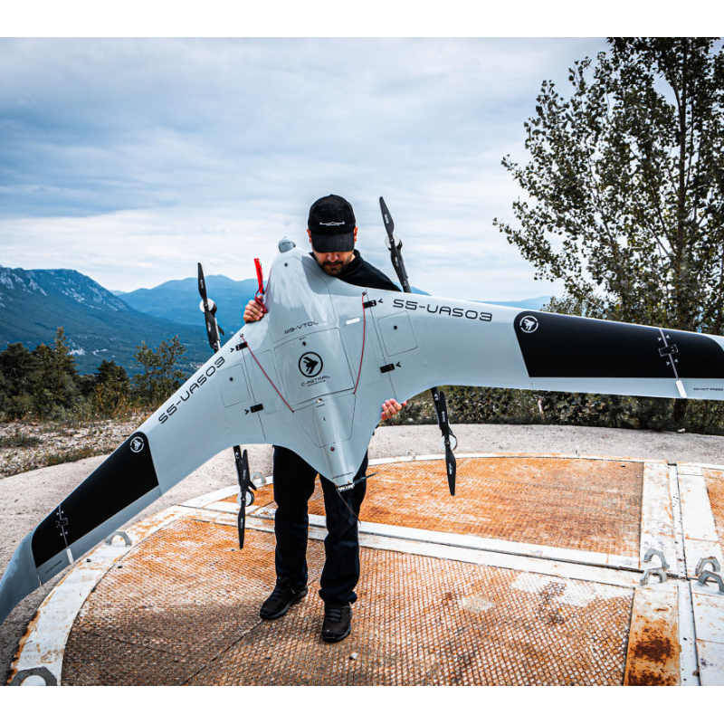
- Flight ready in less than 5 min
- Ability to track, Geo-register or Lock targets
Applications
- Aerophotogrammetry
- LIDAR mapping
- Multispectral remote sensing
- Hyperspectral remote sensing
- Gas leak sensing
- Search and rescue
- First responders
- Firefighting
- Infrastructure control
- Pipeline monitoring
- Woods and landscape management
- Flood monitoring
- Civil defence
- Anti Poaching
- Low-intensity conflict zone control
- Classical ISR
- Complex military-level ISR
- Over the hill observation
- Fire control
- Night Surveillance
- Battlefield management
- Moving target detection and tracking
Do you have questions about this product?
- Questions about price, availability, and/or retailers
- Questions about technical specifications and usage
- Questions about suitability for your project or application
Specifications
-
General
-
Application
-
Platform
-
Platform
Type of UAV
Energy source
Documents
Brochure
sqa-lidar-a4-brochure-v2-web-2.pdf
4.52 MB
Other documents
-
SQA LIDAR BROCHURE4.52 MB
Videos

