UAV BIRDIE GEO+
Complete mapping solution
FlyTech UAV Ltd.
Krakow, PL
Description
BIRDIE UAV is the complete mapping solution, with absolute accuracy up to 3 cm and maximum ground resolution up to 1cm.
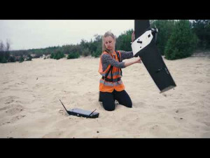
Simple hand launch and precise landing of BIRDIE make it a perfect match even for beginners. Managing your flight will be extremely easy thanks to the intuitive all-in-one flight controller.
4G LTE connectivity and ADS-B receivers ensure the highest level of safety and prepare the platform to conduct BVLOS flights.
Meet the tailor-made UAV BIRDIE, the drone adjusted to your needs.
Specifications
-
Environment
-
Min. operation temperature [°C]
-10
Max. operation temperature [°C]
50
Max. wind speed [m/sec]
15
-
Imaging/scanning devices
-
Type of Camera
Sony RX1R II
Additional Sensors and additional information
Thermal camera, NIR, NDVI; GSM/3G/LTE connectivity
Build-in Stablilsation
N
Exchangeable
Y
Sensor tilting to allow oblique views
N
Onboard imaging/scanning devices
-
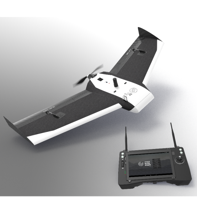
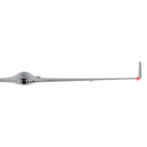
Platform
-
Brand
BIRDIE
Max. payload [kg]
0.6
Max. stay in the air [min]
60
Max. speed [km/h]
90
Max. height above sea level [m]
2500
Propulsion
Electric
Platform
Aircraft
-
Accessories
-
Transportation accessories
flight case, ground control station (flight controller) with tablet and app to plan and manage a flight, cables, chargers, battery
Included batteries and charger
Intelligent Li-Ion battery, charger
More included products and spare parts
control panel with comfortable suspender, chargers, cables, battery
-
Operation Characteristics and Safety
-
Min. ø of launch/landing site [m]
10
Launching method
by hand
Automatic launch and landing
Y
Training provided
Y
Collision avoidance systems (CAS)
N
Autonomous emergency landing
Y
-
Dimensions
-
ø / wingspan [cm]
140
Height [cm]
14
Weight [kg]
2.4
Weight of battery [kg]
0.6
Weight of filled fuel tank [kg]
0
Number of rotors
1
Transport on human back
Y
Length [cm]
56
-
Base Station
-
Ground computer included
Y
Type of Ground computer
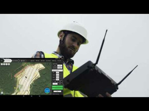
dedicated flight controller with embedded tablet and flight planning app
Real time image and video download link
N
-
Navigation Sensors
-
Type of GNSS receiver and captured signals
RTK multi-constellation, multi-frequency receiver (GPS L1/L2.L5, GLONASS L1/L2, GALILEO L1/E5, BEIDUO B1/B2, QZSS L1/L2/L5, SBAS L1/L5)
Type of IMU
Integrated with autopilot
Other sensors and additional information
Pitot tube
Correction services [PPK, RTK]
Y
-
General
-
Year of last update
2018
Typical applications
Photogrammetry, 2D & 3D mapping, Agriculture, SAR, Power engineering
-
Included software and automatically generated
-
Flight planning software
FlyTech Mission Manager Lite
Photogrammetric software
3D Survey | Agisoft Photoscan | Pix4D
Additional information on software or automatically generated products
Wide possibilities of system’s customization (in terms of drone, equipment, software), warranty, technical support and local service
Type of software included
Flight planning, Photogrammetric software
Automatically Generated Products


