
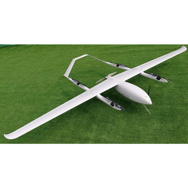
HeadHunter UAV - VTOL
Customized VTOL UAVs, both fixed wing and rotary wing, with electric or hybrid propulsion(electric+gasoline engines), for different applications: aerial topography, precision agriculture/forestry, Law Enforcement, ISR. Payload 1-5 kg Flight endurance: 1-8h Flight range: 10-200km For more details and customized offer, contract us at: [email protected]
HeadHunter Ltd
Brasov, RO
Description
Specifications
-
Environment
-
Min. operation temperature [°C]
-30
Max. operation temperature [°C]
60
Max. wind speed [m/sec]
25
Max. humidity [%]
95
-
Imaging/scanning devices
-
Onboard imaging/scanning devices
RGB Camera, Additional sensors, NIR Camera
Type of Camera
different
Type of Lidar
optional, at request
Additional Sensors and additional information
yes
Build-in Stablilsation
N
Exchangeable
Y
Sensor tilting to allow oblique views
Y
-
Platform
-
Platform
Aircraft
Brand
HeadHunter
Max. payload [kg]
1.5
Max. stay in the air [min]
120
Max. speed [km/h]
150
Max. height above sea level [m]
3500
Propulsion
electric/electric+gasoline version
-
Accessories
-
Transportation accessories
transportation boxthe electric version have 2 h flight endurancethe hybrid version(electric+gasoline) have 4h fight endurancemore details at request, on email: [email protected]
Included batteries and charger
yes
More included products and spare parts
yes
-
Operation Characteristics and Safety
-
Min. ø of launch/landing site [m]
5
Launching method
VTOL
Automatic launch and landing
Y
Training provided
Y
Collision avoidance systems (CAS)
N
Autonomous emergency landing
Y
-
Dimensions
-
ø / wingspan [cm]
350
Height [cm]
70
Weight [kg]
14
Weight of battery [kg]
5.5
Weight of filled fuel tank [kg]
4
Number of rotors
5
Transport on human back
Y
-
Base Station
-
Ground computer included
Y
Type of Ground computer
Panasonic
Sensor control
Y
Real time image and video download link
Y
-
Navigation Sensors
-
Type of GNSS receiver and captured signals
regular GPS, 1m max errorRTK/PPK gps, optional
Other sensors and additional information
46MP camera, multispectral camera, big zoom camera, IR camera
Correction services [PPK, RTK]
optional
-
General
-
Year of last update
2017
Typical applications
aerial maps, precision agriculture, law enforcement, ISR
Product Name
HeadHunter UAV
-
Included software and automatically generated
-
Type of software included
Block adjustment, Camera self-calibration, Flight planning, Photogrammetric software, Point cloud processing software
Flight planning software
yes
Photogrammetric software
yes
Point cloud processing software
yes
Automatically Generated Products
Point Clouds, 3D Landscape Models, DEMs, DTMs, Orthomosaics, NDVI maps
Additional information on software or automatically generated products
at request


