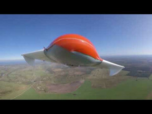
Geoscan 201
System for aerial survey of large territories and linear objects.
Geoscan 201 is fixed-wing drone (automatic aerial survey system), designed to boost the quality and efficiency of mapping of large area with the ability to install various cameras, and flight time up to 3 hours Geoscan 201 is ideal tool to make big projects in different industries
GEOSCAN GROUP
St. Petersburg, RU
Description
Overview
Geoscan 201 is an automated photometric mapping system with 3 hours flight time, offering large-area surveys, as well as increasing the capture range during the flight. With its flight time up to 180 minutes it offers up to 1500 ha with GSD up to 3 cm/px. And onboard receiver GNSS Topcon (PPK) helps you achieve absolute accuracy of down to 3 cm, without GCPs. The drone can be equipped with various cameras, including two cameras at once ( for example, RGB and multispectral). Geoscan 201 in the Urban modification is great for creating 3D, as it can place 2 cameras at different angles to obtain high-quality textures of building facades.
Automated aerial photography process
Simply select the area and set parameters needed to start an aerial survey. The flight plan will be loaded to autopilot, and you need only to confirm the launch. Geoscan 201 will perform the mission with the specified altitude and images’ overlap.
Geoscan 201 models:
Basic package
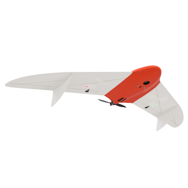
- Unmanned aerial vehicle (UAV) Geoscan 201:
- Upgraded Sony A6000 digital camera with focal plane shutter (24 Mpix, 20 mm lens)
- Battery 5S, 32000 mAh
- Folding rack for UAV assembly
- UAV transport case(IP67, size: 80x52x31 cm, gr.weight: 18,5 kg)
- Flight management software : Geoscan Planner
- Radio Link modem
- Battery charger
- Launcher in transport bag (size:115x19x16 cm, gr.weight.: 7 kg)
- Spares and accessories kit
Software to consider
Operator Training
- Introduction to Geoscan UAV & workflow
- Flight planning & management with Geoscan Planner
- Practical work in the field
Specifications
-
Environment
-
Min. operation temperature [°C]
-20
Max. operation temperature [°C]
40
Max. wind speed [m/sec]
15
-
Battery and Power
-
operating temperature
-20 до +40
-
Imaging/scanning devices
-
Onboard imaging/scanning devices
-
Platform
-
Max. payload [kg]
1.5
Max. speed [km/h]
130
Max. height above sea level [m]
4000
Brand
Geoscan
Platform
Aircraft
Max. stay in the air [min]
180
Propulsion
single pusher propeller, brushless electric motor
-
Operation Characteristics and Safety
-
Launching method
catapult, automated mode
Training provided
Y
Automatic launch and landing
Y
Autonomous emergency landing
Y
Collision avoidance systems (CAS)
N
-
Dimensions
-
ø / wingspan [cm]
222
Weight [kg]
8.5
-
General
-
Product Name
Geoscan 201 Base
Year of last update
2020
Models in series
201
-
Included software and automatically generated
-
Type of software included
Automatically Generated Products
Videos


