
Description
Specifications
-
Environment
-
Min. operation temperature [°C]
-8
Max. operation temperature [°C]
30
Max. wind speed [m/sec]
7
-
Imaging/scanning devices
-
Onboard imaging/scanning devices
RGB Camera, Additional sensors, Gimbal, NIR Camera
Type of Camera
FLIR
Type of Lidar
-
Additional Sensors and additional information
Photogrammetric RGB version.Option 1 - NIR cameraOption 2 - observation version with RGB/IR head
Build-in Stablilsation
N
Exchangeable
Y
Sensor tilting to allow oblique views
N
-
Platform
-
Platform
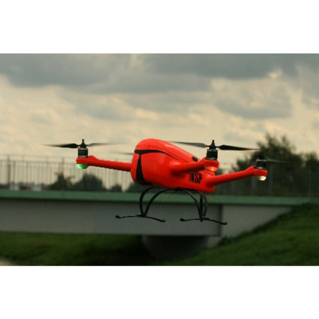
Copter
Brand
geoHOVERFLY
Max. payload [kg]
0.2
Max. stay in the air [min]
40
Max. speed [km/h]
50
Max. height above sea level [m]
2000
Propulsion
electric
-
Accessories
-
Transportation accessories
Ruggedized case
Included batteries and charger
y
-
Operation Characteristics and Safety
-
Min. ø of launch/landing site [m]
1
Launching method
automatic or manual
Automatic launch and landing
Y
Training provided
Y
Collision avoidance systems (CAS)
N
Autonomous emergency landing
Y
-
Dimensions
-
ø / wingspan [cm]
70
Height [cm]
20
Weight [kg]
0.6
Weight of battery [kg]
0.8
Weight of filled fuel tank [kg]
0
Number of rotors
4
Transport on human back
Y
-
Base Station
-
Ground computer included
Y
Sensor control
Y
Real time image and video download link
Y
-
Navigation Sensors
-
Correction services [PPK, RTK]
PPK
-
General
-
Year of last update
2017
Typical applications
photogrammetry, volume calculations, monitoring,
-
Included software and automatically generated
-
Type of software included
Flight planning
Flight planning software
MSP
Automatically Generated Products
Point Clouds, 3D Landscape Models, DEMs, DTMs, Orthomosaics


