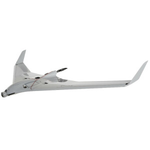
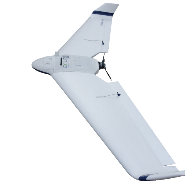
Eclipse 2.0 Professional Survey Portable Fixed Wing Drone
Portable | Accurate | Affordable
Easily and accurately map large areas with the Eclipse Photogrammetry Solution.
Robota LLC
United States
Description
The Robota Eclipse UAV is an easy to use, robust and reliable platform designed for and proven in challenging environments. Hi-resolution 21MP imagery is available with the standard package, yielding 1.2 inches per pixel at 400ft flight altitude. Thermal and NIR payloads are available as well. Eclipse is the ideal portable solution for large area mapping in 3D survey, agriculture, and corridor inspections. Made in the USA along with its Robota Goose autopilot, Eclipse can be ordered for custom applications. Flight time options between 60 and 100 minutes ensure large area mapping capability. Reach out to discover more.
Specifications
-
Environment
-
Max. wind speed [m/sec]
28
Min. operation temperature [°C]
-10
Max. operation temperature [°C]
42
-
Imaging/scanning devices
-
Onboard imaging/scanning devices
Exchangeable
Y
-
Platform
-
Platform
Aircraft
Brand
ROBOTA
Max. stay in the air [min]
80
Propulsion
Electric single
-
Accessories
-
Transportation accessories
Robust transport case
Included batteries and charger
2 Batteries, 1 Charger
-
Operation Characteristics and Safety
-
Launching method
Hand Launch
Training provided
Y
Automatic launch and landing
Y
Autonomous emergency landing
Y
-
Dimensions
-
ø / wingspan [cm]
55
Weight [kg]
1.36
Number of rotors
1
-
Base Station
-
Ground computer included
N
Type of Ground computer
Windows based
-
Navigation Sensors
-
Type of GNSS receiver and captured signals
L1/L2 GNSS
Correction services [PPK, RTK]
PPK/RTK
Positioning Accuracy
.1 ft
-
General
-
Year of last update
2020
Typical applications
Mining, Surveying, Mapping, Agriculture
-
Included software and automatically generated
-
Type of software included
Flight planning, Photogrammetric software, Point cloud processing software
Automatically Generated Products
Flight planning software
Robota GCS
Photogrammetric software
As needed
Point cloud processing software
As needed


