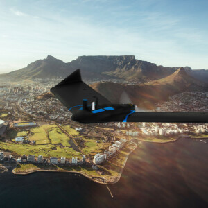
eBee X Drone - C2 Certified
Drone, UAV, UAS - Surveying, Mapping, Mining & Construction Data
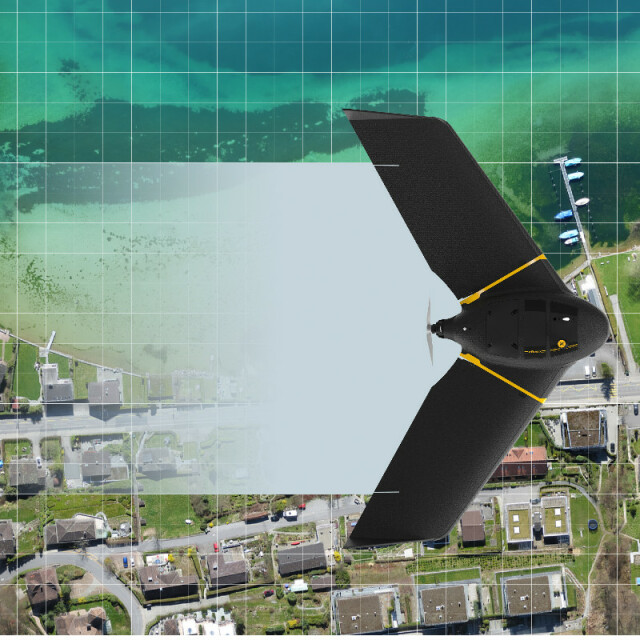
The eBee X series drones are the first UAS in the world to receive EASA - European Union Aviation Safety Agency’s C2 certification. The eBee X is the fixed-wing drone for all your mapping needs. It suits every job thanks to AgEagle's S.O.D.A. 3D, for stunning 3D reconstructions of vertical environments such as urban centres, mines and coastlines, the best-in-class Aeria X RGB photogrammetry camera, and the Duet T for creating geo-accurate thermal maps.
AgEagle Aerial Systems Inc.
Cheseaux-Lausanne, CH
Description
Features:
The eBee X can meet the exacting requirements of every project. Its unique Endurance Extension unlocks a flight time of up to 90 minutes—for vast coverage of up to 500 ha (1,235 ac) at 122 m (400 ft)—while its High-Precision on Demand (RTK/PPK) helps you achieve absolute accuracy of down to 3 cm (1.2 in), without GCPs. The eBee X also allows you to work virtually every site, no matter how demanding, thanks to its Steep Landing technology, ultra-robust design, live air traffic data and more.
Specifications
-
Environment
-
Min. operation temperature [°C]
-10
Max. operation temperature [°C]
40
Max. humidity [%]
95
-
Imaging/scanning devices
-
Onboard imaging/scanning devices
RGB Camera, Additional sensors, Gimbal, NIR Camera
Type of Camera
RGB APS-C or 1-inch, agile RGB for oblique images, RGB + thermal, multispectral RGB+NIR+RE
Build-in Stablilsation
Y
Exchangeable
Y
Sensor tilting to allow oblique views
Y
-
Platform
-
Platform
Aircraft
Brand
AgEagle
Max. stay in the air [min]
90
Max. speed [km/h]
110
Max. height above sea level [m]
2500
Propulsion
single pusher propeller, low-noise brushless electric motor
-
Accessories
-
Transportation accessories
Transport case with wheels and troley handle
Included batteries and charger
Two smart batteries and one charger to charge two batteries
More included products and spare parts
Two spare propellers, ten rubber bands
-
Operation Characteristics and Safety
-
Min. ø of launch/landing site [m]
30
Launching method
One-hand or two-hand
Training provided
N
Automatic launch and landing
Y
Autonomous emergency landing
Y
Collision avoidance systems (CAS)
N
-
Dimensions
-
ø / wingspan [cm]
116
Weight [kg]
1.1
Weight of battery [kg]
0.3
Transport on human back
Y
-
Base Station
-
Ground computer included
N
Type of Ground computer
Windows-based laptop or tablet
Sensor control
Y
Real time image and video download link
N
-
Navigation Sensors
-
Type of GNSS receiver and captured signals
Survey grade, dual frequency, GPS+GLONASS
Correction services [PPK, RTK]
RTK and/or PPK
Other sensors and additional information
Active ground distance sensor, barometer, Pitot probe
-
General
-
Year of last update
2021
Typical applications
mapping photogrammetry 3Dmodels DTM DSM orthomosaic pointclouds drone
-
Included software and automatically generated
-
Type of software included
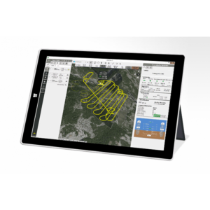
Flight planning
Automatically Generated Products
3D City Models, Point Clouds, 3D Landscape Models, DEMs, DTMs, Orthomosaics, NDVI maps
Flight planning software
senseFly eMotion 3.7
Photogrammetric software
Pix4D Mapper or Photoscan Agisoft or Trimble Business Center
Additional information on software or automatically generated products
Automatic upload to Dronelogbook


