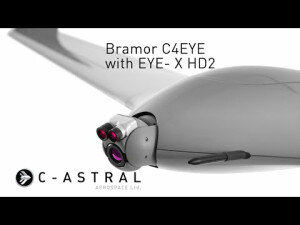
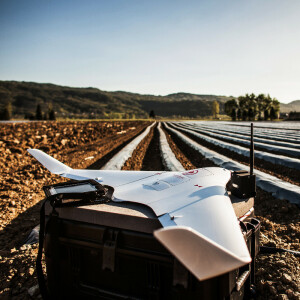
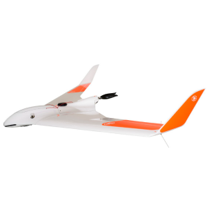
Bramor C4EYE
Battlefield and special OPS proven
The field proven BRAMOR C4EYE UAS line is suitable for operations where real-time or near real time video observation and surveillance capability is of utmost importance. With an endurance of up to 3 hours, a standard data and payload link of up to 40km LOS, or the optional MANET digital communications capabilities.

C-ASTRAL
Ajdovščina, SI
Description
Non-Governmental and private organizations and sovereign actors alike use the C4EYE UAS for a myriad of applications such as Search and Rescue, wildfire containment and mitigation, pipeline and infrastructure monitoring, ISR missions, conflict zone surveillance, convoy and transportation support, perimeter monitoring, border monitoring, environmental monitoring, anti-poaching, wildlife observation, remote sensing research and ice flow dynamics. A myriad of other sensors, options and communications reach, capability and security extensions are available on these systems.
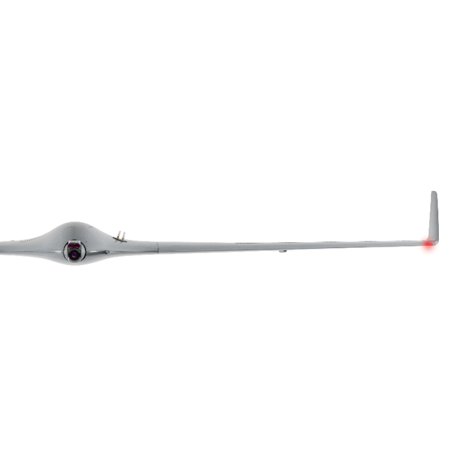
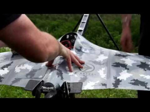
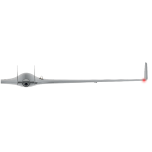
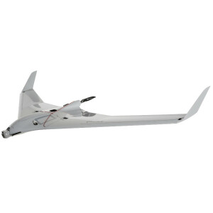
The vehicle is comprised of a blended wing body modular airframe, with the emphasis on the smallest possible takeoff weight, advanced aerodynamics, electric propulsion, completely autonomous operation, endurance, turbulent air penetration and stability, ergonomic and user-friendly ground control station, durability and mobility. The airframe is made of advanced composite materials (Kevlar/Carbon/Vectran) that provide a high level of survivability and no radar signature.
|
|
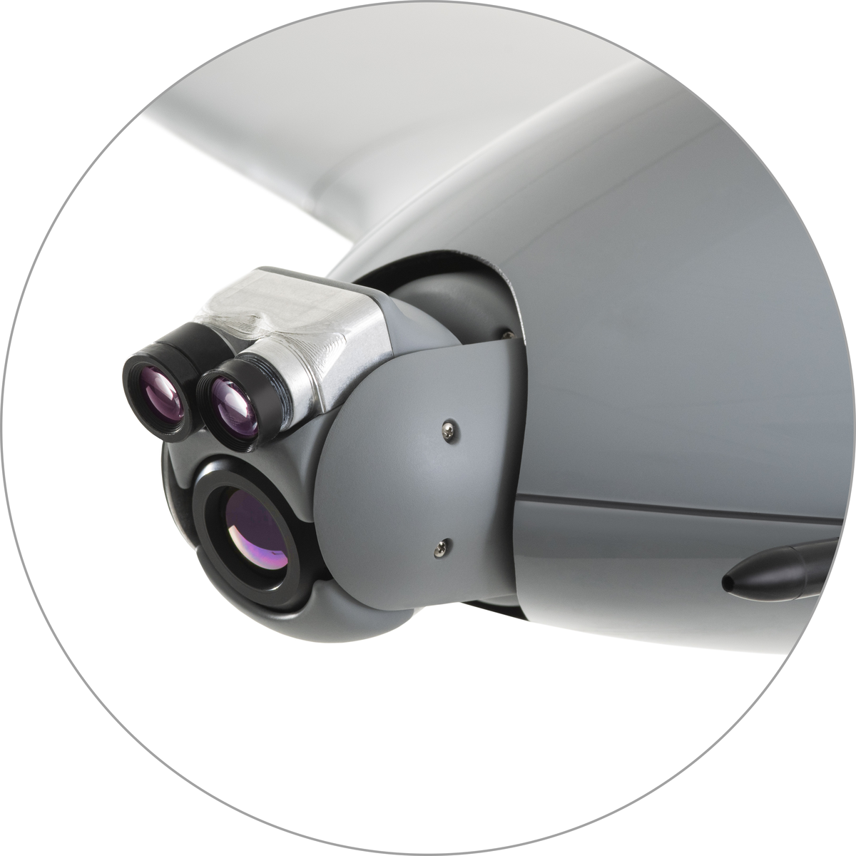
The stabilized C-Astral EYE-X family of gimbals provides electro-optical CCD and state of the art un-cooled micro-bolometer based thermal imaging capabilities with the optional laser illuminator |
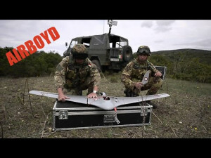
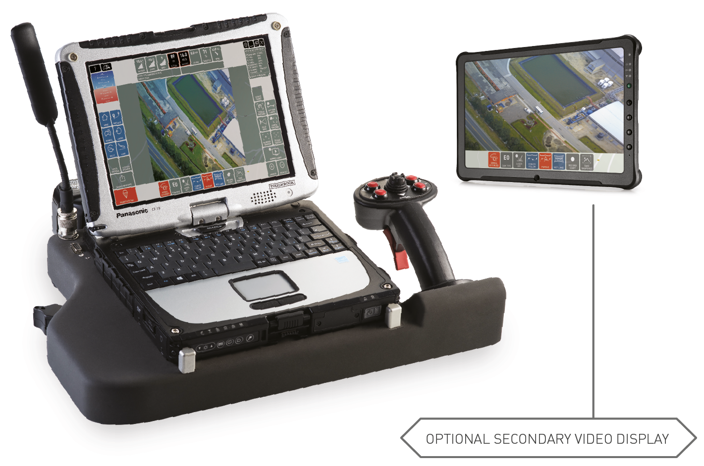
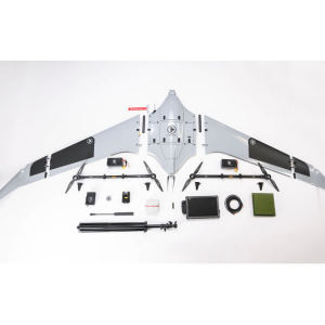
The system consists of the air vehicle with an EYE-XHD2 sensor, a foldable portable takeoff catapult and rugged ground control station. The system is highly mobile and fits into a MILSPEC, rain-resistant backpack with the GCS embedded industry-standard rugged package and is designed for fast deployment, flight-ready in less than five minutes. It can be safely operated by a single operator/pilot in command, although a two-person crew is preferable.
* Flight endurance measured at ICAO standard atmosphere conditions (15 °C / 1013,25 hPa / winds calm), depends on UAS configuration/system weight.
** Product images are for illustrative purposes and may differ from the actual product.
Website: https://www.c-astral.com/en/unmanned-systems/bramor-c4eye
Do you have questions about this product?
- Questions about price, availability, and/or retailers
- Questions about technical specifications and usage
- Questions about suitability for your project or application
Specifications
-
Environment
-
Min. operation temperature [°C]
-25
Max. operation temperature [°C]
50
Max. wind speed [m/sec]
12
Max. humidity [%]
95
-
Battery and Power
-
Battery type
LiPo
-
Imaging/scanning devices
-
Onboard imaging/scanning devices
RGB Camera, Gimbal, SWIR Camera
Type of Camera
RGB 1280x720 HD resolution (20x optical zoom + 2x digital zoom, total 40x continuous zoom), IR 640x480 resolution (4x digital zoom, WH/BH toggle)
Build-in Stablilsation
Y
Exchangeable
Y
Sensor tilting to allow oblique views
Y
Additional Sensors and additional information
IR Laser pointer (850nm, 5mW, Class IIIb)
-
Platform
-
Platform
Aircraft
Brand
C-Astral
Max. payload [kg]
1
Max. stay in the air [min]
150
Max. speed [km/h]
83
Max. height above sea level [m]
5000
Propulsion
Brushless Electric
Maximum rate of ascent
8 m/s
Maxirum rate of descent
3 m/s
Weight (with cooling fan)
4.5 kg
Material
carbon, kevlar, vectran
Maximum roll angle
57°
Maximum climbing speed
8 m/s
Maximum descending speed
3 m/s
Maximum rotation angle
25°/s
-
Accessories
-
Transportation accessories
rugged flight case transportation box or water-resistant rugged mil-spec backpack made from CORDURA fabric
Included batteries and charger
Y
More included products and spare parts
Battery charger, Battery charging cables, Computer charging cable, Parachutes, Checklist, Tools
-
Operation Characteristics and Safety
-
Min. ø of launch/landing site [m]
50
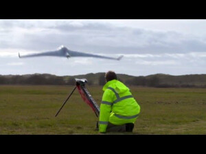
Launching method
Catapult with elastics or Pneumatic catapult
Training provided
Y
Automatic launch and landing
Y
Autonomous emergency landing
Y
Collision avoidance systems (CAS)
N
-
Dimensions
-
ø / wingspan [cm]
230
Height [cm]
15
Width [cm]
230
Length [cm]
95
Weight [kg]
4.5
Weight of battery [kg]
1.6
Number of rotors
1
Transport on human back
Y
-
Base Station
-
Ground computer included
Y
Type of Ground computer
Panasonic CF-20
Sensor control
Y
Real time image and video download link
Y
-
Navigation Sensors
-
Type of GNSS receiver and captured signals
L1 GNSS Receiver (GPS+Glonass)
Type of IMU
internal
Correction services [PPK, RTK]
SBAS
Other sensors and additional information
gyroscope, accelerometer, magnetometer
Velocity Measurement Accuracy
0.1 m/s
Orientation Accuracy
1°
Positioning Accuracy
1 m
-
General
-
Year of last update
2020
Typical applications
Pipeline and infrastructure monitoring, Oil spill inspection, Search and rescue, Wildfire containment and mitigation, ISR missions, Conflict zone surveillance, Convoy and transportation support, Perimeter monitoring, Border monitoring, Environmental monitoring, Anti-poaching, Wildlife observation
Product Name
Bramor
Models in series
C4EYE, ppX, sAR, mSX
Product manual
Y
-
Included software and automatically generated
-
Type of software included
Camera self-calibration, Flight planning
Automatically Generated Products
Point Clouds, 3D Landscape Models, DEMs, DTMs, Orthomosaics
Flight planning software
C3P
Photogrammetric software
Pix4D, Agisoft PhotoScan, 3Dsurvey, Correlator3D, Ensomosaic, PIEneering, Menci Software, Orbit
Point cloud processing software
Pix4D, Agisoft PhotoScan, 3Dsurvey, Correlator3D, Ensomosaic, PIEneering, Menci Software, Orbit
Additional information on software or automatically generated products
POI geotag KML, KLV geotagged FMV video
Documents
Brochure
c-astral_katalog2019-spread.pdf
