
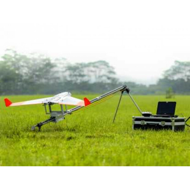
Description
Specifications
-
Environment
-
Min. operation temperature [°C]
-5
Max. operation temperature [°C]
50
Max. wind speed [m/sec]
30
Max. humidity [%]
50
-
Imaging/scanning devices
-
Onboard imaging/scanning devices
RGB Camera, Additional sensors
Type of Camera
RGB
Type of Lidar
Lite
Additional Sensors and additional information
NIR, THERMAL
Build-in Stablilsation
N
Exchangeable
Y
Sensor tilting to allow oblique views
N
-
Platform
-
Platform
Aircraft
Brand
AeroTerrascan
Max. payload [kg]
0.6
Max. stay in the air [min]
60
Max. speed [km/h]
110
Max. height above sea level [m]
2000
Propulsion
Electric
-
Operation Characteristics and Safety
-
Min. ø of launch/landing site [m]
30
Launching method
Catapult
Automatic launch and landing
Y
Training provided
Y
Collision avoidance systems (CAS)
N
Autonomous emergency landing
N
-
Dimensions
-
ø / wingspan [cm]
240
Height [cm]
20
Weight [kg]
4
Weight of battery [kg]
5.5
Weight of filled fuel tank [kg]
0
Number of rotors
1
Transport on human back
Y
-
Base Station
-
Ground computer included
Y
Type of Ground computer
Netbook
Sensor control
Y
Real time image and video download link
N
-
Navigation Sensors
-
Type of GNSS receiver and captured signals
u-blox NEO-7
Type of IMU
Invensense MPU 6000 3-axis accelerometer/gyroscope
Other sensors and additional information
32 bit microprocessor
-
General
-
Year of last update
2016
Typical applications
Photogrammetry
-
Included software and automatically generated
-
Type of software included
Block adjustment, Camera self-calibration, Flight planning, Photogrammetric software, Point cloud processing software
Flight planning software
Custom Mission Planner
Photogrammetric software
Agisoft Photoscan, Other softwares ready
Point cloud processing software
Agisoft Photoscan, Other softwares ready
Automatically Generated Products
3D City Models, 3D Landscape Models, DEMs, Orthomosaics


