
Airobot Z-Mapper
Industrial drone mapping solution
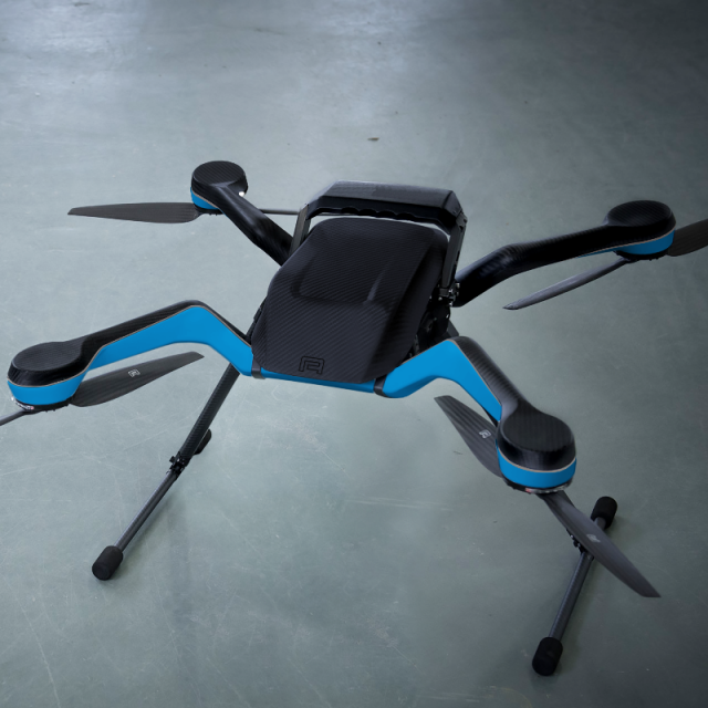
The Airobot Z-Mapper is an end-to-end mapping solution for industrial applications. The Z-Mapper is based on the Acecore Zoe, a professional all-weather-drone with an autonomy of up to 40 minutes, and features a Sony UMC-R10C 20.1MP camera and Septentrio AsteRx-m2 RTK GNSS receiver to collect accurately georeferenced, high quality mapping data. Together with the Airobot Collect software it offers an easy-to-use end-to-end mapping solution for professional users.
Airobot
Belgium
Description
Industrial flying robot for mapping applications
The Airobot Z -Mapper" is an end -to -end mapping solution for industrial applications.
Based on the Acecore Zoe, a professional all-weather-drone with an autonomy of more than 30 minutes,
the Z -Mapper offers a robust and reliable solution for accurate and high quality data collection.
Centimeter Accurate PPK/RTK
The integrated PPK/RTK GNSS receiver ensures collection of accurately georeferenced mapping data.
It can track all satellites in view from GPS, GLONASS, GALILEO and BEIDOU.
It also offers advanced interference and jammer mitigation technology as well as state -of -the -art ionosphere estimation algorithms.
20 Megapixel Camera
The Z -Mapper integrates the Sony UMC -R10C 20.1MP camera, used throughout the industry.
This camera is ideal for collecting high quality images to create maps or 3D models, also in low - light conditions, thanks to the large APS -C image sensor.
Integrated User Interface
An easy -to -use interface is available on any mobile device, without having to install special application firmware.
Robust Digital Data Link
The encrypted digital data link offers a robust and reliable connection to the drone, even at larger distances.
Post-Processing and storage in the cloud
Together with the Airobot Collect software the Z -Mapper offers an easy -to -use end -to -end mapping solution for professional users.
Specifications
-
Imaging/scanning devices
-
Onboard imaging/scanning devices
-
Platform
-
Platform
Copter
Brand
Acecore
Max. payload [kg]
6
Max. stay in the air [min]
40
-
Dimensions
-
Height [cm]
50
Width [cm]
70
Length [cm]
70
-
Navigation Sensors
-
Type of GNSS receiver and captured signals
GPS, GLONASS, GALILEO, BEIDOU, SBAS
Correction services [PPK, RTK]
PPK and RTK
Positioning Accuracy
1 cm
-
General
-
Year of last update
2019
Typical applications
Industrial Mapping
Product Name
Z-Mapper
-
Included software and automatically generated
-
Type of software included
Automatically Generated Products


