
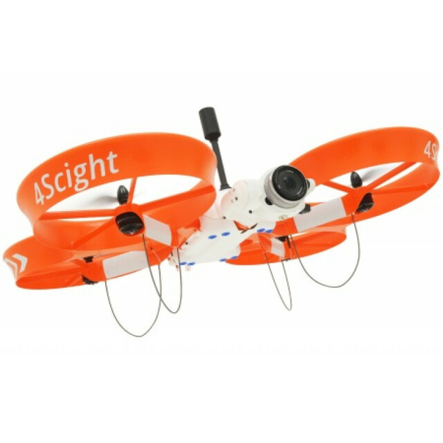
Description
Specifications
-
Environment
-
Min. operation temperature [°C]
0
Max. operation temperature [°C]
40
Max. wind speed [m/sec]
10
Max. humidity [%]
100
-
Imaging/scanning devices
-
Onboard imaging/scanning devices
RGB Camera
Type of Camera
Sony 20MP APS-C with Interchangable Lens
Additional Sensors and additional information
Sony 20MP APS-C with Interchangable LensChoice between 16mm and 20mm lens with fixed focus
Build-in Stablilsation
Y
Exchangeable
Y
Sensor tilting to allow oblique views
Y
-
Platform
-
Platform
Copter
Brand
ScientificAerospace
Max. payload [kg]
1
Max. stay in the air [min]
20
Max. speed [km/h]
60
Max. height above sea level [m]
120
Propulsion
Electric
-
Accessories
-
Transportation accessories
Packaged in Rugged Transport Cases
Included batteries and charger
4x batteries and 2x chargers
More included products and spare parts
Includes a tool case and spare propellers
-
Operation Characteristics and Safety
-
Min. ø of launch/landing site [m]
1
Launching method
VTOL
Automatic launch and landing
Y
Training provided
Y
Collision avoidance systems (CAS)
N
Autonomous emergency landing
Y
-
Dimensions
-
ø / wingspan [cm]
71
Height [cm]
36
Weight [kg]
2.25
Weight of battery [kg]
0.55
Number of rotors
4
Transport on human back
N
-
Base Station
-
Ground computer included
Y
Type of Ground computer
Samsung Android 8.0" Tablet
Sensor control
Y
Real time image and video download link
N
-
Navigation Sensors
-
Type of GNSS receiver and captured signals
L1/L2 GPS, GLONASS, Beidiou
Type of IMU
Triple Axis Gyroscope, Accelerometer, Magnetometer
Other sensors and additional information
Solution is packaged with 4Survey mission planning software, a high precision PPK GNSS and 4Precision post processing software.
Correction services [PPK, RTK]
PPK
-
General
-
Year of last update
2017
Typical applications
Survey, Construction, Inspection, Stockpiles, Pits
-
Included software and automatically generated
-
Type of software included
Block adjustment, Camera self-calibration, Flight planning, Photogrammetric software, Point cloud processing software
Flight planning software
4Survey
Photogrammetric software
Pix4D
Point cloud processing software
Pix4D
Automatically Generated Products
3D City Models, Point Clouds, 3D Landscape Models, DEMs, DTMs, Orthomosaics
Additional information on software or automatically generated products
4Precision for PPK corrections and image geo-tagging


