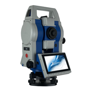
R80
Motorized TS - Integrated solution for your Survey
The Stonex R80 is a Motorized Total Station for classic jobs of survey and stakeout. R80 adopts up to date automatic prism recognition and positioning technology and has an high accuracy of 0.5”-1”. This motorized Total Station runs Windows CE 7.0 operating system and users can choose the software that best meets their needs. It supports also SDK and external control protocol for software development.

Stonex
Paderno Dugnano (MI), IT
Description
R80 adopts up to date automatic prism recognition and positioning technology and has a high accuracy of 0.5”-1”.
R80 has a distance measurement accuracy of 1 mm + 1 ppm (Prism) and a 1.000 m long-range reflectorless distance measurement. This motorized Total Station runs Windows CE 7.0 operating system and users can choose the software that best meets their needs. It supports also SDK and external control protocol for software development.
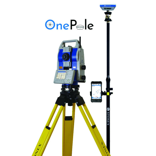
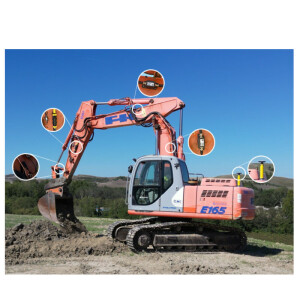
R80 OnePole Solution can be managed by switching from a TS to GPS method in a single solution thanks to Cube-a Software which is able to control every part of the survey.
OnePole Solution | TS+GPS with Cube-a Software
OnePole Solution combines the millimeter positioning accuracy of a prism measurement with the advantage of measuring points not visible from the TS through the GPS Receiver. A total station needs local control points on which it can be set. These points must be visible from the station and therefore the line of sight has to be free of obstacles. An RTK GPS receiver can determine its position in seconds with centimeter level accuracy using data from satellites. The ability to combine and use both systems simultaneously greatly improves surveying efficiency.
Advantages of the system:
• The OnePole Solution allows you to work simultaneously with TS and GPS
• TS and GPS (and diastimeter) can be simultaneously connected to the controller using Bluetooth
• Change the measurement mode from TS to GPS by one simple tap on the always accessible switch button
• Reduce prism search times through auto aiming to the current GPS position
• Easily setup your TS position by Station On Point and Free Station/Resection programs
• View on Google Maps your TS and GPS surveys
Cube-h24 Solution
Cube-h24 has been designed to perform operations to check movements of points in natural places or artificial structures, considered to be at risk of stability. In general, the materialization of the points is made with prisms used for topography, in order to determine the real distances from a station point. It is however possible to use points marked on a reflecting surface.
Cube-h24 allows to:
• Set up surveys and calculation procedures, in order to compare the coordinates of the points subject to control in subsequent interventions
• Check either in real time or in scheduled time the displacements of the points
Do you have questions about this product?
- Questions about price, availability, and/or retailers
- Questions about technical specifications and usage
- Questions about suitability for your project or application
Specifications
-
General
-
Year of introduction
2020
Height [m]
0.38
Width [m]
0.2
Depth [m]
0.225
Weight [kg]
7.9
Display Panel
color touch
Area of Application
Survey, Monitoring
-
User Interface
-
Operating System
Windows CE 7.0
Resolution [px rows x columns]
320x240
Color display
Y
Screen size: length of diagonal ["]
3.5
Screen type
TFTLCD
Touchscreen
Y
-
Distance Measurement with Prism
-
Standard deviation: constant part [mm]
1
Standard deviation: variable part [ppm}
1
Maximum range with 1 standard prism [m]
5
Measuring Time [s]
0.4/0.8
-
Data Storage & Connectivity
-
Internal memory [GB]
4
USB [Y/N]
Y
RS-232 /422 Serial [Y/N]
Y
Bluetooth {Y/N}
Y
-
Miscellaneous
-
Guiding light
Y
Integration with GNSS receiver possible [Y/N]
Y
-
Automatic Tracking and Locking
-
Maximum Range [m]
1000
Maximum angular speed [deg/s]
35
Automatic aiming uncertainty in autolock mode [arcsec]
1.5
Tracking and recovery of moving prism
Y
-
Robotic operation
-
Maximum range of robotic operation[m]
1000
Compatible with GNSS for detail survey
Y
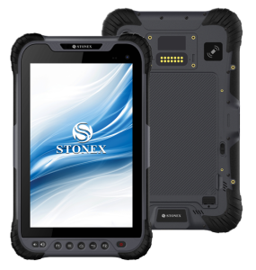
Recommended controller
UT10
Controller IP rating
IP67
Controller display type and size
6"
Graphical field note storage on controller
Y
Camera in controller
Y
-
Operation
-
Minimum working temperature [degC]
-20
Maximum working temperature [degC]
50
IP dust/water protection class [IPxx]
IP55
-
Distance Measurement without Prism
-
Standard deviation: constant part [mm]
3
Standard deviation: variable part [ppm]
2
Maximum range on Kodak gray [m]
1000
-
Power Supply
-
Battery
7.4 V
Capacity
5.800 mAh
Max. operation time on one battery [hr]
8
-
Support
-
Reach of global support network
Y
-
Angle Measurement
-
Standard deviation [arcsec]
0.5-1
Guide Light
100m
-
Connectivity
-
Bluetooth
Y
USB
Yes
RS232
Yes
Other connectors or connector specifications
mini usb
Videos

