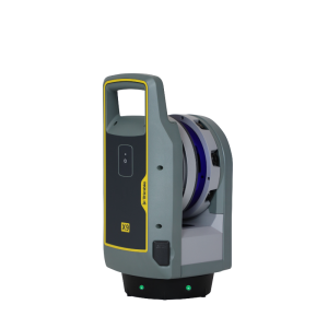
Description
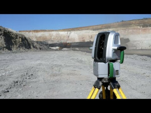
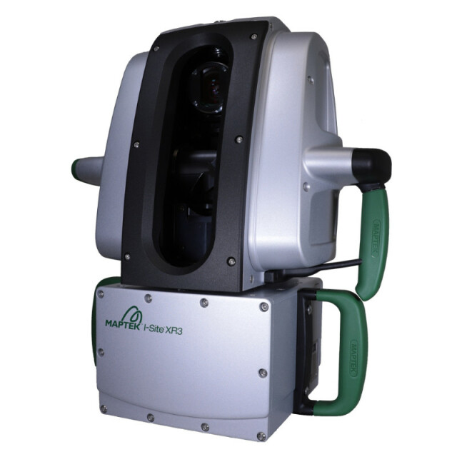
Maptek XR3 laser scanner is an extra long range survey system combining fast accurate sensing, high resolution digital imagery and powerful modelling software for improving overall productivity and site safety.
Specifications
-
Application
-
Main users
Mining, survey, civil
Main applications
Mine survey; General/Civil survey; Forensic; Geotechnical mapping; Face mapping; Highwall monitoring
Distinguishable features
Rated to IP65 for reliable operation in tough conditions. 100-degree scanning aperture. 3D view in scan control software. Lightweight and portable. Easy to use onboard scan controls. USB scan storage for simple file transfer. Intuitive point cloud processing software for modelling laser scan data. Range of mounting kits available for mobile scanning.
-
Peripherals
-
User interface
Supplied tablet PC or On board controls
Additional sensors
Survey grade telescope, High precision inclinometer, Low precision inclinometer, L1 GPS, Compass,
Registration/orientation methods
conventional surveying; matching surface feature/points; N-point; underground boom-frame
-
Operation Characteristics
-
Internal Camera
Y
IP Rating
65
-
Scanning Characteristics
-
Max. vertical field of view [deg]
100
Max. horizontal field of view [deg]
360
Beam deflection mechanism
Rotating mirror
Max. measurement rate [kHz]
200
-
Software Functionality
-
Software name
PointStudio
Automatic detection of tie points
Y
Real time visualization during scanning
Y
Geo-referencing
Y
Fitting of primitives
Y
Specification of primitives
lines, circles and planes
-
Laser Ranger
-
Range measurement principle
pulse
Laser safety classification
1
Max. Range [m]
2400
Range uncertainty (constant part) [mm]
4
-
General
-
Year of introduction
2017
Videos


