
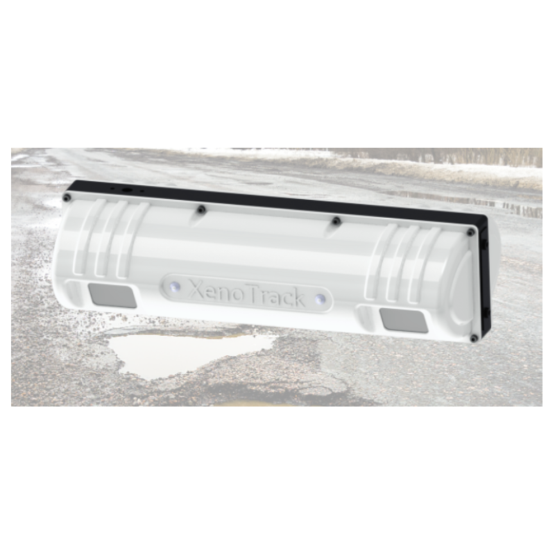

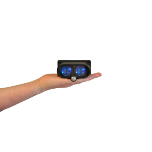
XenomatiX - XenoTrack System
Road Profile Lidar for Road Digitization and Surveying
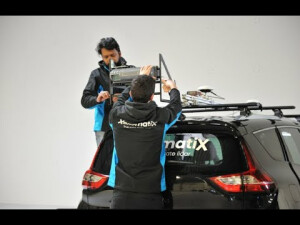
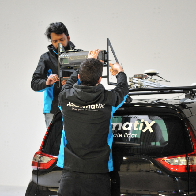
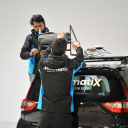
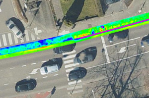
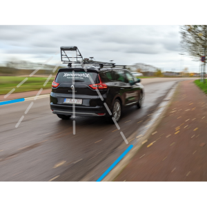
High precision, high resolution short-range lidar with true solid state built and with accuracy to within a millimetre makes it most appropriate for highly granular surface measurements, unlocking every detail of the road geometry. XenoTrack measurements identify road waviness, road damage, small and nearly invisible objects, etc. in RT or for post-analysis. XenoTrack is car mountable and ready for instant use.

XenomatiX
Leuven, BE
Description
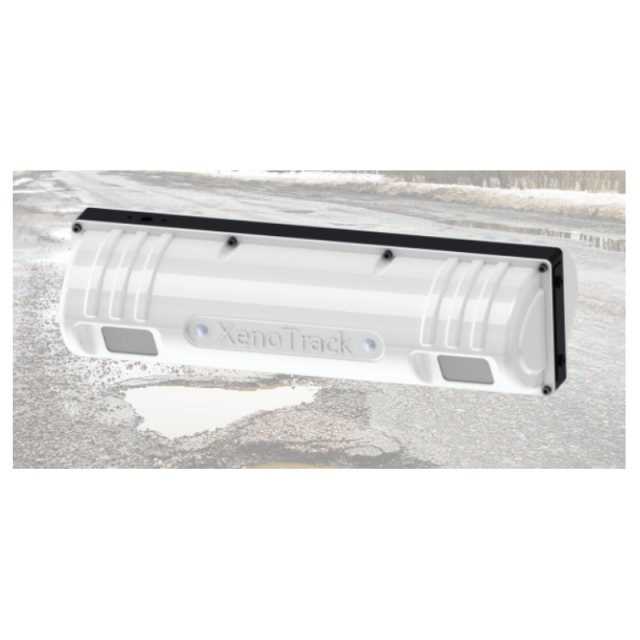
In March 2022 XenomatiX launched a new version of XenoTrack based on the latest Lidar technology for autonomous vehicles and advanced driver-assistance systems (ADAS).
The new updated version of XenoTrack provides improved accuracy, resolution and productivity in a new, sleek design. The new XenoTrack comes with enhanced functionality and a fully integrated total solution with HD camera and RTK GNSS.
XenoTrack is used for multiple applications.
1. Simulation
2. Pro-active suspension
3. Road classification
4. Vehicle-road correlation
5. Road characteristics (international roughness index and rutting index )
Its unique characteristics are:
- High resolution and mm accuracy with 23,500 laser beams in global shutter
- High productivity with on board data processing
- Perfect synchronization with Lidar, camera, GNSS, IMU, wheel encoder and CAN
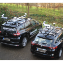
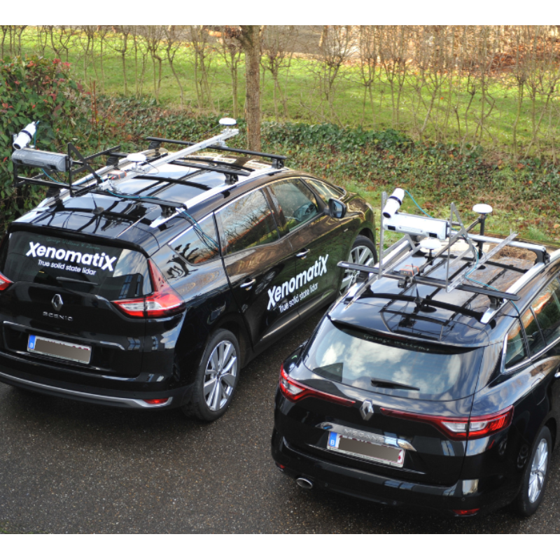
- Flexible. It can be mounted on a regular vehicle
- Easy to integrate with your setup (API, Multiple data formats)
XenoTrack is used in R&D for collecting real-life input data for simulation and testing of vehicle and suspension behavior. It’s also used for measuring proving grounds to keep those assets controlled and monitored.
In the application of preview for (pro-)active suspension, the Road LiDAR is used to pass accurate input to the suspension control algorithm with proven results in comfort (body acceleration). The system is today used as direct input and/or as ground truth for camera developments.
The new Road LiDAR is based on the components of the ToF LiDAR for L3-L4-L5 autonomous vehicles. By using an innovative triangulation algorithm and an RTK gnss/imu integration, mm resolution and precision is achieved and localization is cm-precise in world coordinates! There is no comparable LiDAR in the world.
Do you have questions about this product?
- Questions about price, availability, and/or retailers
- Questions about technical specifications and usage
- Questions about suitability for your project or application
Documents
Brochure
road-management-brochure.pdf
4.81 MB
