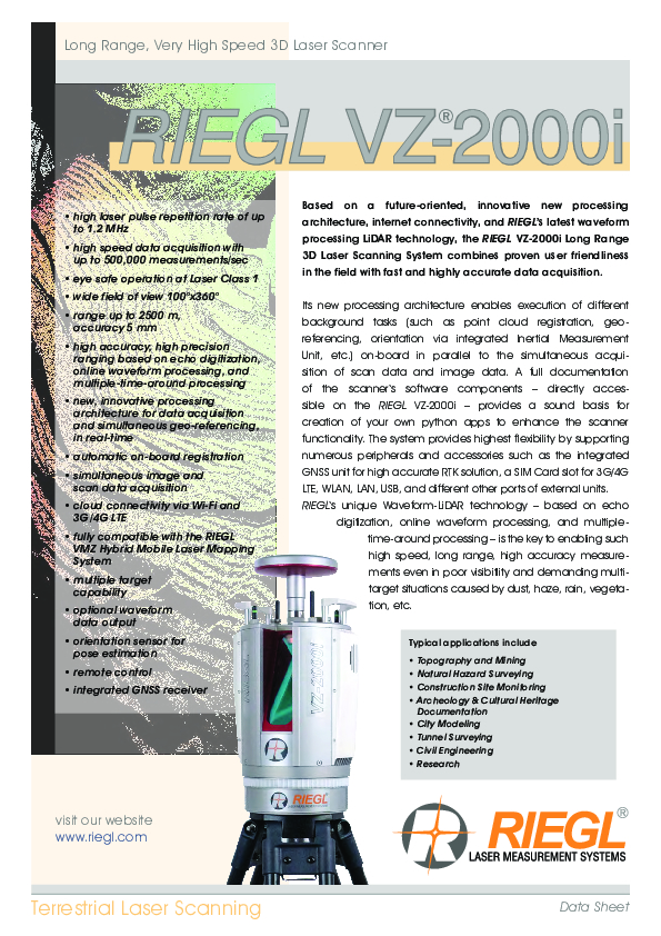
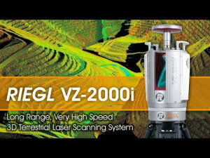
VZ-2000i
Long Range, Very High Speed 3D Laser Scanning System
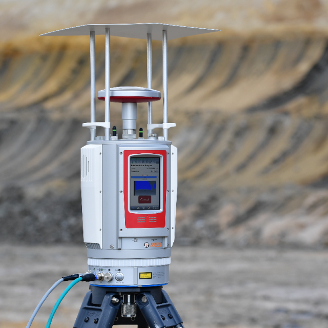
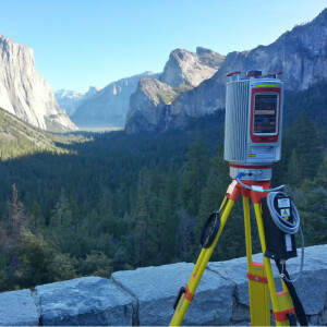
Based on a future-oriented, innovative processing architecture, internet connectivity, and RIEGL’s latest waveform processing LiDAR technology, the RIEGL VZ-2000i Long Range 3D Laser Scanning System combines proven user friendliness in the field with fast and highly accurate data acquisition.

RIEGL | Innovation in 3D
Horn, AT
Description
Based on a future-oriented, innovative new processing architecture, internet connectivity, and RIEGL’s latest waveform processing LiDAR technology, the RIEGL VZ-2000i Long Range 3D Laser Scanning System combines proven user-friendliness in the field with fast and highly accurate data acquisition.
Its new processing architecture enables execution of different background tasks (such as point cloud registration, geo-referencing, orientation via integrated Inertial Measurement Unit, etc.) on-board in parallel to the simultaneous acquisition of scan data and image data. Full documentation of the scanner‘s software components – directly accessible on the RIEGL VZ-2000i – provides a sound basis for creation of your own python apps to enhance the scanner functionality. The system provides the highest flexibility by supporting numerous peripherals and accessories such as the integrated GNSS unit for high accurate RTK solution, a SIM Card slot for 3G/4G LTE, WLAN, LAN, USB, and different other ports of external units. RIEGL‘s unique Waveform-LiDAR technology – based on echo digitization, online waveform processing, and multiple-time-around processing – is the key to enabling such high speed, long-range, high accuracy measurements even in poor visibility and demanding multi-target situations caused by dust, haze, rain, vegetation, etc.
Do you have questions about this product?
- Questions about price, availability, and/or retailers
- Questions about technical specifications and usage
- Questions about suitability for your project or application
Specifications
-
Application
-
Training facilities
Yes
Main applications
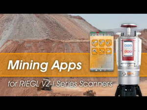
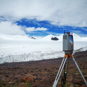
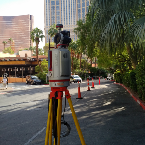
Topography & Mining;Surveying in Open-Pit Mining;Archaeology & Cultural Heritage;City Modeling;Civil Engineering;Monitoring;Forestry;Research;Stand-alone Static and (within RIEGL VMZ) Mobile Laser Scanning;
Distinguishable features
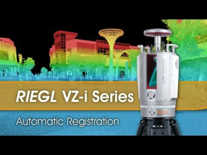
High laser pulse repetition rate of up to 1.2 MHz;High speed data acquisition up to 500,000 measurements/sec;Eye safe operation at Laser Class 1;Wide field of view, 100°x360;°Range up to 2500 m, accuracy 5 mm; simultaneous acquisition of scan data and image data;High accuracy, high precision ranging based on echo digitization, online waveform processing, and multiple-time-around processing;New, innovative processing architecture for data acquisition and simultaneous geo-referencing in real-time ;Automatic on-boad Registration;Easy to use – easy to Train;(e.g. user friendly touchscreen interface, single touch operation, etc.);Cloud connectivity via Wi-Fi and 3G/4G LTE;Multiple target capability ;Optional full waveform data Output;Orientation sensor for pose estimation;Remote control;Integrated GNSS Receiver;Fully compatible with the RIEGL VMZ Mobile Laser Mapping System;
-
Peripherals
-
External Camera
Y
Export formats of camera image
JEPEG, TIFF, RAW
User interface
integrated touchscreen, tablet, PC, smartphone
Specifications
Windows, iOS, Android, Linux
Additional sensors
Orientation sensors (MEMS), GNSS Receiver. SyncTimer, Laser Plummet
Registration/orientation methods
Control/ tie Points, backsight, overlapping surfaces, automatic on-board
-
Operation Characteristics
-
Operating temperature: min. [°C]
-20
Operating temperature: max. [°C]
40
Humidity range [%]
80
Internal Camera
N
Control panel built in
Y
IP Rating
64
Dual Axis Compensation
Y
-
Scanning Characteristics
-
Max. vertical field of view [deg]
100
Max. horizontal field of view [deg]
360
Min. horizontal step size [deg]
0.0015
Min. vertical step size [deg]
0.0007
Beam deflection mechanism
rotating polygon mirror, rotating head
Max. measurement rate [kHz]
1200
-
Software Functionality
-
Software name
RiSCAN PRO
Automatic detection of tie points
Y
Real time visualization during scanning
Y
Geo-referencing
Y
Fitting of primitives
Y
Specification of primitives
lines, planes
Max. size of model [million points]
1000
-
Laser Ranger
-
Range measurement principle
pulse
Laser safety classification
1
Min. Range [m]
1
Max. Range [m]
2500
Range uncertainty (constant part) [mm]
3
Beam divergence [mrad]
0.27
Intensity recording [bits]
16
-
Power
-
Battery type
external
-
General
-
Year of introduction
2017
Height [m]
0.308
Depth [m]
0.206
Width [m]
0.206
Total Weight [kg]
9.8
Documents
Brochure
RIEGL VZ-2000i Datasheet.pdf
4.32 MB


