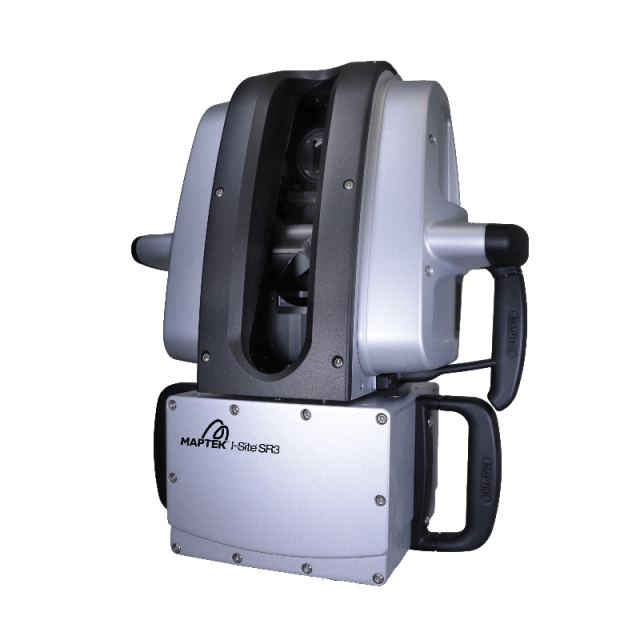
SR3
Short range underground survey system
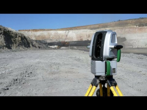
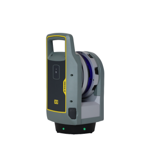
Maptek SR3 laser scanner is a new short range laser scanner designed for underground survey and mapping applications. It combines fast accurate sensing, dedicated mount accessories and powerful modelling software for improving overall productivity and safety underground.
Maptek
Glenside, AU
Description
Maptek SR3 laser scanner is a new short range laser scanner designed for underground survey and mapping applications. It combines fast accurate sensing, dedicated mount accessories and powerful modelling software for improving overall productivity and safety underground.
Specifications
-
Application
-
Main users
mining; general survey; forensics; civil survey; earthworks
Main applications
Underground stopes; Development drives; Geological mapping; Shotcrete thickness; Stockpiles; Indoor/outdoor silo; Continuous monitoring;
Distinguishable features
125-degree scanning aperture3D view in scan control softwarePortable, weighs <12 kgRated to IP65 for reliable operation undergroundOnboard, easy-to-use scan controlsUSB scan storage for simple file transferIntuitive software for modelling laser scan dataRange of mounting kits for mobile scanningExtendable 10m carbon fibre boom
-
Peripherals
-
User interface
Integrated/tablet
Specifications
Panasonic toughbook for parameter definition, scan management and viewing
Additional sensors
Inclination sensors; compass, L1 GPS
Registration/orientation methods
Conventional surveying; matching surface feature/points; N-point; underground boom-frame
-
Operation Characteristics
-
Internal Camera
Y
IP Rating
65
-
Scanning Characteristics
-
Max. vertical field of view [deg]
130
Max. horizontal field of view [deg]
360
Beam deflection mechanism
rotating mirror
Max. measurement rate [kHz]
200
-
Software Functionality
-
Software name
PointStudio
Automatic detection of tie points
Y
Real time visualization during scanning
Y
Geo-referencing
Y
Fitting of primitives
Y
Specification of primitives
lines; planes; circles
-
Laser Ranger
-
Range measurement principle
pulse
Laser safety classification
1
Min. Range [m]
1
Max. Range [m]
600
Range uncertainty (constant part) [mm]
3
-
Power
-
Battery type
internal
-
General
-
Year of introduction
2018
Videos


