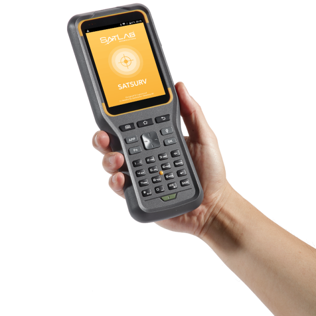
Satsurv Field Surveying Software
Professional field surveying software
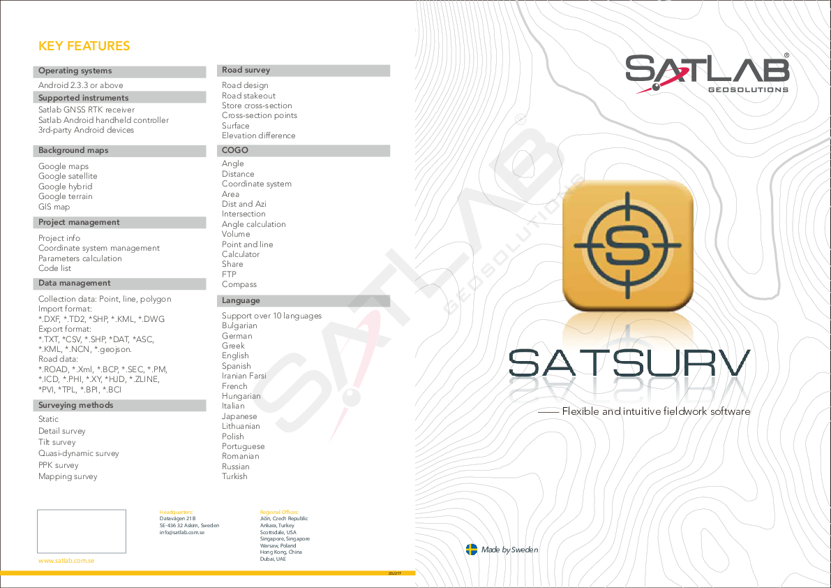
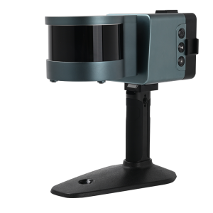
Satsurv is a customized and easy-to-use Android software for field surveying tasks, such as detail Survey, data stakeout, cadastral, surveying, road design and data management. It supports tilt survey, quasi-dynamic, PPK and static surveying mode. Equipped with built-in NFC, Bluetooth, FTP functions, Satsurv provides an industrial solution for efficient fieldwork.

SatLab
Vastra Frolunda, SE
Description
Detail Survey
Satsurv supports a variety of collection methods, such as tilt survey, quasi-dynamic survey, PPK collection and static collection, etc. In the detail survey interface, users can set the collection accuracy, stakeout standard, or check the current number of satellites, solution status, age of correction, positioning accuracy, etc.
Data Stakeout
Advanced AR stakeout function will help users improve the efficiency and accuracy of data staking out without focusing on the software interface in real-time. With the intelligent voice prompts, users can accurately determine the direction of data stakeout forward with a built-in compass.
Data Stakeout also supports access to DXF, DWG format data for point stakeout and line stakeout. By the object snap functions of INT, TAN, PER, NOD, user can achieve data stakeout easily.
Data Management
Data Management supports Google Maps, Google Satellite Maps, GIS Offline Maps, and OGC map service of WMS, TMS, WCS, and WFS as its data collection maps. Besides, it supports access to third-party rangefinders to achieve a more accurate measurement of distance and angle.
Shortcut Methods
Satsurv provides some shortcut methods to facilitate users’ operation, such as triggering a Bluetooth connection by using NFC shortcut mode without searching for the device number, quickly registering and opening the latest saved coordinate system via QR code scanning. With the FTP transmission, users can transfer documents in the same network environment without connection cables.
For more information, please click HERE to visit our website.
Do you have questions about this product?
- Questions about price, availability, and/or retailers
- Questions about technical specifications and usage
- Questions about suitability for your project or application
Specifications
-
Laser scanning
-
Laser scan data collection
N
Compute unregistered point cloud
N
Point cloud registration to targets in cloud
N
Scan data output formats supported
Not supported
-
Photogrammetric data processing
-
Photo planning
N
Processing in cloud / on-premise
N
Airborne photography
N
Handheld terrestrial photography
N
Can more than one camera be used?
N
Camera calibration computed for all cameras used
N
Accepts input camera calibration data
N
Data from more than one camera supported
N
Accepts GNSS RTK photo exposure positions
N
Supports registration to ground control
N
Output data formats supported
Not supported
-
GNSS data and processing
-
GNSS static / RTK data collection
Y
GNSS setting out
Y
Static baseline post-processing
N
Output data for least squares adjustment with data from other sources
N
Base and rover RTK
Y
Network RTK
Support
Post processed kinematic
Y
Input data formats supported
*.dxf; *.dwg; *.kml; *.raw; *.xml; *.csv; *dat; *.txt; *.NCN
-
GNSS + dead reckoning data (mobile mapping)
-
IMU data used trajectory computation
N
SLAM data used in trajectory computation
N
Wheel odometer data used in trajectory computation
N
SfM (photogrammetry) used in trajectory computation
N
Adjust trajectory to fit overlapping point cloud data
N
Adjust trajectory to fit ground control points
N
Adjust point clouds (not trajectory) to fit ground control points
N
Trajectory provided with precision data
N
-
Levelling and Orientation
-
Import of instrument data
Not supported
Rise and fall level book format output
N
Height of collimation level book format output
N
Unadjusted levels, adjustment and adjusted level shown
N
Output data for least squares adjustment with data from other sources
N
-
Total Station (TS) data processing
-
Traverse computation
N
Output data for least squares adjustment with data from other sources
N
Compute 3D radial observations
N
TS setting out
N
Feature attribute coding
N
Feature geometry coding
N
Data input formats supported
Not supported
Data output formats supported
Not supported
-
CAD functions
-
CAD functions for Internal measured building surveys
N
CAD functions for open drainage modelling
N
CAD functions for Rail applications
N
CAD functions for Road applications
Y
CAD functions for Pipeline applications
N
CAD functions for Overhead Power Line applications
N
CAD functions for Site development applications
N
CAD functions for Industrial plant applications
N
Output formats supported
*.dxf; *.dwg; *.kml; *.raw; *.xml; *.csv; *dat; *.txt; *.NCN; *.kml
-
General
-
Software version
V2.0.4
Mobile (real time connected to instrument)
Y
Laptop / Office computer (post processing)
N
-
Integrated environment for
-
GNSS data
Y
GNSS + dead reckoning data (Mobile Mapping)
N
TPS data
N
Point cloud data
N
Level data
Y
Integrated least squares computation of control
Y
Transformation between map projections
Y
Compute grid DTM
Y
Compute TIN
Y
Computation of sections through surfaces
Y
Volume computation from sections
Y
Volume computation by substracting surfaces
N
-
More information
-
Distinguishable features
Support tilt survey, quasi-dynamic, PPK and static surveying mode.
Documents
Brochure
satsurv-brochure-en-20200617-s.pdf
785.83 KB
