Echoes 3500 T7
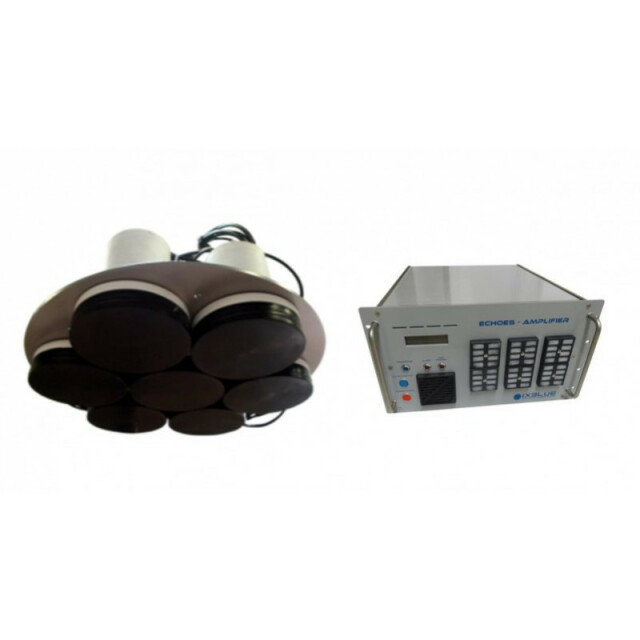
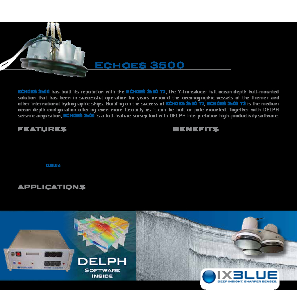
Echoes 3500 has built its reputation with the Echoes 3500 T7, the 7-transducer full ocean depth hull-mounted solution that has been in successful operation for years onboard the oceanographic vessels of the Ifremer and other international hydrographic ships. Together with Delph seismic acquisition, Echoes 3500 is a full-featured survey tool with Delph interpretation high-productivity software.

Exail
Saint Germain en Laye, FR
Description
Echoes 3500 has built its reputation with the Echoes 3500 T7, the 7-transducer full ocean depth hull-mounted solution that has been in successful operation for years onboard the oceanographic vessels of the Ifremer and other international hydrographic ships. Building on the success of Echoes 3500 T7, Echoes 3500 T3 is the medium ocean depth configuration offering even more flexibility as it can be hull or pole mounted.
Together with Delph seismic acquisition, Echoes 3500 is a full-featured survey tool with Delph interpretation high-productivity software.
Do you have questions about this product?
- Questions about price, availability, and/or retailers
- Questions about technical specifications and usage
- Questions about suitability for your project or application
Specifications
-
Mode of operation
-
Platform type
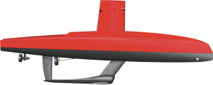
Hull Mounted
Operating System
Windows, Other
Min. depth of operation [m]
1
Max. depth of operation [m]
11
Min. frequency [Hz]
1.7
Max. frequency [Hz]
5.5
Signal composition
Chirp
Power output [W]
4000
Max. resolution [m]
0.2
Max. penetration [m]
300
Max. pulse length [s]
0.1
Frequency
-
General
-
Product type
Full Ocean Depth SBP Hull-Mount
Year of initial development
1999
Application
Deep sea
Max power consumption [W]
1200
Power type
AC
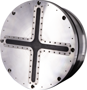
Transducer weight [kg]
360
Transducer length [m]
1
Transducer width [m]
1
Transducer height [m]
0.4
Weight of logging unit [kg]
30
Length of logging unit [m]
0.6
Width of logging unit [m]
0.483
Height of logging unit [m]
0.266
Portability of logger
Desktop, Rack
Components to be used in combination with product
GPS, inertial navigation system
-
Integration in work process
-
Remote operation
Y
External heave input
Y
External roll input
Y
External pitch input
Y
External positioning input
Y
Marking of events
Y
Real time coupling to survey software
Y
Coupling to post-processing software
Y
-
Data Processing
-
Data displayed
Navigation, attitude, depth, signal voltage; spectrum. On-screen measurement of horizontaland vertical distance; slope.
Main use
Oceanographic, hydrographic, geophysical, defense, geological, continental shelf extension, cable route, hazard surveys and sediment classification. There are 2 amplifier output power available: ECHOES 3500 T7 4kVA up to 6000m water column, ECHOES 3500 T7 6kVA up to 6000m water column, ECHOES 3500 T7 now includes latest generation Class-D amplifier
Data output
Raw data, processed data (real & imaginary parts; envelop; phase)
Formats
SEGY/XTF/NAV/ASCII/SHAPE/GeoTIFF
Data output for seafloor classification
Y
Connections
LAN, RS232, USB
Internal logging
DVD, Hard drive
Post-processing
Delph Seismic Interpretation Software is INCLUDED; Gain corrections; Horizontal stacking; Swell filtering; digitizing;DTM building; volume computation
Documents
Brochure
migrationgjjtu6.pdf
459.07 KB
Videos
