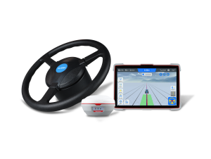
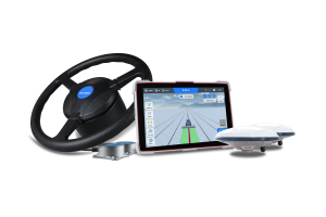
Geotrack explorer plus agricultural guidance system
Agricultural guidance system with a wide set of functions and stable accuracy using a free satellite signal
Support for automatic sprayer section control. professional rtk mode with accuracy up to 2.5 cm.
Geometer International LLC
Dnipro, UA
Description
AGRICULTURAL GUIDANCE SYSTEM WITH A WIDE SET OF FUNCTIONS AND STABLE ACCURACY USING A FREE SATELLITE SIGNAL. SUPPORT FOR AUTOMATIC SPRAYER SECTION CONTROL. PROFESSIONAL RTK MODE WITH ACCURACY UP TO 2.5 cm.
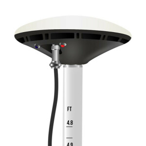
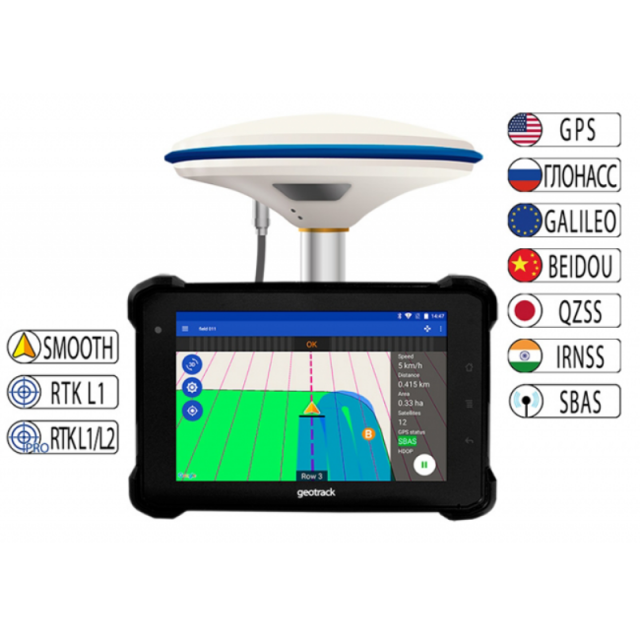
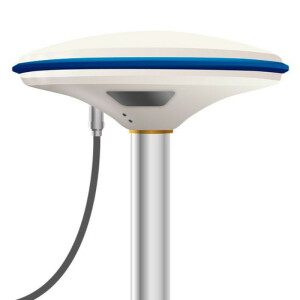
Forget about the lack of a satellite signal while working and stopping field work. With the new and state-of-the-art GM SMART GNSS receiver, your navigation system for agricultural machines will always be up and running. Thanks to simultaneous work with satellite systems GPS, GLONASS, GALILEO, BEIDOU, QZSS you will always have enough satellites for uninterrupted work in the field. The average number of satellites in operation - more than 35 satellites.
The geotrack explorer PLUS has embedded EVOLUTION series software, which provides accuracy of 15 cm from pass-to-pass, and the ability to connect to RTK and obtain an accuracy of 1-3 cm. Geotrack explorer PLUS display has a shockproof enclosure, and a completely sealed monitor from dust and moisture.
Using the navigation system for agricultural machinery will allow you to easily solve a number of problems, including: accurate control of machinery in the field, measurement of agricultural land, reducing the number of workers for field work, the ability to work in poor visibility (night, fog, dust); saving time, significantly reducing the cost of fuel, fertilizers, plant protection products and herbicides. During operation, the tips on the screen of the navigation system help to ensure accurate driving, preventing the appearance of untreated areas (flaws) and areas of double treatment (overlaps).
ADVANTAGES OF A GEOTRACK SYSTEM WITH GM SMART GNSS RECEIVER:
 |
GNSS Smoothing mode designed specially for agricultural guidance. Accuracy on a free satellite signal of 15 cm from pass-to-pass. Stable accuracy at no extra cost. |
 |
Using a base station that transmits satellite corrections within 8 km, the receiver can operate in RTK mode with an accuracy of 2.5 cm. A base station is required. |
 |
Supports software unlocking to the level of a dual-frequency RTK receiver. Ability to work from the RTK CORS network at a distance of 50 km from the base station with an accuracy of 2.5 cm. |
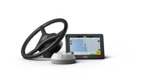
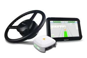
The GeoTrek Explorer PLUS navigation system has a 7-inch (17.8 cm) high-brightness screen that is easy to read even on a bright sunny day. High screen resolution allows you to see a clearer picture. Visual night mode is provided. The display has shock protection and is protected from dust and moisture. The set includes a reliable vibration-resistant metal RAM mount and a docking station. RS232 connectors are available for connecting external devices such as autosteering and the sprayer section control module.
Equipment:
- Rugged monitor geotrack explorer plus 7" (17,8 cm)
- GNSS/RTK receiver GM Smart
- Docking station with RS232
- RAM mount
- Cables
- User manual, warranty card and other documents
Pass-to-pass accuracy:
15-20 cm
1-3 cm (RTK mode)
Supported operating systems and software:
Operating system:
Android
version 9.0 and above
Application:
Geotrack
Strength characteristics:
- Dust and moisture protection: IP67
- Vibration resistance consistency: MIL-STD-810G
- Gravity drop resistance test: 150 cm
Functionality:
- Accurate guidance from pass-to-pass
- Accurate area measurement
- Treatment of saved fields
- Determining the treated area
- Visualization of the treated area
- Displaying the movement speed
- Displaying azimuth
- Five guidance patterns
- Adjustment of width of equipment (to centimeters)
- Online technical support
- Saving a field map
- Automatic saving works
- Specifying Job Types (sowing, spraying, etc.)
- Support for RTK L1
- Optional support for RTK L1/L2
- Online sync with Agroprofile
Operating modes:
- Area measurement
- Area measurement with offset
- Free guidance mode
- Straight A-B
- Curve A-B
- Perimeter - Straight A-B
- Perimeter - Curve A-B
Cloud opportunities:
- Synchronization of field areas
- Synchronization of scheduled works
- Displaying works on the map
- Online view of performing works in the fields
- Entering the types of work
- Quality control of works (% of overlapping)
- Time spent doing work
What data is displayed while driving:
- Treated area
- Travelled length
- Speed of movement
- Number of satellites
- Satellite signal quality (HDOP)
- Visual guidance tips
- Calculation of working time
- Count overlapping
- Visualization of overlapping
- Ratio: work done / in process
Specifications
-
General
-
Type of control
Active
Direction of control
Forward
Mounting
