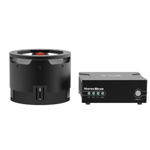
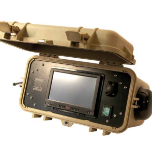
GeoSounder
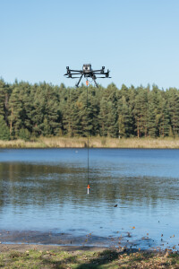
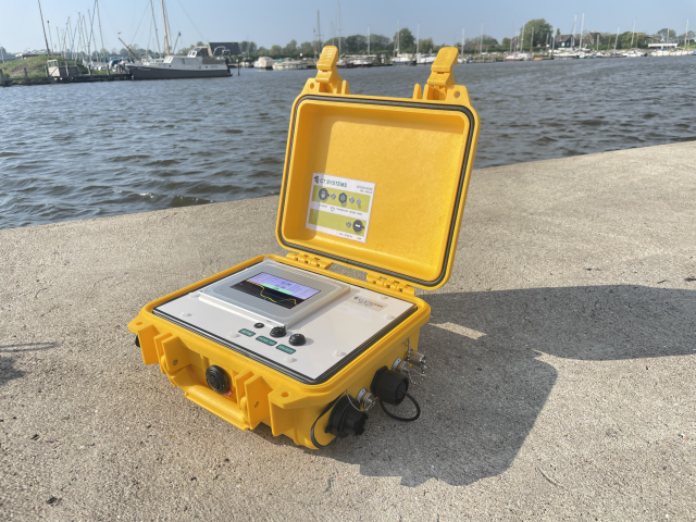
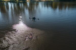
The GeoSounder is a compact, rugged and survey grade single beam echo sounder, with internal GNSS. Transducer data and GNSS data are combined and transmitted over both RS232 and TCP ethernet connections.
CT Systems
Hippolytushoef, NL
Description
Features
Rugged & Waterproof
Internal (RTK) (D)GNSS
Internal UHF Transceiver
Single & Dual Frequency
Available as turn-key solution with Viking & Viking Process software
Specifications
-
General
-
Year of initial development
2012
Max. power consumption [W]
6
Min. external DC power [V]
9
Max. external DC power [V]
30
Min. external AC power [V]
0
Max. external AC power [V]
0
Weight in air [kg]
1.5
Width [m]
0.26
Length [m]
0.20
Height [m]
0.12
-
System integration
-
Remote operation capability
Y
Supported external data inputs
heave, position, roll & pitch, tide
Marking of events and other annotations
N
Real-time sound velocity and temperature profile inclusion
N
Real-time coupling to survey/post-processing software
Y
Data displayed in real time
Not on the unit
-
Mode of operation
-
Software platform
Windows XP, Other
Min. depth of operation [m]
0.30
Max. depth of operation [m]
100
Min. frequency [kHz]
30
Max. frequency [kHz]
200
Number of simultaneous frequencies
2
Max. power output [W]
500
Min. beam angle [deg]
2.9
Max. beam angle [deg]
19
Depth resolution [m]
0.01
-
Other specifications
-
Main use of the system
is a compact, rugged and portable echo sounder. Offering a built-in DGPS receiver or the use of any extern GPS and a fast data processing unit. The unit is software programmable with an external PC. Parameters that can be altered are: draft, specific gravity, data format, data storage and the type of transducer. The output rate, depending on which transducer is used can easily be as high as 10 times a second.
-
Output
-
Data output options
NMEA depth and temperature
Data output formats
GGA, ZDA, DBT, DBS, XDR
Data output for sea floor classification
N
Data display details
Not on the unit
Connectors
LAN, RS232


