


Pulsar - high resolution side scan sonar
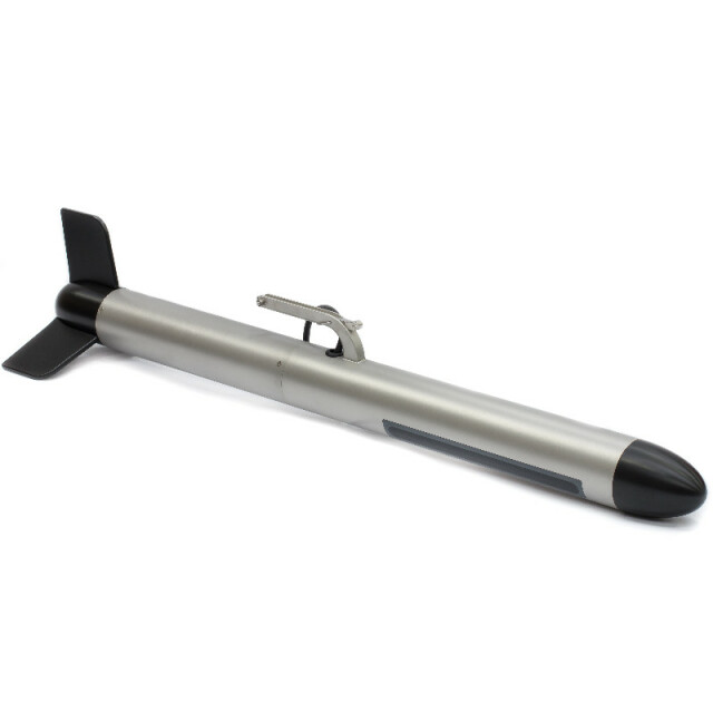
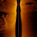
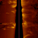
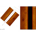
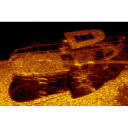
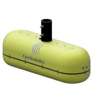
Pulsar acquires high resolution acoustic images of the seabed by using a rugged tow fish that can be easily operated with a water protected deck unit and small cable hand reel. Large areas can be surveyed efficiently revealing small objects and structures in great detail. The system is ideal for search and recovery operations, underwater inspection as well as engineering and scientific surveys.

GeoAcoustics Ltd
Great Yarmouth, GB
Description
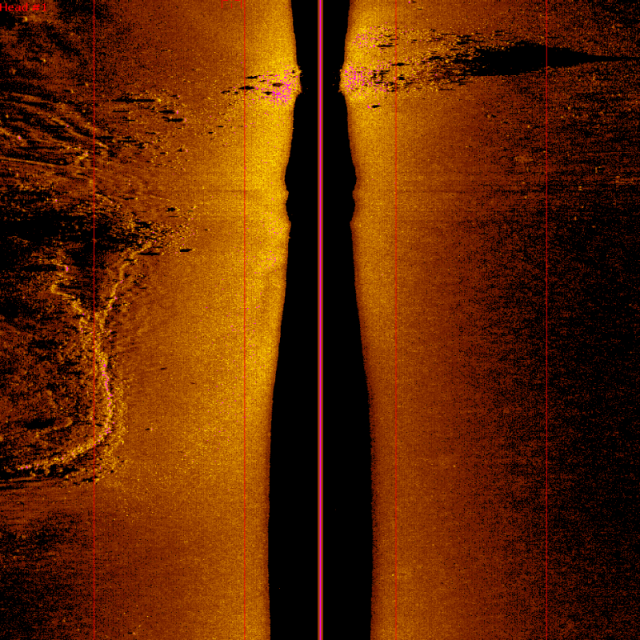
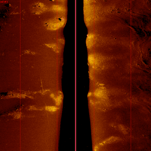
The system operates in a frequency range of 550 kHz to 1 MHz. Within this bandwidth source signals, both FM and CW, can be selected in order to optimise the range and resolution for the given survey task.
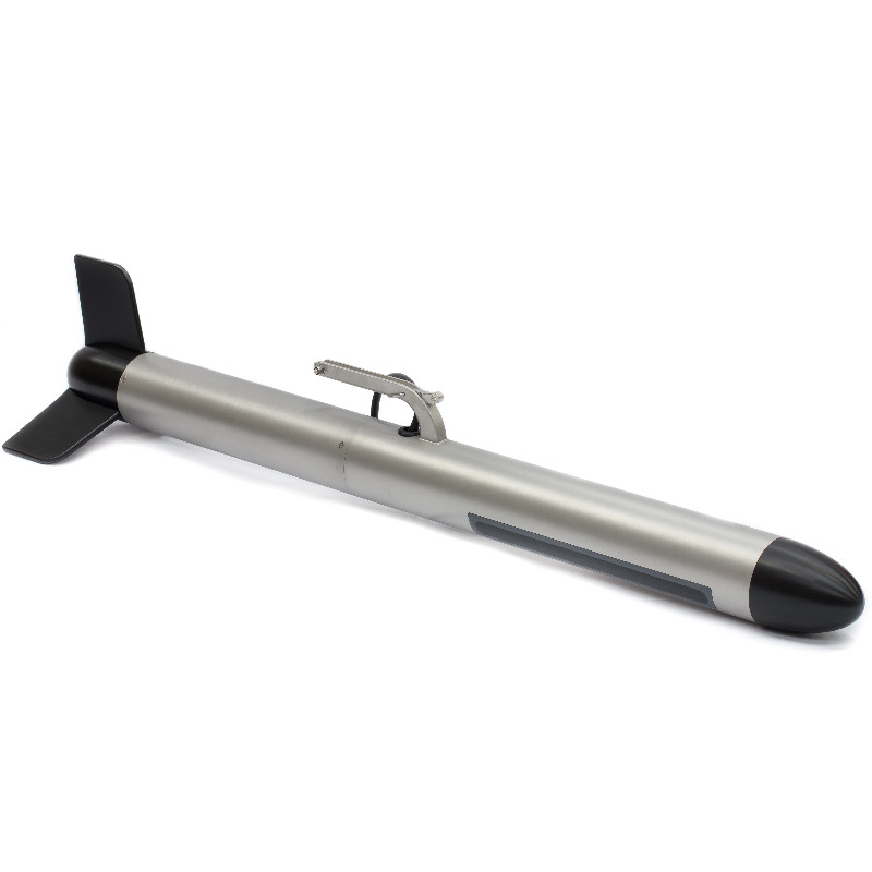
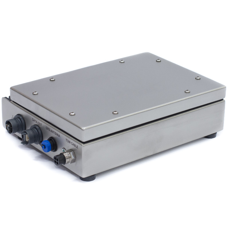
The set-up comprises a compact stainless steel towfish, which is towed from a 100 m long soft tow cable. The cable can be paid out from a compact hand reel, which uses slip rings so that it stays connected to the deck unit via a dedicated deck cable during operation. Optionally various soft tow and armoured cables, up to 300 m length, are available.
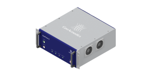
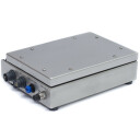
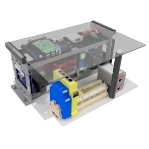
The deck unit has been designed for use on small vessels like open RIBs and is therefore water protected (IP64) and can be battery or mains powered, 24 VDC or 110/230 VAC respectively. It has an integrated GPS system that provides positioning information with SBAS differential corrections. Alternatively an external positioning system can be connected via a serial port.
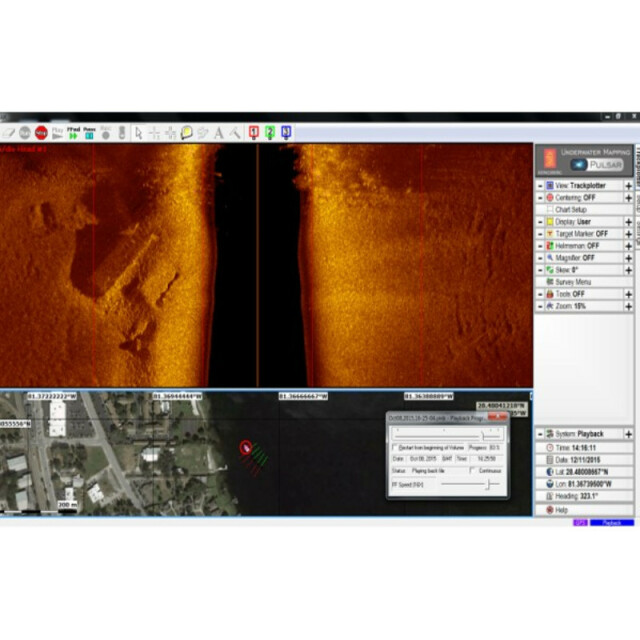
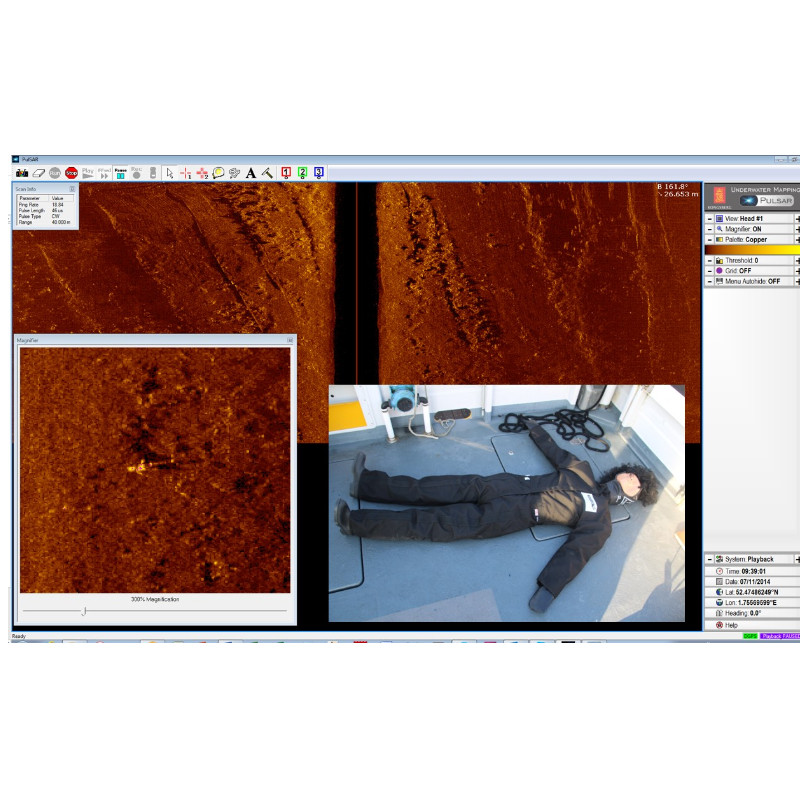
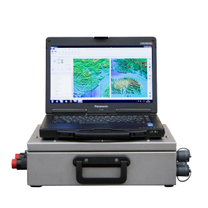
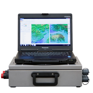
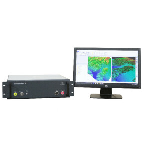
The system is delivered with a dedicated software package to be run on a customer laptop computer connected via Ethernet to the deck unit. It allows the user to plan and conduct the survey and acquire sonar data with embedded positioning information. The data can be processed, visualised and interpreted in the software package and exported in industry standard formats to third party packages for further use.
The system is designed for easy deployment and intuitive operation. It can be operated by non-specialised personnel for quickly carrying out effective surveys using vessels of opportunity in search and recovery (SAR) missions.
Underwater inspection and engineering surveys can also easily be conducted without large overheads for survey platforms and survey specialists.
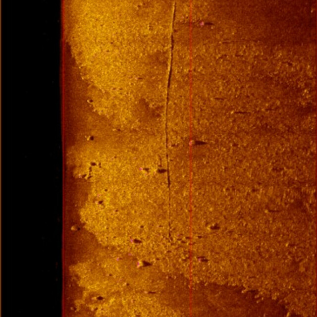
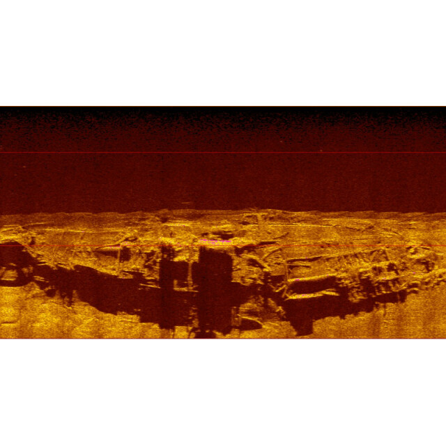
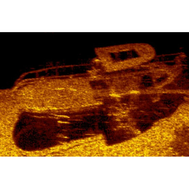
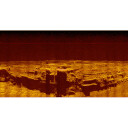
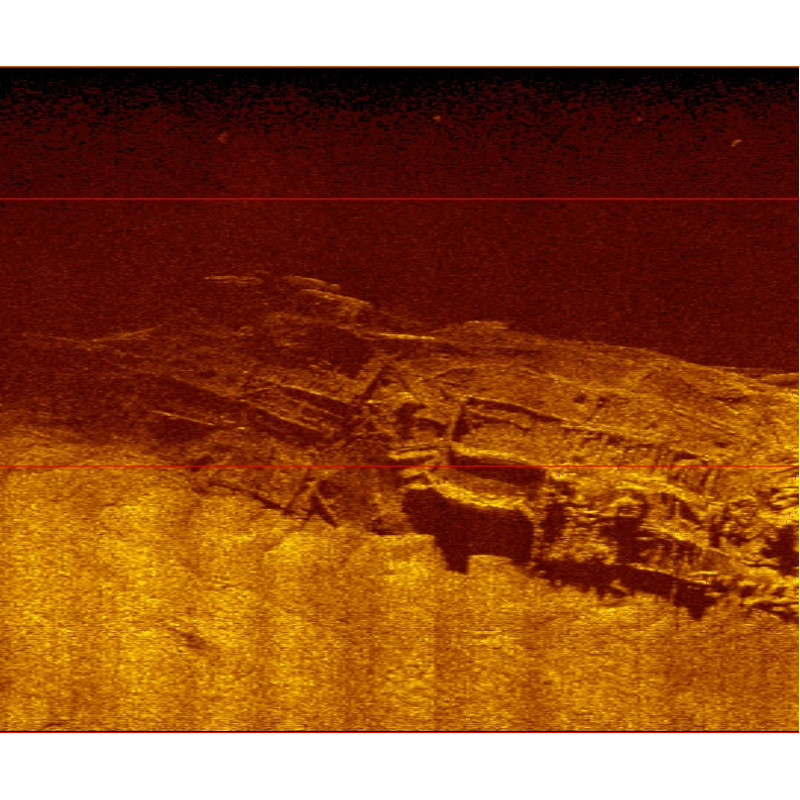
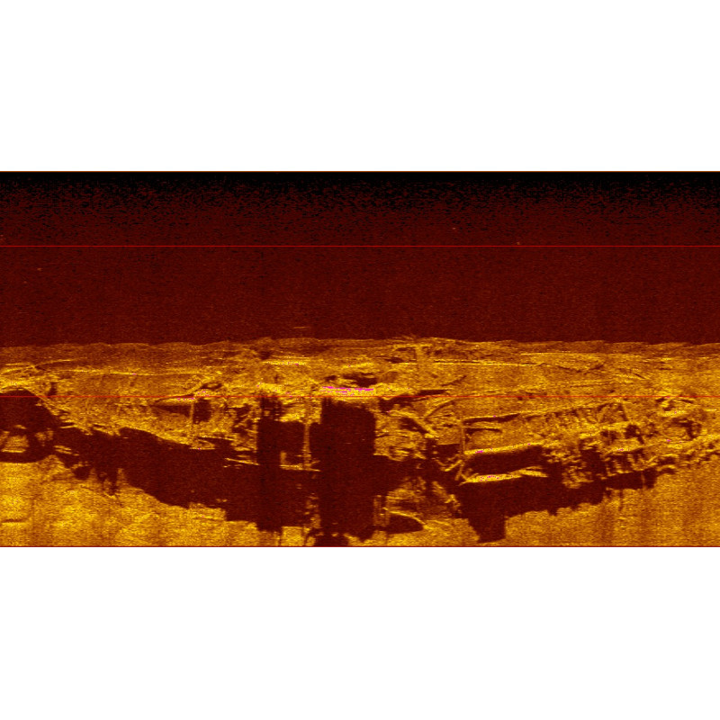
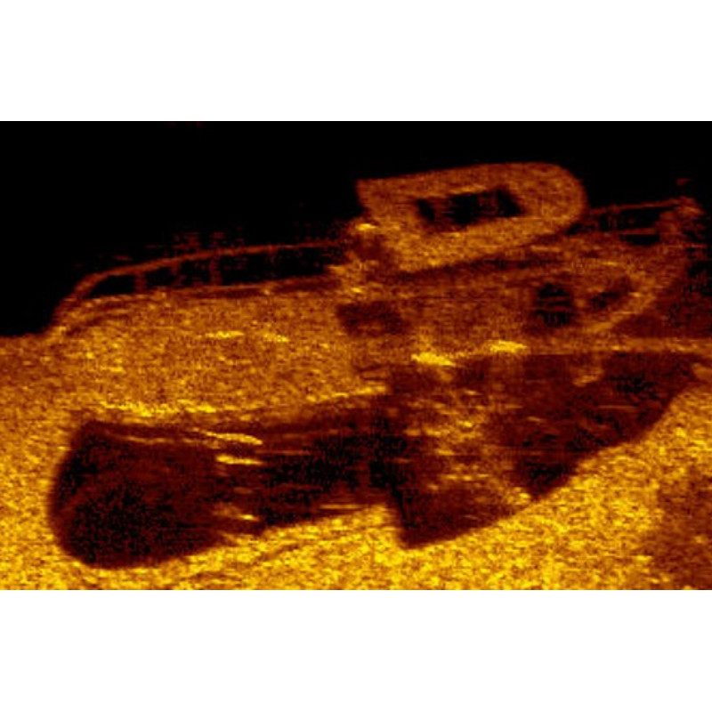
The high resolution achievable with the system results in seafloor maps with detail that may form the basis for scientific investigation in areas such as marine geology and geophysics as well as marine archaeology.
Do you have questions about this product?
- Questions about price, availability, and/or retailers
- Questions about technical specifications and usage
- Questions about suitability for your project or application
Specifications
-
Towfish
-
Model identification
SAR04-0001
Length [m]
110
Width [m]
9
Height [m]
7.5
Weight in air [kg]
16.5
Max. depth rating [m]
1000
Deployment methods
Towed or Over The Side Mounted
-
Transceiver and recorder
-
Model name
Pulsar
Min. AC power [V]
110
Max. AC power [V]
230
Min. DC power [V]
10
Max. DC power [V]
30
Power consumption [W]
50
Data processing and imaging capabilities
Optional Pulsar software of SonarWiz 7
Standard system interfacing capabilities
xtf output
Generation of firing trigger
Internal
-
System Description
-
System type
Stand alone
Mode of operation
Single frequency
Location of digitation
Towfish
-
More information
-
Application
Search & Recovery, Survey, Debris Location, Ship Wreck Survey, Site Survey
Distinguishable features
Selectable frequency without changing transducers. Easy to use and deploy.
-
Cable and winch
-
Type of Cable supported
Coaxial - either softtow or armoured
Max. length of cable [m]
300
Winch type recommended
Hand winch for shorted cable lengths, optional powered winch for upto 300m availible
-
Operating frequencies
-
Min. frequency [kHz]
550
Max. frequency [kHz]
1000
Source level [dB]
223
Max. Range [m]
150
Min. beam width [deg]
0.4
Max. beam width [deg]
0.5
Min. vertical beam width [deg]
50
Max. vertical beam width [deg]
50
Max. horizontal resolution [cm]
1
Max. operating speed [kt]
10
-
General
-
Year of introduction
2015
Documents
Brochure
pulsar
Other documents
-
Pulsar 2024.pdf4.63 MB

