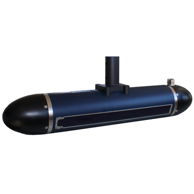

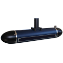

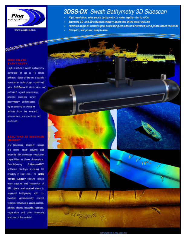
3DSS-DX
Co-registered 2D and 3D Sidescan Imagery and Bathymetry for shallow water imaging applications.
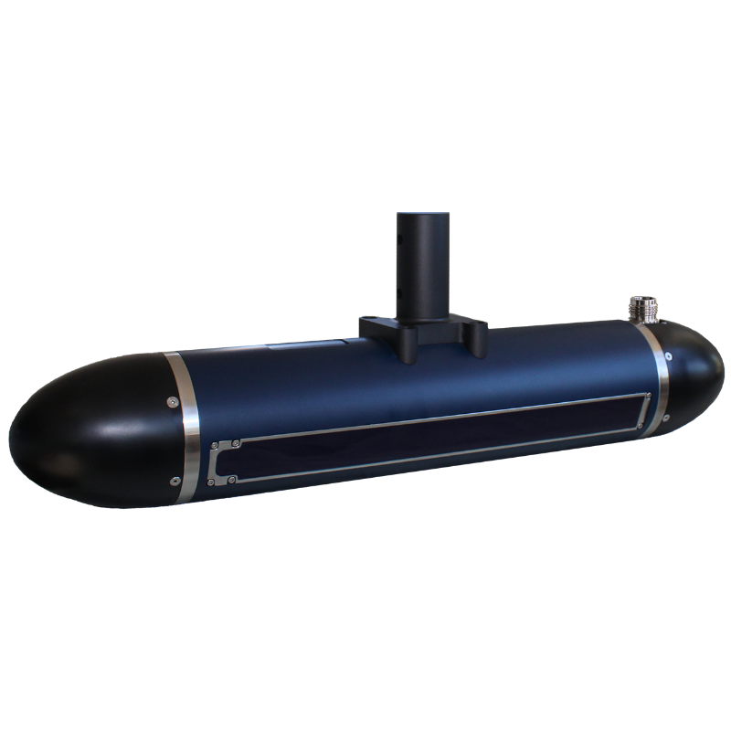
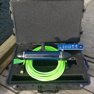
The 3DSS-DX utilizes state-of-the-art acoustic transducer array technologies, SoftSonar(TM) electronics, and advanced signal processing techniques to produce superior swath bathymetry and 3D side-scan imagery. The 3DSS-DX is a portable hydrographic/3D imaging sonar for either rapid assessment/search applications integration with an INS on a hydrographic survey launch or USV / ASV.

Ping DSP
North Saanich, CA
Description
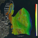
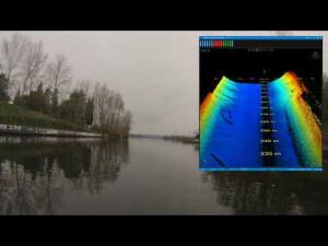
The 3DSS-DX utilizes state-of-the-art acoustic transducer array technologies, SoftSonar™ electronics, and advanced signal processing techniques to produce superior swath bathymetry and 3D side-scan imagery. This patented technology is able to resolve multiple concurrent acoustic arrivals, separating backscatter from the seabed, sea-surface, water-column and multipath arrivals. The result is stunning 3D side-scan imagery spanning the entire water-column, and superior swath bathymetry from a compact, easy-to-use sonar.
The 3DSS-DX provides superior hydrographic surveying and underwater 3D imaging for a wide variety of applications including:
- Shallow water hydrographic surveys
- Habitat mapping
- Shallow water IED mine-hunting (MCM) detection
- Port & Harbour security
- Marine debris search
- Subsea structure surveying/inspection
- Dredging operations
- ASV and AUV applications
- And more!
Do you have questions about this product?
- Questions about price, availability, and/or retailers
- Questions about technical specifications and usage
- Questions about suitability for your project or application
Specifications
-
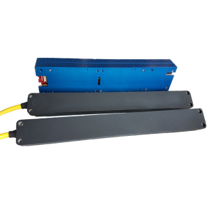
Towfish
-
Model identification
Pole Mount
Length [m]
0.57
Width [m]
0.099
Height [m]
0.099
Weight in air [kg]
8
Max. depth rating [m]
100
Transducer type and material
Proprietary
Fish height from seabed determination method
Bathymetry output at nadir.
Deployment methods
Over the side of manned vesselsas small as 8feet.On autonomous surface vessels.On autonomous underwater vehicles.
Depression technique
NA
-
Transceiver and recorder
-
Model name
3DSS-DX-450 (pole mount)
Min. DC power [V]
21
Max. DC power [V]
27
Power consumption [W]
25
Data processing and imaging capabilities
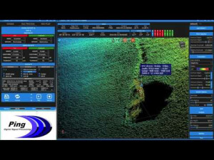
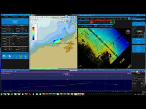
Both 2D and 3D sidescan outputs together with a bathymetry output.3D sidescan based on Computed Angle-of-Arrival Transient Imaging technology to provide 2D sidescan resolution in three dimensions.3D sidescan point cloud display software provides real-time viewing and manipulation of 3D backscatter.Internal MRU included.
Standard system interfacing capabilities
Ethernet TCP to supporting multiple clients.2D sidescan and Bathymetry can be directly interfaced to 3rd party survey software such as Hypack and SonarWiz.Connections provided for optional GPS and external MRU interface.
Generation of firing trigger
Internal or external.
-
System Description
-
System type
Stand alone
Mode of operation
Single frequency
Location of digitation
Head
-
More information
-
Application
Pole mounted, shallow water (<40m) survey, search, rapid assessment, structure inspection, full water column river and canal mapping, habitat mapping.ASV mounted shallow water operation.AUV mounted operation to 100m.
Distinguishable features
3D sidescan, 2D sidescan, bathymetry, compact.
-
Cable and winch
-
Type of Cable supported
3DSS Cable
Max. length of cable [m]
50
-
Operating frequencies
-
Min. frequency [kHz]
450
Max. frequency [kHz]
450
Min. pulse length [µs]
10
Max. pulse length [µs]
200
Max. Range [m]
200
Min. beam width [deg]
0.4
Max. beam width [deg]
0.4
Min. vertical beam width [deg]
19
Max. vertical beam width [deg]
125
Max. depression angle [deg]
65
Max. horizontal resolution [cm]
1.67
Max. vertical resolution [cm]
1.67
Max. operating speed [kt]
4
Documents
Brochure
3dss-dx-brochure.pdf
988.34 KB
