


R2Sonic I2NS Type I or Type II
Integrated Inertial Navigation System I2NS Type I or Type II
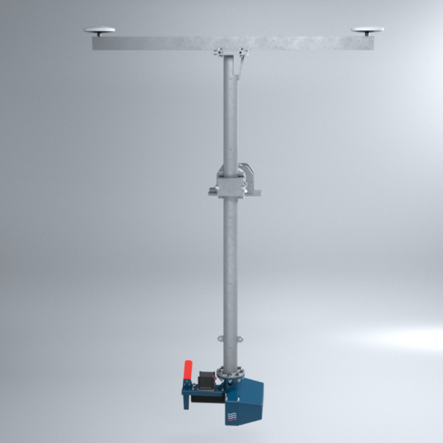
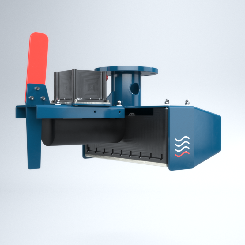
The integrated Inertial Navigation System I2NS™ from R2Sonic is based on the Applanix OceanMaster™ (Type I) or WaveMaster™ (Type II) and integrates seamlessly with the R2Sonic Wideband-Broadband Multibeam Echosounder Systems.

Subsea Europe Services GmbH
Halstenbek, DE
Description
The R2Sonic I2NS integrates seamlessly with R2Sonic Sonic Series Multibeam Echosounders, providing accurate and robust geo-referencing and motion compensation for hydrographic surveys.
Easy to set-up, operate and control through a monitoring window built into the R2Sonic graphical user interface, the I2NS is an industry-proven, tightly coupled solution for vessel roll, pitch, heave, heading, position, and velocity.
Main Advantages:
- Seamless integration with R2Sonic MBES
- Compact IMU in a waterproof housing
- Selectable accuracy configurations
- Inertial aided RTK (Real-Time Kinematic) positioning
- High immunity to GNSS (Global Navigation Satellite System) outages
- Reduced cabling and processing modules with a single Ethernet port for data
- Export license not required for most countries
- Affordable pricing options
- 3-year standard warranty
R2Sonic offers various accuracy and options for the I2NS:
I2NS™ Type I – 0.01°
| Integrated INS | DGPS | RTK | Accuracy During GNSS Outages |
|---|---|---|---|
| Position | 0.5-2m depending on quality of differential corrections | Horizontal: 1cm or better Vertical: 1.5cm or better |
~3m for 60 s total outages (RTK) ~1m for 60 s total outagges (IAPPK) |
| Roll & Pitch | 0.02° | 0.01° | 0.03° |
| Heading | 0.01° w/4m baseline 0.02° w/2m baseline |
Same | Negligible for outages < 60s |
| Heave | 5cm or 5% 2cm or 2% TrueHeave™ |
5cm or 5% 2cm or 2% TrueHeave™ |
5cm or 5% 2cm or 2% TrueHeave™ |
I2NS™ Type II – 0.02°
| Integrated INS | DGPS | RTK | Accuracy During GNSS Outages |
|---|---|---|---|
| Position | 0.5-2m depending on quality of differential corrections | Horizontal: 1cm or better Vertical: 1.5cm or better |
~3m for 30 s total outages (RTK) ~2m for 60 s total outages (IAPPK) |
| Roll & Pitch | 0.03° | 0.02° | 0.04° |
| Heading | 0.015° w/4m baseline 0.03° w/2m baseline |
Same | Negligible for outages < 60s |
| Heave | 5cm or 5% 2cm or 2% TrueHeave™ |
5cm or 5% 2cm or 2% TrueHeave™ |
5cm or 5% 2cm or 2% TrueHeave™ |
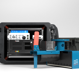
Scope of supply for the I2NS Type I or Type II system:
- 1 x Integrated Inertial Navigation System Type R2Sonic I2NS Type I (Type II) complete with
- Roll / Pitch Accuracy: 0.01° (0.02°) with RTK
- Heading Accuracy: 0.02° (0.03°) with 2 m antenna baseline
- Heave Accuracy 5 cm or 5%, 2 cm or 2% with TrueHeave™
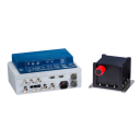
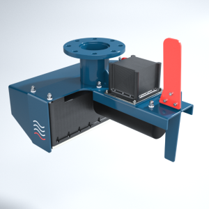
- 1 x Sonic Interface Module with INS (SIM-INS)
- 2 x Trimble 540AP antennas
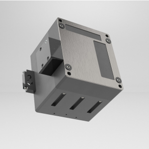
- 1 x I2NS IMU Assembly, Type II
- 2 x Antenna Cable, 8 m (optional 15 m and 25 m)
- 1 x Deck cable, 15 m, for IMU (optional 25 m and 50 m)
- Optional Fugro Marinestar GNSS G2/G4+ Regional (German EEZ - Baltic Sea and North Sea)
Do you have questions about this product?
- Questions about price, availability, and/or retailers
- Questions about technical specifications and usage
- Questions about suitability for your project or application
Specifications
-
Application area
-
Select your application area
Habitat Mapping, Hydrography, Infrastructure, Offshore Renewables, Oil & Gas
-
Region
-
Select your region
Europe
-
Category
-
Select your category
INS - Inertial Navigation Systems
Documents
Brochure
i2ns-spec-sheet-a4-02-2020.pdf
370.55 KB
More from Subsea Europe Services GmbH
