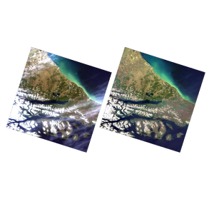
Remote Sensing Image Processing Software
Remote sensing image processing software is a critical tool for transforming raw imagery and sensor data from satellites, drones and aircraft into valuable geospatial information products. These powerful software packages allow geospatial professionals to process, analyze and extract insights from remote sensing data.
With a wide range of tools for geometric correction, radiometric enhancement, photogrammetry, and machine learning, remote sensing software enables the creation of detailed maps, 3D models and geospatial analytics. Geo-matching provides a complete overview of remote sensing image processing software, allowing you to compare products, read relevant articles and reach out to suppliers.
Showing 1-7 of 7 results
Need some help? Ask a Geo-matching expert!
Our team and network of 1000+ manufacturers and developers is here to assist you.

