

About Pythagoras
Pythagoras BV has been developing software solutions for the geospatial industry for more than 30 years. Our solutions are used and trusted by thousands of happy customers all over the world.
Pythagoras CAD - Surveying & mapping software
Our Pythagoras CAD software is specifically designed for land surveyors. It comes with intuitive tools so you can start without undergoing lengthy training. Moreover, our friendly support team, is always ready to help you. Pythagoras CAD integrates with all industry file formats, brands, and devices, whether you're using traditional survey equipment or cutting-edge scanners.

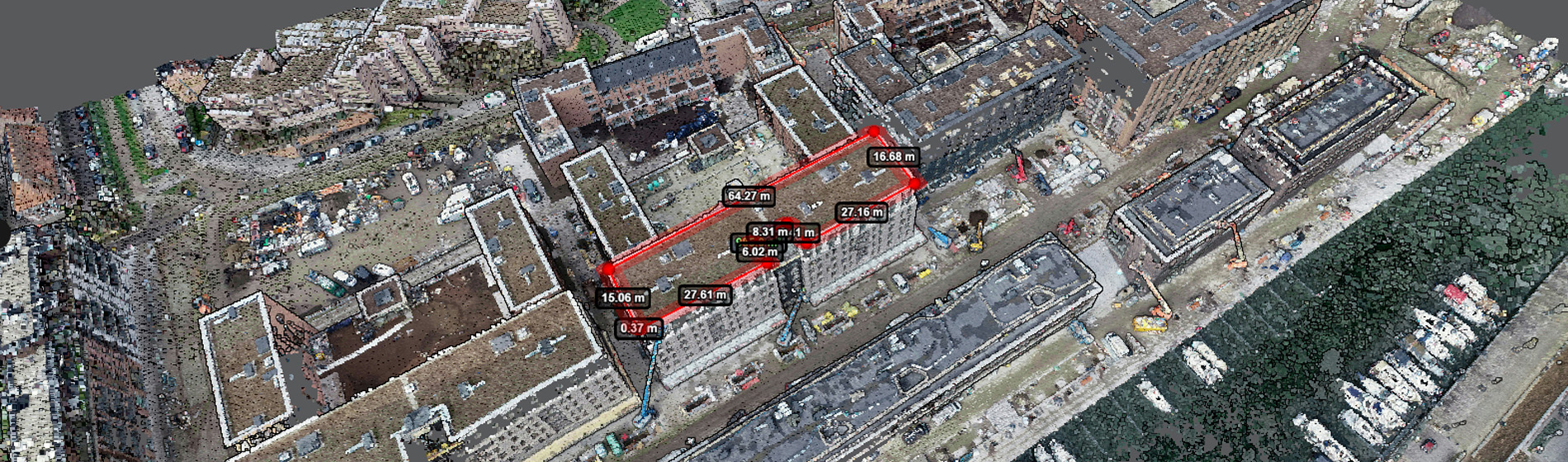
Pointorama - Point cloud portal
And if you're passionate about scanners and point clouds, meet Pointorama! Pointorama is your go-to platform to visualize, share, and edit your point clouds easily. With the help of AI, your point clouds will be cleaned, filtered, downsized, and classified in minutes, without the need for bulky storage or heavy processors. You can access it on any device as long as you have a browser.


Contact us or visit us at Intergeo or GEO Business to learn more!
Featured products

Main office
-
Rubensstraat 104/3
B-2300 Turnhout
Belgium -
+32 14 61 32 70
- http://www.pythagoras.net