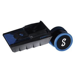
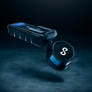
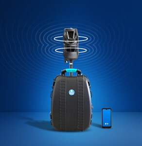
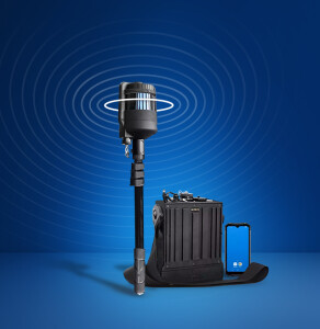
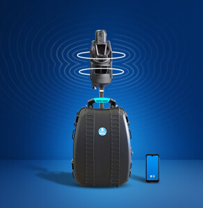
TerrusS
Fast and Accurate Surface Mapping
The TerrusS is the best-in-class, ultra-low drift mapping system used for reality capture, GIS or large-scale survey applications. Globally accurate, colourised maps are generated on the system as either a . LAS or.PLY format using 4x 4k 360-degree colour cameras located about the perimeter of the sensor pack. Whether it be walking or driving, the TerrusS creates rapid large-scale maps of challenging and difficult spaces.
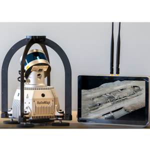
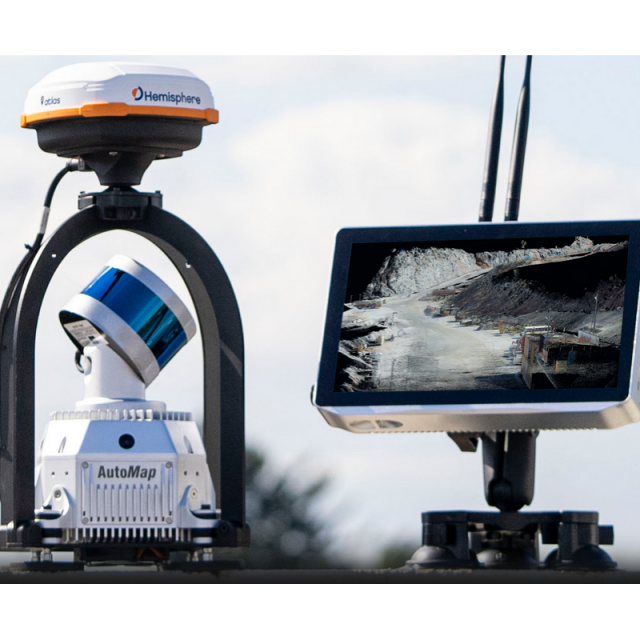
AutoMap
Australia
Description
The TerrusS, powered by WildcatSLAM, is the optimal solution for capturing large-scale, challenging, urban environments. Native GPS integration enables automatic trajectory realignment to create globally accurate maps at the push of a button. Scan roads, buildings and other busy spaces with ease using the TerrusS. The TerrusS is driven by a touchscreen interface that enables the user to create globally accurate, colourised maps. Export maps to USB or automatically transfer them to OrbisFuse for storage and visualisation as you travel through busy GIS spaces.
Specifications
-
General
-
Type
Applications
Road scanning, GIS, Large-scale outdoor areas
Year of last update
2022
Year of introduction
2021
Height [cm]
45
Width [cm]
22
Length [cm]
22
Operating temperature: min. [°C]
5
Operating temperature: max. [°C]
75
Weight [kg]
3.7
-
Camera System
-
Number of cameras
4
FoV per camera [horizontal in deg]
87
Maximum frames/sec. per camera
30
FoV per camera [vertical in deg]
80
Export formats
ts, mp4
-
Software specifications
-
Output data [point cloud, images, mesh, ...]
colourised point cloud
Output file formats
ply, las
-
More information
-
Main applications
road and large-scale outdoor scanning
Training facilities
Yes
Distinguishable features
globally accurate high fidelity pointclouds
-
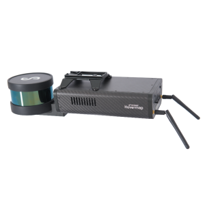
Laser Scanner
-
Number of laser scanners
1
Brand and type
Velodyne
Wavelength [nm]
905
Laser safety classification
Class 1
Absolute accuracy [1 sigma in mm]
20
Max Range [m]
0.06
Max. vertical field of view [deg]
87
Max. horizontal field of view [deg]
360
Range precision [1 sigma in mm]
7
Max. measurement rate [kHz]
300
-
Positioning System
-
SLAM algorithm implemented
Y
GNSS receiver type
800 Channel, multi constellation
IMUs type
High end mems imu
-
Data storage
-
Data storage type [120 characters]
2Tb ssd
Max. data storage [Internal + External in Gb]
4000
Max. size of model [in million points]
5000
-
Power Supply
-
Battery type [120 characters]
Lithium dc battery
Operating time on single battery [hr]
2
Related products
