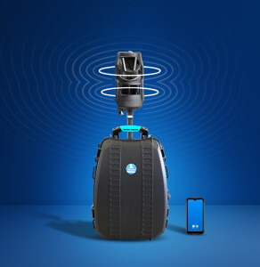
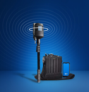
Join 40,000+ geospatial professionals and get technology news delivered straight to your inbox every week. Subscribe today.

TerrusM

TerrusM

Fast and Accurate Underground Mapping

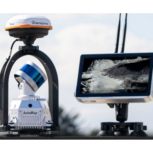
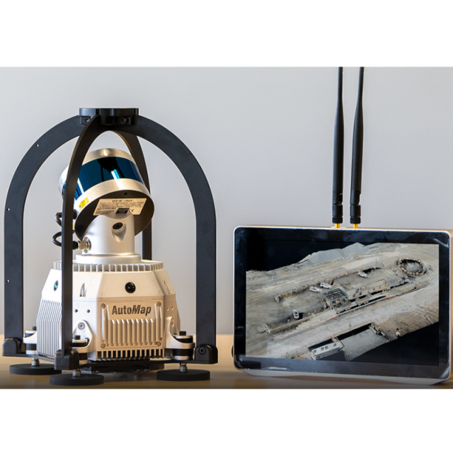
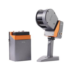
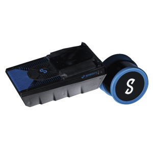
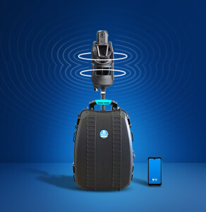
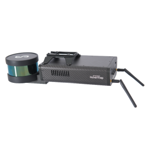
The award-winning TerrusM is the best-in-class, ultra-low drift mapping system used for reality capture, GIS or large-scale survey applications. Globally accurate, colourised maps are generated on the system as either a .las or .ply format using 4x 4k 360-degree colour cameras located about the perimeter of the sensor pack. Whether it be walking or driving, the TerrusM creates rapid large-scale maps of challenging and difficult environments.

AutoMap
Australia

Description

The TerrusM is able to realign maps on the device in order to mitigate ‘SLAM drift’. Capture accurate large-scale global maps that are re-projected into a global frame. Speed up your data capture process significantly by moving to the next-generation TerrusM reality, GIS and survey capture tool. The TerrusM scanner is a mobile mapping platform that can easily fit light and large vehicles. Operating at low driving speeds, the TerrusM can collect map data rapidly in busy environments with ease using a simple touchscreen interface. Powered by the latest generation Wildcat engine, the TerrusM is the perfect tool for large construction, mining, port, plant and rail operators as they manage their changing assets.

SPECS

  • Scan Range: 100m
  • 360° Cameras:  4 x 4k
  •  Edge Compute Platform: NVIDIA AI
  • Points Per Second: 300,000
  • Accuracy and Localisation precision: Sub-CM
  • Designed to survive any environment: Rugged
  • Rapid Mapping - 7km Captured in 1 hour

Included in the Box:

  • TerrusM Sensor Pack.
  • Xbox Controller.
  • Terminal Pack + Stand.
  • 1.8m Harness Cable.
  • 20v Rechargeable Power Bank.
  • AV Power + Other miscellaneous cables.

Specifications

General

Type

Applications

Mine, Tunnel and Subterranean Mapping

Year of last update

2022

Year of introduction

2020

Height [cm]

45

Width [cm]

22

Length [cm]

22

Operating temperature: min. [°C]

5

Operating temperature: max. [°C]

75

Weight [kg]

3.7

Camera System

Number of cameras

4

FoV per camera [horizontal in deg]

87

Maximum frames/sec. per camera

30

FoV per camera [vertical in deg]

80

Export formats

ts, mp4

Software specifications

Output data [point cloud, images, mesh, ...]

Colourised point cloud

Output file formats

ply, las

More information

Training facilities

Yes

Distinguishable features

globally accurate high fidelity pointclouds

Laser Scanner

Number of laser scanners

1

Brand and type

Velodyne

Wavelength [nm]

905

Laser safety classification

Class 1

Absolute accuracy [1 sigma in mm]

20

Max. vertical field of view [deg]

0.06

Max. horizontal field of view [deg]

87

Range precision [1 sigma in mm]

7

Max. measurement rate [kHz]

300

Positioning System

SLAM algorithm implemented

Y

IMUs type

High end mems imu

Data storage

Data storage type [120 characters]

2Tb ssd

Max. data storage [Internal + External in Gb]

4000

Max. size of model [in million points]

5000

Power Supply

Battery type [120 characters]

Lithium dc battery

Operating time on single battery [hr]

2

Related products

Ask a question

AutoMap team is happy to assist.

AutoMap

We're available on all weekdays and usually reply within 1-2 working days.

Please provide detailed information. Your input helps AutoMap assist you effectively.

Let us know a little about you and your contact information.

Do you represent a company or organization?

Before we proceed, would you be interested in subscribing to our newsletter?

By completing this form, you acknowledge and agree to abide by our Terms and Conditions, Privacy Policy and Cookie Policy.

Thank you for your message! Our team tipically to respond to inquiries within 1-2 business days.