
T3D Rail
Automated railway point cloud processing
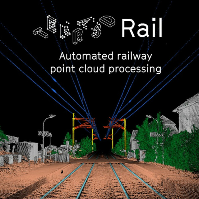
T3D Rail is a software suite composed of powerful, fully automated and easy to use point cloud processing tools for railway asset management: classification, digitization and specific applications.
Terra3D
France
Description
T3D Rail is a software suite composed of powerful, fully automated and easy to use point cloud processing tools for railway asset management.
- Supports a large range of input 3D point cloud formats (LAS/LAZ, PLY, XYZ, ASC, PTS, E57).
- Supports most common output vector formats (DXF, ShapeFile).
- Easy to use through GUI, scriptable through command line.
- Mobile Mapping System, Terrestrial Laser Scanning and UAV sourced clouds.
Available on Linux and Windows.
Semantic classification
Extract 14 classes. ASPRS Standards labels or user-defined labels. Customizable extraction parameters.
- terrain,
- rail,
- catenary: cable, cantilever, pole,
- vegetation: high, medium, low,
- traffic light,
- building,
- structure,
- platform,
- noise: low point, high point.
Our algorithm improves fast, the list of the classes it handles is frequently updated.
High precision digitization
Generation of 3D polylines and extraction of geometric attributes. Creation or update of a GIS database with georeferenced assets.
- Rail digitization: generation of a 3D multi-polyline.
- Catenary digitization: generation of a 3D polyline for the cables and extraction of poles positions and orientations.
Specific applications
- Clash detection.
- Ballast profile and volume survey.
- Cross and longitudinal sections.
- Vegetation monitoring.
Specifications
-
General
-
Year of initial introduction
2016
Year of last update
2019
Source of Point Clouds


