RS Web-Survey
The WEB portal for the distribution of Laser Mapping Data in streaming mode
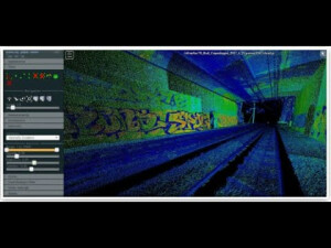
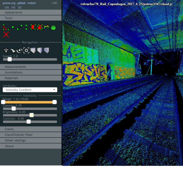
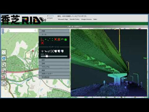
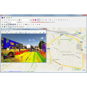
RS Web Survey is a web application developed by Siteco for the consultation, distribution, editing of the data surveyed with any Mobile Mapping System (Road-Scanner, RIEGL, Optech, Z&F, and so on) through the web, in streaming mode. Images and point clouds are stored in an organized and structured database and can be consulted and viewed in their mapping context through a WEBGIS portal.
Siteco Informatica
Bologna, IT
Description
A smart user-friendly interface allows the data consultation, deployment and download, through the definition of user-profiles with different access privileges, according to needs.
The management console, developed in a .Net environment, allows the organization of the data and their publication on the Portal starting from point clouds (LAS or LAZ format files), trajectories or spherical images captured in a survey.
The key technical features of the application are the following:
•PHP and Javascript language, based on open-source technologies,
•Apache webserver,
•Cartographic component created with Openlayers Javascript libraries,
•Display of point clouds via Potree Javascript libraries, and WebGL,
•Display of spherical images using Photo Sphere Javascript libraries,
•PostGIS database,
•Geoserver for WMS publishing layers.
Specifications
-
Hardware/software requirements
-
RAM [GB]
8
HD [GB]
20
Use of GPU
N
Processor
Any
Stereo Display
N
Stand-alone
No
List software environment, e.g. Microstation
Any Web Browser
-
Other
-
Support
Provided
Training
Y
-
Files and Registering
-
Stitching multiple scans
Y
Input formats
LAS/LAZ
Output formats
LAS
Max. file size (#3D points)
0
Geo-referencing
Y
Automatic Target Detection
N
-
Pre-processing and Automatic Filtering
-
Image matching facilities
N
Frequency domain decoding for data reduction
-
Removal of individual outliers
N
Removal of vegetation
N
Removal of buildings
N
Bare ground DEM generation
N
-
Manual Measurements
-
3D Coordinates extraction
Y
Length and Height
Y
Angle
Y
Distance
Y
Area
Y
Volume
Y
-
General
-
Source of Point Clouds
Outdoor TLS, Airborne Lidar, Photogrammetric
Year of initial introduction
2018
Year of last update
2020
Modules
Point clouds and spherical images consultation in streaming mode
Supported Systems
Any Mobile Mapping System
-
Analysis
-
Line of sight
N
Aspect and slope
N
Individual tree heights
N
Simulation facilities
-
Time series analysis
N
-
Automatically Generated Products
-
Regular Grid DEMs
N
Break lines
N
Boundary detection of solids
N
Cross sections
Y
TIN
N
Contour Lines
N
Building footprints
N
Building roofs
N
3D City modelling
-
-
Solid Modelling
-
Lines
N
Planes
N
Cubes
N
Spheres
N
Cylinders
N
NURBS
N
Industrial features
-
Earth surface features
-
-
Visualisation and Editing
-
Zoom, pan and rotate
Y
Fly-throughs
Y
Adding Points
Y
Removing Points
N
Point Reduction
N


