Road-SIT Survey
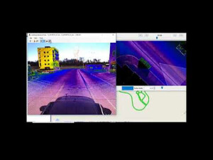
Road-SIT Survey is designed and developped to work with georeferenced images and point clouds. The software is fully compatible with any mobile mapping LIDAR and images dataset. It provides a wide range of specialized features to produce and edit CAD drawings and GIS maps in an efficient way by keeping under control the geographical context.
Siteco Informatica
Bologna, IT
Description
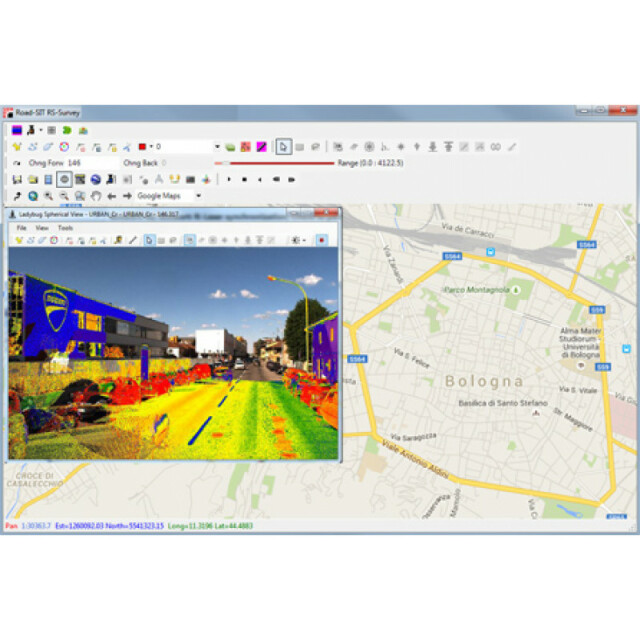
Road-SIT Survey is designed and developped to work with georeferenced images and point clouds. The software is fully compatible with any mobile mapping LIDAR and images dataset. It provides a wide range of specialized features to produce and edit CAD drawings and GIS maps in an efficient way by keeping under control the geographical context. The module is also available as a plug-in for AutoCAD, ArcGIS and MicroStation, thus greatly simplifying the production of cartographic drawings in their original environment.
Specifications
-
Hardware/software requirements
-
RAM [GB]
8
HD [GB]
1.5
Use of GPU
Y
Processor
["64-bit"]
Stereo Display
Y
-
Other
-
Support
Phone, online
Typical applications
Mobile Mapping, High Grade Survey
Distinguishing features
Ground Control Point calibration and mission Geodatabase editing, AUTOCAD, ArcGIS and MicroStation plug-inPhotogrammetry and snap to laser points Feature extraction and Edge detection.
Training
Y
-
Files and Registering
-
Input formats
SQL, MDB, txt, pts,bmp, E57, LAS, LAZ, FLS, Octree
Output formats
SQL, MDB, txt, pts,bmp, E57, LAS, LAZ, FLS, Octree
Geo-referencing
Y
Automatic Target Detection
N
Stitching multiple scans
Y
-
Pre-processing and Automatic Filtering
-
Image matching facilities
Y
Frequency domain decoding for data reduction
No
Removal of individual outliers
N
Removal of vegetation
N
Removal of buildings
N
Bare ground DEM generation
N
-
Manual Measurements
-
3D Coordinates extraction
Y
Length and Height
Y
Angle
Y
Distance
Y
Area
Y
Volume
N
-
Interoperability
-
CAD software
Microstation, Autocad, ArcGis
Hydrological software
No
Assigning colour from imagery to points
Y
Image overlay on TIN
N
Integration with other data types
CAD drawings, Shape Files, Point Clouds
-
General
-
Year of last update
2016
Year of initial introduction
2008
Modules
Microstation PluginAutocad PluginArcGis Plugin
Supported Systems
FARO, ZF, OPTECH, TOPCON, RIEGL, VELODYNE, LADYBUG
Source of Point Clouds
Airborne Lidar, Indoor TLS, Outdoor TLS, Photogrammetric, Radar
-
Analysis
-
Line of sight
N
Aspect and slope
Y
Individual tree heights
Y
Simulation facilities
No
Time series analysis
N
-
Automatically Generated Products
-
Regular Grid DEMs
Y
Cross sections
Y
TIN
N
Contour Lines
Y
Break lines
N
Boundary detection of solids
N
Building footprints
N
Building roofs
Y
3D City modelling
No
-
Solid Modelling
-
Lines
N
Planes
Y
Cubes
N
Spheres
N
Cylinders
N
NURBS
N
Industrial features
No
Earth surface features
No
-
Visualisation and Editing
-
Zoom, pan and rotate
Y
Fly-throughs
Y
Adding Points
Y
Removing Points
Y
Point Reduction
Y


