Description
Specifications
-
Hardware/software requirements
-
RAM [GB]
8
HD [GB]
8
Use of GPU
Y
Processor
["64-bit"]
Stereo Display
Y
List software environment, e.g. Microstation
stand-alone
Stand-alone
Yes
-
Other
-
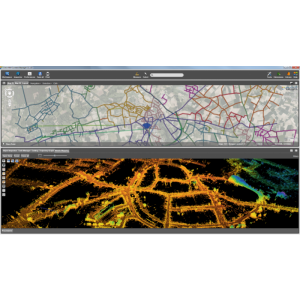
Typical applications
Mobile Mapping (Indoor & Outdoor), Drone/UAS Mapping. TLW, Aerial Oblique and LiDAR.
Distinguishing features
Hi-Professional Feature Extraction. Full production unit for mobile mappingcreate and manage themes easilydocument assetsallows centralized data management
-
Files and Registering
-
Geo-referencing
Y
Automatic Target Detection
Y
Stitching multiple scans
Y
-
Pre-processing and Automatic Filtering
-
Image matching facilities
Y
Frequency domain decoding for data reduction
Y
Removal of individual outliers
Y
Removal of vegetation
Y
Removal of buildings
Y
Bare ground DEM generation
Y
-
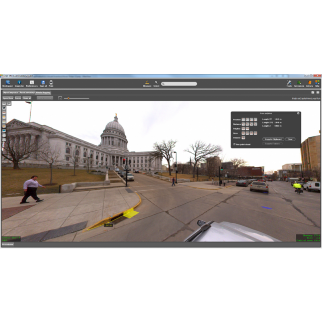
Manual Measurements
-
3D Coordinates extraction
Y
Length and Height
Y
Angle
Y
Distance
Y
Area
Y
Volume
Y
-
Interoperability
-
CAD software
NoN
Hydrological software
N
Assigning colour from imagery to points
N
Image overlay on TIN
Y
Integration with other data types
Y
-
General
-
Year of last update
2019
Year of initial introduction
2010
Modules
Hi-Professional (automated/guided) Feature Extraction. full production unit for mobile mapping; create and manage themes easily; document assets; allows centralized data management. Includes QC.
Source of Point Clouds
Airborne Lidar, Indoor TLS, Outdoor TLS, Photogrammetric, Radar
Supported Systems
all system support, all reality capture techiques
-
Analysis
-
Line of sight
N
Aspect and slope
Y
Individual tree heights
Y
Simulation facilities
N
Time series analysis
N
-
Automatically Generated Products
-
Regular Grid DEMs
Y
Cross sections
Y
TIN
Y
Contour Lines
Y
Break lines
Y
Boundary detection of solids
Y
Building footprints
Y
Building roofs
Y
3D City modelling
no
-
Solid Modelling
-
Lines
N
Planes
N
Cubes
N
Spheres
N
Cylinders
N
NURBS
N
Industrial features
N
Earth surface features
N
-
Visualisation and Editing
-
Zoom, pan and rotate
Y
Fly-throughs
Y
Adding Points
Y
Removing Points
Y
Point Reduction
Y
Related products


