


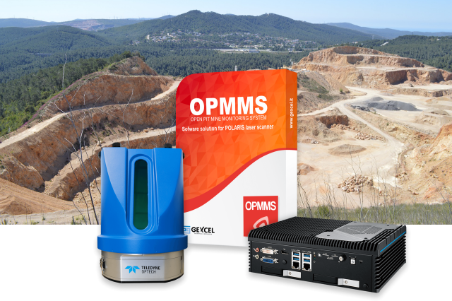


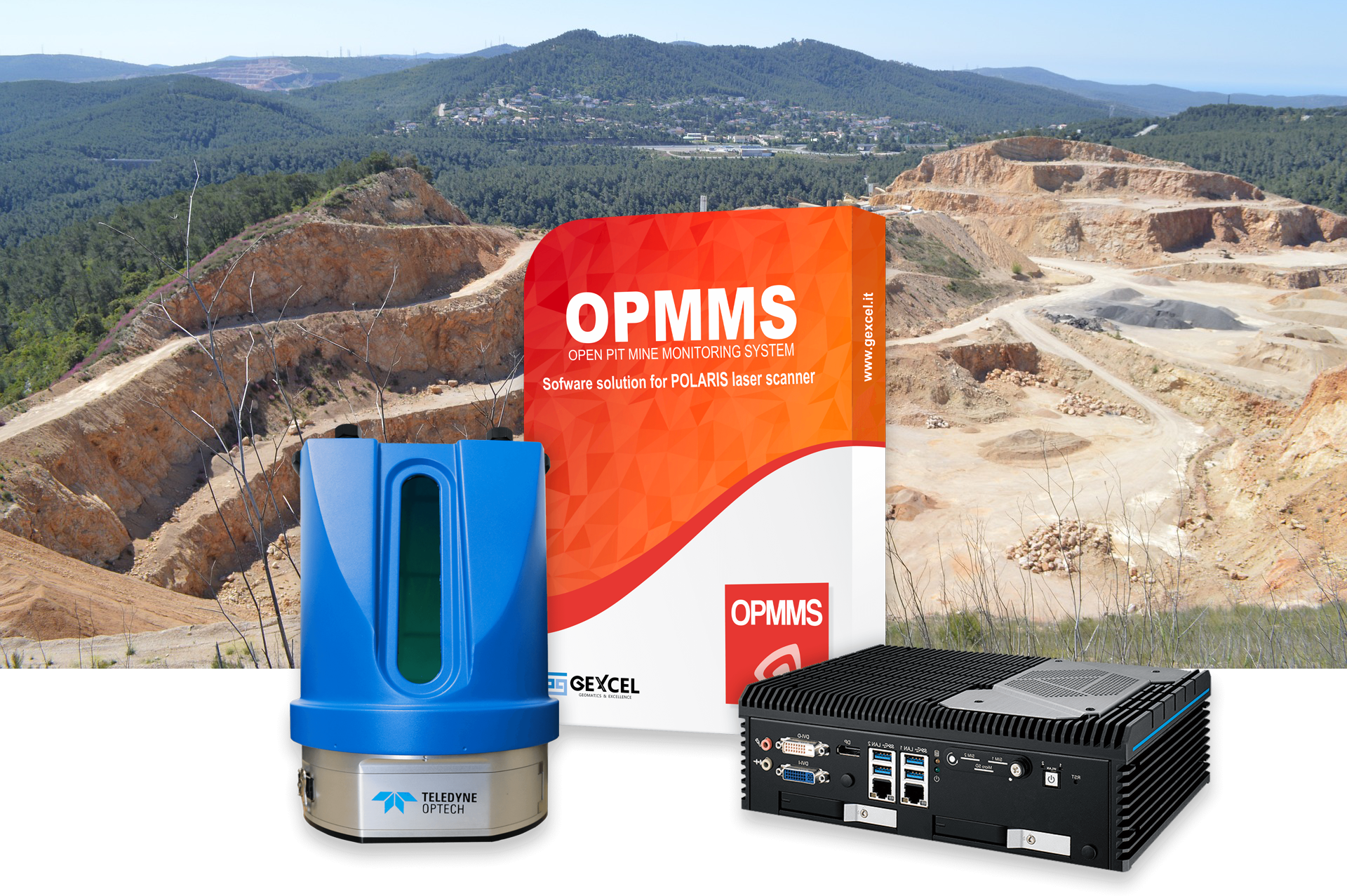

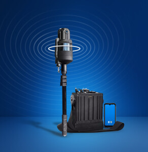
OPMMS
OPMMS - Open Pit Mine Monitoring System - Automatic Long Range Monitoring System
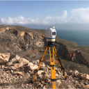
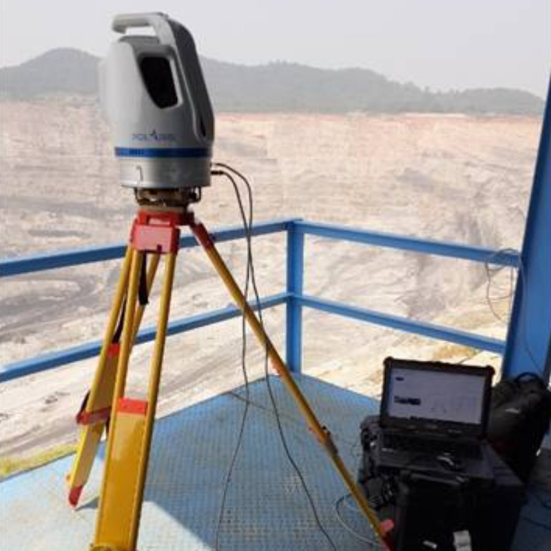
OPMMS is a laser-measurement-based monitoring system for automatic and manual long-range profiling of open pits’ slopes and surfaces and other mining applications.

GEXCEL
Brescia, IT
Description
A laser-measurement-based monitoring system for long-range profiling of
• open pit mines (blasting, rock movements, worker security);
• natural hazard areas (rock falls, landslides, debris flow, glaciers);
• construction sites (infrastructure deformations, working areas, worker safety).
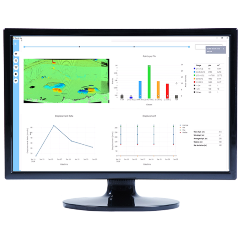
OPMMS automatically performs continuous remote scanning from designated permanent sites, comparing the obtained scans to a reference one and identifying displacements and changes.
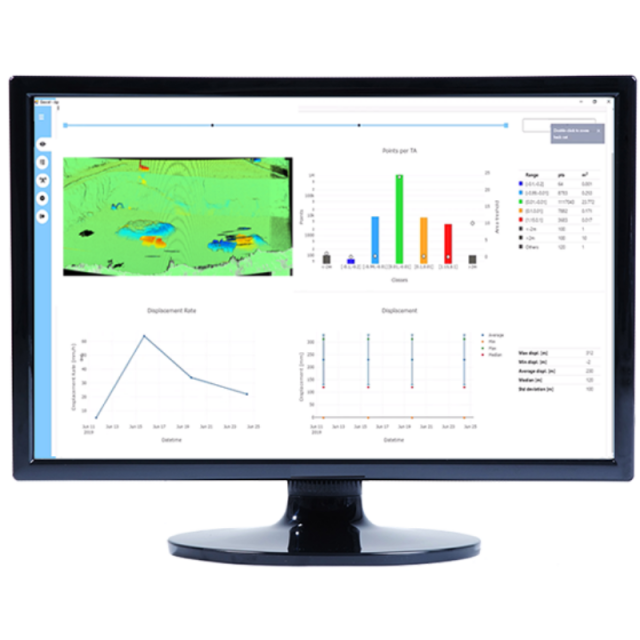
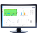
Within the inspected region, manual on-the-fly analysis and output (statistics, inspection maps, classification charts, displacement and displacement rate graphs across time intervals) are possible. Alerts and customisable notifications are sent via email and SMS.
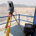
OPMMS is a complete solution that consists of a Teledyne long-range terrestrial laser scanner that is entirely controlled by processing software built into a dedicated control unit.
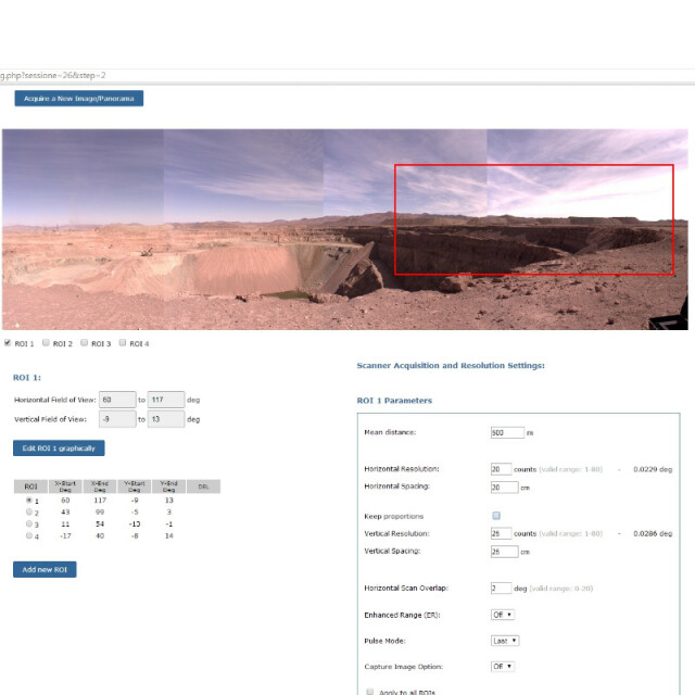
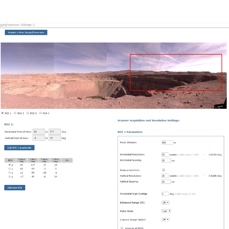
OPMMS gives you the possibility to create a permanent setup with multiple ROI at different resolutions.
OPMMS allows you to decide the Start/End time and the acquisition frequency or choose a specific range of dates you want to inspect.
OPMMS stores 3D data for investigations such as volumetric computations landslides or slopes movements; analysis and planning of excavation processes.
BENEFITS
Keep under control movements of surfaces. Customize monitoring frequency and notification thresholds. When the preset threshold is overtaken, the system automatically alerts the supervisor.
Check mine productivity. Compare change detection and displacement measurements with respect to a reference scan. Compute volumetric variations with post-processing analysis.
Manage risk and safeguard workers, underlining potential dangerous areas. Risky areas will be reported to the supervisors who can plan further onsite analysis with geotechnical teams, engineers and topographic surveyors.
Do you have questions about this product?
- Questions about price, availability, and/or retailers
- Questions about technical specifications and usage
- Questions about suitability for your project or application
Specifications
-
Hardware/software requirements
-
Stereo Display
N
Stand-alone
Yes
List software environment, e.g. Microstation
OPMMS Software Platform - Reconstructor
-
Other
-
Support
During the system installation and for tuning the scanning and alarm parameters
Training
Y
Typical applications
Open pit mine monitoring, landslide monitoring, rock fall monitoring, glaciers monitoring
Distinguishing features
Automatic change detection, Email and sms automatic alarm notification, remote access to the OPMMS outputs, automating registration between sequential scans
-
Files and Registering
-
Input formats
raw scan from Teledyne Polaris and M3 TLS
Output formats
alert E-mail and sms, change detection reports, sequence of TLS scan with change detection layers in E57 and LAS
Geo-referencing
Y
Automatic Target Detection
N
Stitching multiple scans
Y
-
Pre-processing and Automatic Filtering
-
Image matching facilities
Y
Removal of vegetation
Y
Removal of buildings
N
Bare ground DEM generation
Y
-
Manual Measurements
-
3D Coordinates extraction
Y
Length and Height
Y
Angle
Y
Distance
Y
Area
Y
Volume
Y
-
Interoperability
-
Assigning colour from imagery to points
Y
Image overlay on TIN
Y
Integration with other data types
Reconstructor software
-
General
-
Year of initial introduction
2017
Year of last update
2023
Source of Point Clouds
Outdoor TLS
Supported Systems
Teledyne Polaris and M3 TLS
-
Analysis
-
Line of sight
N
Aspect and slope
Y
Individual tree heights
N
Time series analysis
Y
-
Automatically Generated Products
-
Regular Grid DEMs
Y
Cross sections
Y
TIN
Y
Contour Lines
Y
Break lines
Y
Boundary detection of solids
N
Building footprints
N
Building roofs
N
-
Solid Modelling
-
Lines
Y
Planes
Y
Cubes
N
Spheres
Y
Cylinders
Y
NURBS
N
-
Visualisation and Editing
-
Zoom, pan and rotate
Y
Adding Points
Y
Removing Points
Y
Point Reduction
Y
Documents
Brochure
2023_OPMMS_Brochure_front.jpg
210.89 KB


