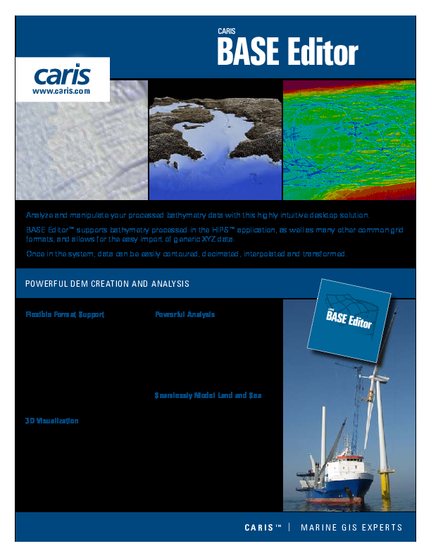
BASE Editor
A desktop application for compiling, analyzing, and storing source bathymetry.
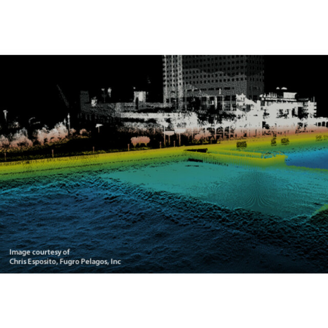
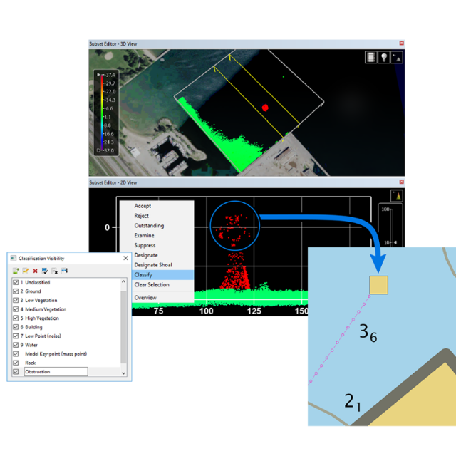
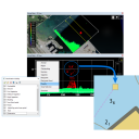
Access the latest tools for working with bathymetric data from any sensor. Use BASE Editor to validate, analyze, and compile datasets in a variety of formats and from multiple new and historical sources. Integrate the latest high-resolution bathymetry and topography with historical data in a user-friendly environment. Generate products like smoothed contours, depth areas, and selected soundings for use in charting. Visualize the data with raster images and vector features in the 3D viewer.
Teledyne Geospatial
Vaughan, CA
Description
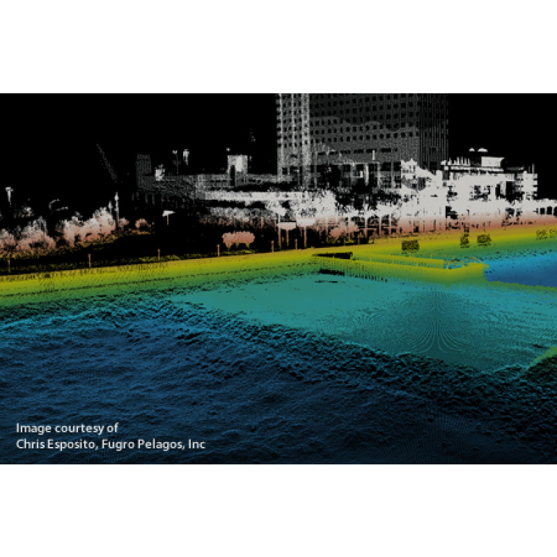
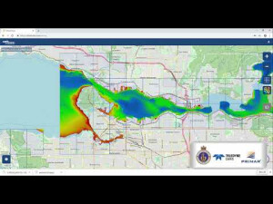
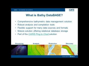
Powered by the CSAR engine and backed by proven RDBMS technology, Bathy DataBASE delivers a robust and scalable solution for the storage and analysis of ever-expanding volumes of sonar and lidar data.
Bathy DataBASE is able to incorporate all sources of data from historical fieldsheets to the latest high density multibeam and lidar surveys in a single space.
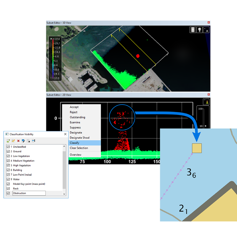
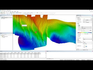
Manipulate, analyze and compile data using intuitive CARIS tools, and create bathymetric and cartographic products with confidence.
Extend the Bathy DataBASE advantage by adding the new Engineering Analysis Module to import, create and maintain theoretical models of the seafloor for dredging and other engineering options.
Do you have questions about this product?
- Questions about price, availability, and/or retailers
- Questions about technical specifications and usage
- Questions about suitability for your project or application
Specifications
-
Hardware/software requirements
-
RAM [GB]
16
HD [GB]
1
Use of GPU
Y
Stereo Display
Y
List software environment, e.g. Microstation
CARIS
Processor
[]
Stand-alone
Yes
-
Other
-
Support
Helpdesk, Telephone, Email, Webinars
Training
Y
Typical applications
Terrain modelling, visualization, analysis, etc.
Distinguishing features
Process and visualize very high volume datasets through the CARIS CSAR framework which utilizes an inverse pyramid system to draw the appropriate level of detail for the scale.
-
Files and Registering
-
Input formats
ASCII,C&C,CRS,GSF,HOB,HTF,HYD93,LAS/LAZ,Raster,etc
Output formats
ASCII,DXF,GML,Shape,CSAR,BAG,ESRI ASCII Grid,etc.
Geo-referencing
Y
Automatic Target Detection
N
Stitching multiple scans
Y
-
Pre-processing and Automatic Filtering
-
Image matching facilities
N
Frequency domain decoding for data reduction
N
Removal of individual outliers
Y
Removal of vegetation
N
Removal of buildings
N
Bare ground DEM generation
N
-
Manual Measurements
-
3D Coordinates extraction
Y
Length and Height
Y
Angle
Y
Distance
Y
Area
N
Volume
N
-
Interoperability
-
CAD software
AutoCAD LandXML (models), DGN, DXF
Hydrological software
CARIS
Assigning colour from imagery to points
Y
Image overlay on TIN
Y
Integration with other data types
Yes:Raster, Vector, Terrestrial, Bathymetric, etc.
-
General
-
Year of last update
2020
Year of initial introduction
2005
Modules
Engineering Analysis Module, Limits and Boundaries Module, BASE Manager Module
Supported Systems
Kongsberg, Reson, R2Sonic, Optech, LADS, AHAB, RIEGL, Renishaw, Leica
Source of Point Clouds
Airborne Lidar, Indoor TLS, Outdoor TLS
-
Analysis
-
Line of sight
Y
Aspect and slope
Y
Individual tree heights
N
Simulation facilities
Y
Time series analysis
N
-
Automatically Generated Products
-
Regular Grid DEMs
Y
Cross sections
Y
TIN
Y
Contour Lines
Y
Break lines
Y
Boundary detection of solids
N
Building footprints
N
Building roofs
N
3D City modelling
N
-
Solid Modelling
-
Lines
N
Planes
Y
Cubes
N
Spheres
N
Cylinders
N
NURBS
N
Industrial features
N
Earth surface features
N
-
Visualisation and Editing
-
Zoom, pan and rotate
Y
Fly-throughs
Y
Adding Points
Y
Removing Points
Y
Point Reduction
N
Documents
Brochure
migrationycf8b5.pdf
332.43 KB
Other documents
-
CHS's Modern Approach to Bathymetry Compilation882.28 KB
-
Automation tools creating generalized features from bathymetry for Nautical Charting.452.32 KB
-
Port of Melbourne describes the importance of database storage.182.53 KB
-
Port of Hamburg centralize storing of their bathymetric data.1.88 MB


